Tak Bai District
Tak Bai (Thai: ตากใบ, pronounced [tàːk bāj]) is a district (amphoe) in the southeastern part of Narathiwat Province, southern Thailand.
Tak Bai
ตากใบ | |
|---|---|
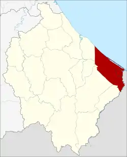 District location in Narathiwat Province | |
| Coordinates: 6°15′32″N 102°3′18″E | |
| Country | Thailand |
| Province | Narathiwat |
| Seat | Chehe |
| District established | 1909 |
| Area | |
| • Total | 253.45 km2 (97.86 sq mi) |
| Population (2009) | |
| • Total | 66,579 |
| • Density | 257.5/km2 (667/sq mi) |
| Time zone | UTC+7 (ICT) |
| Postal code | 96110 |
| Geocode | 9602 |
History
When the United Kingdom and Siam (Thailand) signed the Anglo-Siamese Treaty of 1909, they agreed to use the Kolok River (Sungai Golok) near Wat Chonthara Singhe (วัดชลธาราสิงเห) as the boundary between British Malaya and Siam due to the culture and arts inside the temple. Before, the area was part of the Mueang Kelantan.
The district was officially created on 12 August 1909.[1]
On 25 October 2004 at least 85 demonstrators died after a brutal police action in the so-called Tak Bai Incident.[2]
Geography
Neighboring districts are (from the southwest clockwise): Su-ngai Kolok, Su-ngai Padi, Cho-airong, Mueang Narathiwat of Narathiwat Province, and the Gulf of Thailand. To the southeast is the state Kelantan of Malaysia.
The boundary crossing is at Pengkalan Kubur (Malaysia) and Taba (Thailand).
On 1 January falls on the New Year's Day, Tak Bai is the first place in Thailand that receives the sunshine, despite not being the easternmost area in the country. This is because the Earth's axis is tilted during the cold season. Which the sun will rise before Khong Chiam District in Ubon Ratchathani Province the location of Pha Taem National Park, about one minute.[3]
Administration
The district is divided into eight sub-districts (tambons), which are further subdivided into 56 villages (mubans). Tak Bai itself has town (thesaban mueang) status and covers parts of tambon Che He. There are a further eight tambon administrative organizations (TAO).
| No. | Name | Thai | Villages | Pop.[4] |
|---|---|---|---|---|
| 1. | Chehe | เจ๊ะเห | 8 | 19,205 |
| 2. | Phrai Wan | ไพรวัน | 10 | 8,712 |
| 3. | Phron | พร่อน | 6 | 4,418 |
| 4. | Sala Mai | ศาลาใหม่ | 8 | 8,847 |
| 5. | Bang Khun Thong | บางขุนทอง | 6 | 5,064 |
| 6. | Ko Sathon | เกาะสะท้อน | 9 | 9,219 |
| 7. | Na Nak | นานาค | 4 | 4,497 |
| 8. | Khosit | โฆษิต | 5 | 6,617 |
References
- ประกาศกระทรวงมหาดไทย ประกาศตั้งอำเภอสะเดาและอำเภอตากใบ (PDF). Royal Gazette (in Thai). 26 (0 ง): 1107. 22 August 1909.
- "Mass Killing at Tak Bai Narathiwat Thailand". Asian Human Rights Commission. Retrieved 22 June 2019.
- ""อ.ตากใบ จ.นราธิวาส" จุดเห็นแสงแรกของปี" ["Tak Bai, Narathiwat" the first light spot of the year]. PPTV HD (in Thai). 31 December 2019. Retrieved 1 January 2020.
- "Population statistics 2009". Department of Provincial Administration. Archived from the original on 3 March 2016.
