Tataouine
Tataouine (Berber languages: Tiṭṭawin; Arabic: تطاوين) is a city in southern Tunisia. It is the capital of the Tataouine Governorate. The below-ground "cave dwellings" of the native Berber population, designed for coolness and protection, render the city and the area around it a tourist and film makers' attraction.
Tataouine
| |
|---|---|
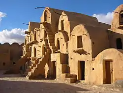 Ksar Ouled Soltane, near the city of Tataouine | |
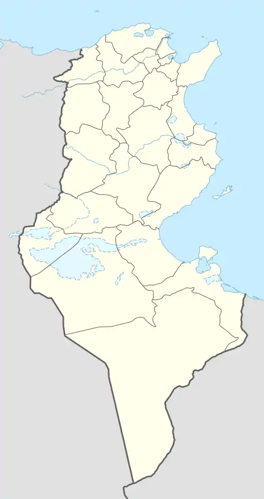 Tataouine Location in Tunisia | |
| Coordinates: 32°55′50″N 10°27′00″E | |
| Country | |
| Governorate | Tataouine Governorate |
| Population (2014) | |
| • Total | 67,291 |
| Time zone | UTC1 (CET) |
Etymology
The name Tiṭṭawin means 'eyes' and 'water springs' in the Berber language. It is sometimes transliterated in European languages as Tatahouine, Tatahouïne, Tatawin or Tatooine. The names "Tataouine", "Tatahouine" and "Foum Tatahouine" all appeared in the postcards portraying the city in the 1920s.
The city used to be called Fum Taṭāwīn (فم تطاوين), alternatively spelled Fumm Tattauin, Foum Tatahouine, Fum Tatawin, or Foum Tataouine, which means 'mouth of the springs'.[1]
History
From 1892 to 1951, Tataouine was the garrison town of the French penal military unit known as the "Battalion of Light Infantry of Africa".[2] After the French established the town, a mosque (built in 1898) and homes were built in Tataouine.[1]
On June 27, 1931, a meteorite of unusual achondrite type and green color impacted at Tataouine;[3] about 12 kg of fragments were found. The meteorite consists largely of the mineral enstatite, and is of the rare Diogenite type.[4]
In March 2015, it was briefly reported that ISIL was using Tataouine as a military base,[5] but later these claims were denied by the Tunisian government as false.[6]
In September 2016, a new oil field was found south of the town by the Italian company Eni.[7]
Climate
| Climate data for Tataouine (1961–1990, extremes 1989–2017) | |||||||||||||
|---|---|---|---|---|---|---|---|---|---|---|---|---|---|
| Month | Jan | Feb | Mar | Apr | May | Jun | Jul | Aug | Sep | Oct | Nov | Dec | Year |
| Record high °C (°F) | 26.2 (79.2) |
36.2 (97.2) |
38.7 (101.7) |
40.3 (104.5) |
45.6 (114.1) |
47.2 (117.0) |
48.4 (119.1) |
47.4 (117.3) |
45.0 (113.0) |
42.0 (107.6) |
36.8 (98.2) |
31.5 (88.7) |
48.4 (119.1) |
| Average high °C (°F) | 15.8 (60.4) |
18.5 (65.3) |
21.3 (70.3) |
24.9 (76.8) |
29.4 (84.9) |
33.7 (92.7) |
36.2 (97.2) |
36.2 (97.2) |
34.9 (94.8) |
31.5 (88.7) |
22.7 (72.9) |
16.9 (62.4) |
26.8 (80.3) |
| Daily mean °C (°F) | 11.3 (52.3) |
13.2 (55.8) |
15.9 (60.6) |
18.7 (65.7) |
22.9 (73.2) |
26.8 (80.2) |
29.2 (84.6) |
29.4 (84.9) |
28.5 (83.3) |
25.2 (77.4) |
17.5 (63.5) |
12.0 (53.6) |
20.9 (69.6) |
| Average low °C (°F) | 6.8 (44.2) |
7.8 (46.0) |
10.4 (50.7) |
12.4 (54.3) |
16.5 (61.7) |
19.9 (67.8) |
22.1 (71.8) |
22.4 (72.3) |
22.0 (71.6) |
18.9 (66.0) |
12.4 (54.3) |
7.1 (44.8) |
14.9 (58.8) |
| Record low °C (°F) | 1.0 (33.8) |
−1.8 (28.8) |
2.0 (35.6) |
4.2 (39.6) |
8.4 (47.1) |
9.4 (48.9) |
16.1 (61.0) |
17.8 (64.0) |
12.8 (55.0) |
8.2 (46.8) |
5.3 (41.5) |
1.0 (33.8) |
−1.8 (28.8) |
| Average precipitation mm (inches) | 19.3 (0.76) |
9.8 (0.39) |
17.0 (0.67) |
10.2 (0.40) |
7.0 (0.28) |
0.6 (0.02) |
0.1 (0.00) |
1.7 (0.07) |
8.7 (0.34) |
13.4 (0.53) |
7.6 (0.30) |
11.9 (0.47) |
107.3 (4.23) |
| Average precipitation days (≥ 1.0 mm) | 4.1 | 2.5 | 2.8 | 1.5 | 1.1 | 0.3 | 0.0 | 0.2 | 1.6 | 1.7 | 1.9 | 1.7 | 19.4 |
| Average relative humidity (%) | 66.0 | 58.0 | 59.4 | 55.4 | 54.6 | 53.4 | 50.9 | 52.4 | 56.4 | 53.8 | 62.4 | 66.5 | 57.4 |
| Source: Institut National de la Météorologie (precipitation days/humidity/sun 1961–1990)[8][9][10][note 1] | |||||||||||||
Culture
The Ksour Festival (French: Festival international des ksour sahariens) is an annual festival held in Tataouine in March.[12] In Tataouine some people speak a Berber dialect.[13]
Popular culture
- Star Wars: Tataouine's name became famous worldwide when George Lucas, who shot the original Star Wars film in various locations in Tunisia,[14] named Luke Skywalker's fictional home planet Tatooine.[15]
- X-Files: Tataouine appeared in the end of the film The X-Files as Foum Tataouine, where an extraterrestrial viral experiment facility was located.[16]
- The Amazing Race: Tataouine appeared in the fifth episode of The Amazing Race 1.[17]
References
- Daniel Jacobs; Peter Morris (2001). The Rough Guide to Tunisia. Rough Guides. p. 266. ISBN 978-1-85828-748-5.
- Jacques Sicard, page 46 "Les Bataillons d' Infanterie Legere d'Afrique et leurs insignes, 1832-1972", Militaria Magazine Septembre 1994
- "Météorite Achondrite Tataouine". www.carionmineraux.com. Retrieved 19 October 2016.
- Monica M. Grady; Natural History Museum (London, England) (31 August 2000). Catalogue of Meteorites Reference Book with CD-ROM. Cambridge University Press. p. 484. ISBN 978-0-521-66303-8.
- Beaumont-Thomas, Ben (25 March 2015). "Tataouine, town in Tunisia that inspired Star Wars, becomes Isis waypoint – reports". The Guardian. Retrieved 19 October 2016.
- Beaumont-Thomas, Ben (27 March 2015). "Star Wars sets are safe from Isis, say Tunisian officials". The Guardian. Retrieved 19 October 2016.
- "A New Hope: Oil Found in Tataouine". Tunisia Live. 21 September 2016. Retrieved 19 October 2016.
- "Les normales climatiques en Tunisie entre 1981 2010" (in French). Ministère du Transport. Archived from the original on 19 December 2019. Retrieved 25 January 2020.
- "Données normales climatiques 1961-1990" (in French). Ministère du Transport. Archived from the original on 21 December 2019. Retrieved 25 January 2020.
- "Les extrêmes climatiques en Tunisie" (in French). Ministère du Transport. Archived from the original on 21 December 2019. Retrieved 25 January 2020.
- "Réseau des stations météorologiques synoptiques de la Tunisie" (in French). Ministère du Transport. Retrieved 25 January 2020.
- Nachrichten, Oberösterreichische. "Tunesien: Neues, altes Land". Retrieved 20 October 2016.
- "Tunisia". Retrieved 20 July 2016.
- "Star Wars location spotting in Tunisia | LosApos". www.losapos.com. Retrieved 13 October 2016.
- Prentice Hall Literature: Timeless Voices, Timeless Themes (Platinum Level) (8th ed.). Prentice Hall, Inc. 2002. ISBN 9780130547903.
- "The X-Files Newbie Recap: "The End" & The X-Files Movie". www.themarysue.com. Retrieved 19 October 2016.
- Castro, Adam-Troy (2006). My Ox Is Broken!: Roadblocks, Detours, Fast Forwards and Other Great Moments from Tv's 'the Amazing Race'. BenBella Books. p. 72. ISBN 9781941631454.
Notes
- The Station ID for Tataouine is 57272111.[11]
External links
 Media related to Tataouine at Wikimedia Commons