Minnesota State Highway 15
Minnesota State Highway 15 (MN 15) is a 154.322-mile-long (248.357 km) highway in south-central and central Minnesota, which runs from Iowa Highway 15 at the Iowa state line and continues north to its northern terminus at its interchange with U.S. Highway 10 outside of Sartell and Sauk Rapids, north of St. Cloud.
| ||||
|---|---|---|---|---|
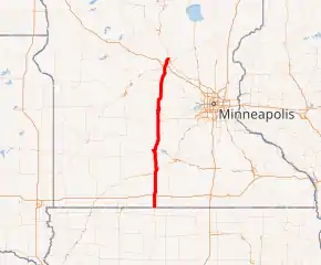
MN 15 highlighted in red | ||||
| Route information | ||||
| Maintained by MnDOT | ||||
| Length | 154.322 mi[1] (248.357 km) | |||
| Existed | 1920–present | |||
| Major junctions | ||||
| South end | ||||
| North end | ||||
| Location | ||||
| Counties | Martin, Watonwan, Brown, Nicollet, Sibley, McLeod, Meeker, Stearns, Benton | |||
| Highway system | ||||
| ||||

Route description
MN 15 serves as a north–south highway between Fairmont, Madelia, New Ulm, Hutchinson, and St. Cloud in south-central and central Minnesota.
MN 15 parallels MN 4 throughout its route in south-central and central Minnesota.
Flandrau State Park is located near MN 15 in Brown County on the Cottonwood River. The park is located just south of New Ulm.[2]
MN 15 is a four-lane highway on the west side of St. Cloud from Interstate 94 (I-94) to U.S. Highway 10 (US 10). MN 15 crosses the Bridge of Hope at the Mississippi River between Sartell and Sauk Rapids.
History
MN 15 was authorized in 1920, 1933, and 1950.
The section of MN 15 between New Ulm and the Iowa state line was originally Minnesota Constitutional Route 15, dating back to 1920.
The section of MN 15 between St. Cloud and Kimball was originally part of Constitutional Route 24.
The middle section of MN 15 was authorized in 1933, the northernmost section in 1950. This northerly section was originally part of old MN 152 and was routed through downtown St. Cloud. Now, it bypasses central St. Cloud to the west side of town.
By 1940, only two short gravel sections of MN 15 remained, both paved by 1953.
In the 1970s, MN 15 through the St. Cloud area was planned to be constructed as a freeway, providing a high-speed connection between I-94 and US 10]]. However, funding fell short of completing the freeway beyond MN 23 and County Road 75 (CR 75, 2nd Street South). As a result, it was eventually decided that right-of-way needed to build interchanges would be sold off so the remaining segment of MN 15 across the Mississippi River, connecting to US 10, could be built. Therefore, from 2nd Street South to US 10, the highway is currently built as an expressway with signalized intersections.[3] As of now, MN 15 is able to serve traffic, with stretches posted at a 60 mph (97 km/h) speed limit. However, continuing increases in traffic in the St. Cloud area will require the highway to be eventually converted to a freeway in the long term (post 2030).
Major intersections
All exits are unnumbered.
| County | Location | mi[1] | km | Destinations | Notes |
|---|---|---|---|---|---|
| Martin | Silver Lake Township | 0.000 | 0.000 | Continuation into Iowa | |
| Fairmont | 10.486 | 16.876 | Southern end of I-90 Bus. overlap | ||
| 12.351 | 19.877 | Interchange; northern end of I-90 Bus. overlap; I-90 exit 102 | |||
| Watonwan | Antrim Township | 27.276 | 43.896 | Southern end of MN 30 overlap | |
| Fieldon Township | 33.380 | 53.720 | Parclo interchange; northern end of MN 30 overlap; northbound left exit and southbound entrance | ||
| 33.442 | 53.820 | Interchange; southern end of MN 60 overlap; southbound left exit and northbound left entrance | |||
| Madelia Township | 37.513– 37.559 | 60.371– 60.445 | South end of freeway | ||
| 38.776 | 62.404 | ||||
| 39.201 | 63.088 | Northern end of MN 60 overlap; north end of freeway | |||
| Brown | Linden Township | 45.354 | 72.990 | ||
| Cottonwood Township | 54.635 | 87.927 | Southern end of MN 68 overlap | ||
| New Ulm | 58.862 | 94.729 | Northern end of MN 68 overlap; southern end of US 14 overlap | ||
| 59.304 | 95.441 | Front Street | Interchange via connector road at roundabout; formerly a folded diamond interchange | ||
| Minnesota River | 59.671 | 96.031 | Bridge No. 9200 | ||
| Nicollet | Courtland Township | 60.252 | 96.966 | Dumbbell interchange, opened December 2019;[4] northern end of US 14 overlap; CSAH 21 west is Minnesota River Valley Scenic Byway west | |
| Sibley | Winthrop | 76.546 | 123.189 | ||
| McLeod | Sumter Township | 89.155 | 143.481 | ||
| Hutchinson | 101.288 | 163.007 | |||
| Meeker | Dassel | 115.079 | 185.202 | ||
| Kingston Township | 126.028 | 202.822 | Southern end of MN 24 overlap | ||
| Stearns | Kimball | 131.529 | 211.675 | Northern end of MN 24 overlap | |
| St. Cloud–Waite Park line | 145.059 | 233.450 | South end of freeway; cloverleaf interchange; I-94 exits 167A-B | ||
| Dumbbell interchange | |||||
| St. Cloud | 149.070 | 239.905 | At-grade intersection; north end of freeway; southern end of MN 23 overlap | ||
| 149.314 | 240.298 | Northern end of MN 23 overlap | |||
| St. Cloud–Sartell line | 151.670 | 244.089 | Diverging diamond interchange, converted from existing intersection on October 17, 2013[5] | ||
| Mississippi River | 153.940– 154.263 | 247.742– 248.262 | Bridge of Hope | ||
| Benton | Sauk Rapids | 152.929 | 246.115 | Interchange | |
| Sartell | 153.956 | 247.768 | |||
| 154.322 | 248.357 | Interchange; northern terminus | |||
1.000 mi = 1.609 km; 1.000 km = 0.621 mi
| |||||
References
- "Statewide Trunk Logpoint Listing" (PDF). Minnesota Department of Transportation. November 6, 2013. Retrieved March 24, 2014.
- "Flandrau State Park". Minnesota Department of Natural Resources. Retrieved October 5, 2010.
- Minnesota Department of Transportation. "Project Study: Highway 15 - St. Cloud Metro". District 3 Local News & Project Studies. Archived from the original on October 16, 2007. Retrieved November 23, 2007.
- Busch, Fritz (December 19, 2019). "It's open!". The Journal. New Ulm, Minnesota. Retrieved March 14, 2020.
- "Hwy 15/CR 120 diverging diamond interchange opens Oct. 17" (Press release). Minnesota Department of Transportation. Archived from the original on October 21, 2013. Retrieved October 17, 2013.