U.S. Bicycle Route 50
U.S. Bicycle Route 50 (USBR 50) is a west–east U.S. Bicycle Route. As of 2019, it consists of two sections: a western section from San Francisco to Border, Utah, and an eastern section from just outside Terre Haute, Indiana, to Washington, D.C. The route is ultimately planned to span the country, connecting the two sections.
| ||||
|---|---|---|---|---|
| Route information | ||||
| Length | 1,500.65 mi[1][2][3][4][5][6][7] (2,415.06 km) | |||
| Existed | 2013–present | |||
| Western section | ||||
| West end | San Francisco | |||
| Major junctions |
| |||
| East end | Border, Utah | |||
| Eastern section | ||||
| West end | Near Terre Haute, Indiana | |||
| Major junctions |
| |||
| East end | Washington, D.C. | |||
| Location | ||||
| States | California, Nevada, Indiana, Ohio, West Virginia, Pennsylvania, Maryland, District of Columbia | |||
| Highway system | ||||
| ||||
.svg.png.webp)
History
The first segment of USBR 50, incorporating the length of the C&O Canal Towpath in Maryland, was approved by the American Association of State Highway and Transportation Officials (AASHTO) on October 23, 2013.[1] On May 29, 2014, AASHTO approved additional segments in Ohio and Washington, D.C., including the remaining 3.6 miles (5.8 km) of the C&O Towpath.[2] On September 25, 2015, AASHTO approved the route through Indiana, as well as an alternate route in the Columbus, Ohio, area that had been part of Ohio's original route proposal.[3] USBR 50 signs were posted along the Ohio segment in the summer of 2016.[8] AASHTO approved the 160-mile-long (260 km) route across Pennsylvania in 2017[9][10] and the 410-mile-long (660 km) route across Nevada the following year.[11] AASHTO also approved a 2018 realignment of USBR 50 in Ohio, trimming 5 miles (8.0 km) from the route, passing through Hopedale and bypassing Alexandria.[12][5][13] In the Fall 2018, AASHTO approved a realignment within London, Ohio, adding 1.3 miles (2.1 km) to the route.[14] AASHTO approved the route across West Virginia at their Fall 2019 meeting.[15]
Route description
| mi | km | |
|---|---|---|
| CA[7] | 233 | 375 |
| NV | 409.6 | 659.2 |
| IN | 171.0 | 275.2 |
| OH[14] | 309.6 | 498.3 |
| WV[6] | 9.35 | 15.05 |
| PA | 160 | 260 |
| MD | 204.5 | 329.1 |
| DC | 3.6 | 5.8 |
| Total | 1,500.65 | 2,415.06 |
California
USBR 50 begins in San Francisco. It incorporates a ferry ride across the San Francisco Bay, the Jedediah Smith Memorial Trail in Sacramento County, the El Dorado Trail in El Dorado County, and the Mormon Emigrant Trail before reaching South Lake Tahoe.[7]
Nevada
USBR 50 crosses the state line at Stateline, Nevada, then follows U.S. Route 50 for 409.6 miles (659.2 km) to the Utah state line at Border, Utah, with a brief detour along State Route 722. Near the eastern terminus is a junction with State Route 487, which leads to U.S. Bicycle Route 79 at the Utah state line near Garrison, Utah. The Nevada segment of USBR 50 includes 12 summits over 6,000 feet (1,800 m). It passes near Great Basin National Park.[4][11][16][17]
Indiana
After a large gap in the Midwestern United States, USBR 50 traverses eight counties in Indiana, from the Illinois state line just outside Terre Haute to the Ohio state line outside Richmond. The route through Indiana roughly parallels the Historic National Road (U.S. Route 40), except for a bypass to the south of Indianapolis. USBR 50 briefly joins U.S. Bicycle Route 35 in New Palestine.
Ohio
USBR 50 continues through Ohio, traversing 11 counties to the Market Street Bridge that connects Steubenville and Follansbee, West Virginia.[18]
The route through Ohio incorporates a number of rail trails. From west to east, it follows the Wolf Creek Recreation Trail, Great Miami River Recreation Trail, Mad River Recreation Trail, Creekside Trail, Little Miami Scenic Trail, Prairie Grass Trail, Roberts Pass, Camp Chase Trail, Scioto Greenway Trail, Alum Creek Greenway Trail, Thomas J. Evans Trail, and Panhandle Trail. USBR 50 also runs along state and U.S. routes, especially in the more rugged terrain east of Newark.[19] In Xenia, USBR 50 shares a short segment of the Little Miami trail with State Bike Route 3. From Xenia to Columbus, it shares the Prairie Grass, Roberts Pass, and Camp Chase trails with State Bike Route 1, the Ohio to Erie Trail.
West Virginia
This is in the Northern Panhandle of West Virginia. The route begins at the Market Street Bridge at its crossing the Ohio River at connects to the Panhandle Trail and continues on into Pennsylvania.
Pennsylvania
USBR 50 mostly follows the Panhandle and Montour Trails and the Great Allegheny Passage as it crosses five counties to connect Colliers, West Virginia, with Frostburg, Maryland.[9] From West Newton to Rockwood, it shares the Great Allegheny Passage with BicyclePA Route S.[20]
Maryland and Washington, D.C.
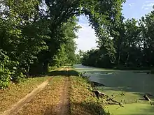
From the Pennsylvania state line near Frostburg, USBR 50 continues along the Great Allegheny Passage and then follows the Chesapeake & Ohio Canal Towpath to the Georgetown neighborhood of Washington, D.C.. U.S. Bicycle Route 11 currently terminates at USBR 50 in Brunswick, Maryland. After crossing the Washington, D.C. line, the Arizona Avenue Bridge, carrying the Capital Crescent Trail, eventually passes over USBR 50, after which the final three miles of the route run close and parallel to the Capital Crescent Trail.[1][21] U.S. Bicycle Route 1 is accessible close to the terminus of USBR 50 south of the Potomac River in Virginia.
U.S. Bicycle Route 50A
| |
|---|---|
| Location | Westerville – Alexandria, Ohio |
| Length | 32.3 mi[3] (52.0 km) |
| Existed | 2015–present[3] |
U.S. Bicycle Route 50A is an alternate route through Delaware and Licking counties northeast of Columbus, Ohio. During planning for USBR 50 in Ohio, this route was proposed as a scenic route. However, it was omitted from the USBR 50 proposal approved by AASHTO in 2013. USBR 50A was later approved by AASHTO in 2015. The route extends from Westerville to Alexandria over various local roads as well as the Thomas J. Evans Trail, Hoover Scenic Trail, and Genoa Township Trail (part of the Ohio to Erie Trail).[3]
See also
- American Discovery Trail, a long-distance hiking trail with similar endpoints
References
- Special Committee on U.S. Route Numbering (October 28, 2013). "Special Committee on US Route Numbering Meeting Minutes for October 17, 2013 and Report to SCOH October 18, 2013" (PDF) (Report). Washington, DC: American Association of State Highway and Transportation Officials. Archived (PDF) from the original on June 3, 2019. Retrieved June 9, 2014.
- Special Committee on U.S. Route Numbering (May 29, 2014). "Report to SCOH" (DOCX) (Report). Washington, DC: American Association of State Highway and Transportation Officials. Retrieved June 1, 2014.
- Special Committee on U.S. Route Numbering (September 25, 2015). "Special Committee on U.S. Route Numbering Report to the Standing Committee on Highways" (PDF) (Report). Washington, DC: American Association of State Highway and Transportation Officials. Archived (PDF) from the original on August 20, 2018. Retrieved October 2, 2015.
- Madewell, Bob (April 5, 2018). "US Bike Route Application - US 50, State of Nevada" (PDF). Letter to Patricia Ng'ethe. pp. 68–73. Retrieved August 19, 2018.
- Griffith, Caraline (April 2, 2017). "Application for Designation of a U.S. Bicycle Route" (PDF). Letter to American Association of State Highway and Transportation Officials. Retrieved August 19, 2018.
- Keller, Perry (2019-09-05), Application for Designation of a U.S. Bicycle Route: West Virginia USBR No. 50 (PDF), retrieved 2019-10-28
- "South Lake Tahoe is start to 1st US Bicycle Route in California". Tahoe Daily Tribune. South Lake Tahoe, California: Swift Communications. September 2, 2020. Retrieved January 3, 2021.
- Crawford, Laura; Sullivan, Ginny (March 22, 2017). "Building the Largest Official Cycling Route Network in the World". Adventure Cycling Association. Retrieved April 26, 2018.
- "Pennsylvania Becomes 25th State to Join the U.S. Bicycle Route System" (Press release). Missoula, Montana: Adventure Cycling Association. June 12, 2017. Retrieved June 15, 2017.
- Krauss, Margaret J. (June 22, 2017). "Ready For A Cross Country Trip? Grab A Bike". WESA.
- "The U.S. Bicycle Route System grows to 26 states and over 13,000 miles" (Press release). Missoula, Montana: Adventure Cycling Association. June 12, 2018. Retrieved August 19, 2018.
- Special Committee on U.S. Route Numbering (May 22, 2018). "2018 Spring Meeting Report to the Council on Highways and Streets" (PDF) (Report). Washington, DC: American Association of State Highway and Transportation Officials. pp. 5–6. Archived (PDF) from the original on June 3, 2019. Retrieved August 19, 2018.
- Giauque, Becky (June 2015). "National bicycle route taking shape with Ohio project" (PDF). Transcript. Ohio Department of Transportation. p. 6. Retrieved August 20, 2018.
- Griffith, Caraline (2018-08-31), Application for Designation of a U.S. Bicycle Route: Ohio USBR No. 50 Realignment (PDF), retrieved 2019-08-09
- Special Committee on U.S. Route Numbering (October 6, 2019). "2019 Annual Meeting Report to the Council on Highways and Streets" (PDF) (Report). Washington, DC: American Association of State Highway and Transportation Officials. Archived (PDF) from the original on October 23, 2019. "Ballot" (PDF). Archived (PDF) from the original on October 23, 2019.
- Staff report (July 26, 2018). "Highway 50 designated an official U.S. Bicycle Route". Fernley Leader-Courier. Gannett Company. Retrieved August 19, 2018 – via Reno Gazette-Journal.
- "UDOT Installs Signs Extending National Bike Route" (Press release). Utah Department of Transportation. October 25, 2016. Retrieved August 19, 2018.
- "U.S. Bicycle Route 50 in Ohio". Ohio Department of Transportation. Retrieved March 17, 2015.
- Townley, Jennifer (April 10, 2014). "USBR 50 update" (PDF). Ohio Department of Transportation. Retrieved June 1, 2014.
- https://pennshare.maps.arcgis.com/apps/webappviewer/index.html?id=d8e1c77ad2444268bb56bd2d2a85ec46
- "New U.S. Bicycle Routes Approved in Maryland and Tennessee" (Press release). Missoula, Montana: Adventure Cycling Association. May 11, 2013. Retrieved May 11, 2013.
External links
- U.S. Bicycle Route 50 in Ohio, Ohio Department of Transportation