Umboi Island
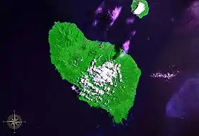
Umboi (also named Rooke or Siassi) is a volcanic island between the mainland of Papua New Guinea and the island of New Britain. It is separated from New Britain by Dampier Strait and Huon Peninsula, New Guinea Island by Vitiaz Strait. It has an elevation of 1,548 metres (5,079 feet).
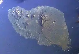 Space Shuttle image of Umboi Island (north to upper right). | |
 Umboi Island | |
| Geography | |
|---|---|
| Coordinates | 5°32′S 147°52′E |
| Archipelago | Bismarck Archipelago |
| Highest elevation | 1,548 m (5079 ft) |
| Highest point | Mount Talo |
| Administration | |
Papua New Guinea | |
| Province | Morobe Province |
Languages are Papuan Kobai; and Austronesian:Mbula, Karanai, and Saveng languages.
This article is issued from Wikipedia. The text is licensed under Creative Commons - Attribution - Sharealike. Additional terms may apply for the media files.