Sakar Island
Sakar Island is a volcanic island north-west of New Britain in the Bismarck Sea, at 5.416667°S 148.1°E. It is a stratovolcano with a summit crater lake. No recorded eruptions are known.
| Sakar Island | |
|---|---|
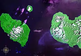 Dampier Strait seen from space. Also visible are Umboi Island (west), New Britain (east) and Sakar Island (north). (false color) | |
| Highest point | |
| Elevation | 992 m (3,255 ft) |
| Prominence | 992 m (3,255 ft) |
| Coordinates | 5°24′50″S 148°05′40″E |
| Geography | |
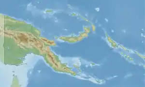 Sakar Island Location in Papua New Guinea | |
| Location | Papua New Guinea |
| Geology | |
| Mountain type | Stratovolcano |
| Last eruption | Unknown |
This article is issued from Wikipedia. The text is licensed under Creative Commons - Attribution - Sharealike. Additional terms may apply for the media files.