Ward River (Central West Queensland)
The Ward River, part of the Murray-Darling basin, is a river located in Central West Queensland, Australia.
| Ward | |
|---|---|
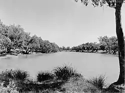 Ward River waterhole, near Charleville, 1955. | |
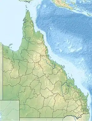 Location of Ward River mouth in Queensland | |
| Location | |
| Country | Australia |
| State | Queensland |
| Region | Central West Queensland |
| Physical characteristics | |
| Source | Warrego Range |
| • location | south of Tambo |
| • coordinates | 25°06′39″S 146°13′17″E |
| • elevation | 389 m (1,276 ft) |
| Mouth | confluence with the Langlo River |
• location | west of Charleville |
• coordinates | 26°25′51″S 146°05′32″E |
• elevation | 284 m (932 ft) |
| Length | 455 km (283 mi) |
| Basin size | 14,671 km2 (5,665 sq mi) |
| Basin features | |
| River system | Murray-Darling basin |
| [1][2] | |
The headwaters of the river rise in the Warrego Range, south of Tambo. Formed by the confluence of Larry Creek and Rams Gully, the river flows generally south, much of the river is braided channels, joined by 21 minor tributaries, before reaching its confluence with the Langlo River west of Charleville. The Langlo is itself a tributary of the Warrego River that flows into the Darling River. The river descends 105 metres (344 ft) over its 455-kilometre (283 mi) course.[1]
References
| Wikimedia Commons has media related to Ward River (Central West Queensland). |
- "Map of Ward River, QLD". Bonzle Digital Atlas of Australia. Archived from the original on 4 December 2020. Retrieved 3 December 2015.
- "Water streamflow data - Ward River @ Binnowee". Department of Environment and Resource Management. Queensland Government. Archived from the original on 24 July 2008. Retrieved 21 May 2009.
Rivers of Queensland | |||||||||||||||
|---|---|---|---|---|---|---|---|---|---|---|---|---|---|---|---|
| |||||||||||||||
| |||||||||||||||
| |||||||||||||||
| |||||||||||||||
| |||||||||||||||
| |||||||||||||||
This article is issued from Wikipedia. The text is licensed under Creative Commons - Attribution - Sharealike. Additional terms may apply for the media files.