Severn River (New South Wales)
The Severn River , a perennial river that forms part of the Border Rivers group, is part of the Macintyre catchment of the Murray-Darling basin, located in the Northern Tablelands and North West Slopes regions of New South Wales, Australia.
| Severn | |
|---|---|
.JPG.webp) Severn River, at Dundee | |
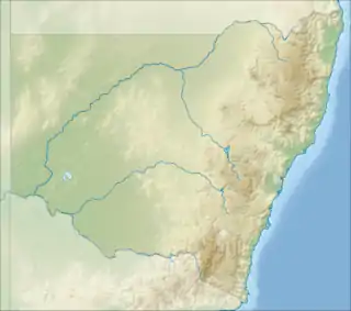
 Location of Severn River (NSW) mouth in New South Wales | |
| Etymology | After Severn Valley (England)[1] |
| Location | |
| Country | Australia |
| State | New South Wales |
| Regions | Northern Tablelands, North West Slopes |
| Physical characteristics | |
| Source | Great Dividing Range |
| • location | northeast of Glen Innes |
| • coordinates | 29°38′12″S 151°56′52″E |
| • elevation | 1,110 m (3,640 ft) |
| Mouth | confluence with the Macintyre River |
• location | north of Wallangra |
• coordinates | 29°07′40″S 150°58′06″E |
• elevation | 284 m (932 ft) |
| Length | 205 km (127 mi) |
| Basin features | |
| River system | Macintyre River catchment, Murray–Darling basin |
| Tributaries | |
| • left | Beardy Waters |
| Reservoir | Lake Pindari |
| [2][3] | |
Course and features
The river rises on the western slopes of the Great Dividing Range, north of Glen Innes and flows generally northwest, joined by eleven tributaries, including Beardy Waters, and impounded by Lake Pindari, near Ashford. The river reaches its confluence with the Macintyre River, north of Wallangra; descending 825 metres (2,707 ft) over its 205-kilometre (127 mi) course.
Recreation
The Severn River flows through Kwaimbal National Park. A rare plant, the Severn River heath-myrtle is restricted to the Severn River Nature Reserve and an adjacent property, about 60 kilometres (37 mi) north-west of Glen Innes.[4]
Excellent fishing can be found along the river and is regularly stocked with native fingerlings, Murray Cod and Golden Perch.
The Severn River Rail Bridge on the now disused Main North Railway Line, 6 kilometres (3.7 mi) west-south-west of Dundee has been placed on the Register of the National Estate. This bridge consists of a series of timber trusses completed in 1886 and is long, with fifteen spans totalling 159 metres (522 ft). When completed it was the longest timber truss bridge in Australia.
References
- "Severn River". Geographical Names Register (GNR) of NSW. Geographical Names Board of New South Wales. Retrieved 5 February 2013.

- "Map of Severn River, NSW (east of Ashford)". Bonzle Digital Atlas of Australia. Retrieved 5 February 2013.
- "Map of Severn River, NSW (north west of Ashford)". Bonzle Digital Atlas of Australia. Retrieved 5 February 2013.
- "Severn River Heath-myrtle". New South Wales Office of Environment and Heritage. 26 August 2014. Retrieved 2 November 2015.
External links
- "Border Rivers catchments" (map). Office of Environment and Heritage. Government of New South Wales.