World map
A world map is a map of most or all of the surface of Earth. World maps, because of their scale, must deal with the problem of projection. Maps rendered in two dimensions by necessity distort the display of the three-dimensional surface of the earth. While this is true of any map, these distortions reach extremes in a world map. Many techniques have been developed to present world maps which address diverse technical and aesthetic goals.[2]
Charting a world map requires global knowledge of the earth, its oceans, and its continents. From prehistory through the Middle ages, creating an accurate world map would have been impossible because less than half of Earth's coastlines and only a small fraction of its continental interiors were known to any culture. With exploration that began during the European Renaissance, knowledge of the Earth's surface accumulated rapidly such that most of the world's coastlines had been mapped at least roughly by the mid 1700s and continental interiors by the 20th century.
Maps of the world generally focus either on political features or on physical features. Political maps emphasize territorial boundaries and human settlement. Physical maps show geographic features such as mountains, soil type or land use. Geological maps show not only the surface, but characteristics of the underlying rock, fault lines, and subsurface structures. Choropleth maps use color hue and intensity to contrast differences between regions, such as demographic or economic statistics.
Map projections
All world maps are based on one of several map projections, or methods of representing a globe on a plane. All projections distort geographic features, distances, and directions in some way; the various map projections that have been developed provide different ways of balancing accuracy and the unavoidable distortion inherent in making world maps.
Perhaps the best known projection is the Mercator Projection, originally designed as a nautical chart.
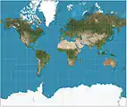 Mercator projection (82°S and 82°N.)
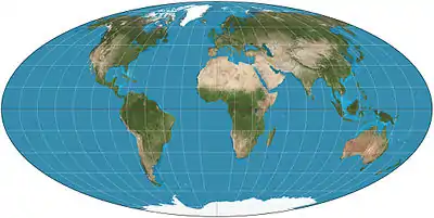
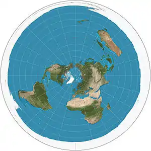 Polar azimuthal equidistant projection
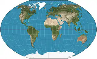
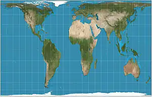 Gall–Peters projection, an equal area map projection
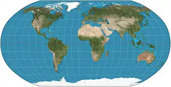 Robinson projection, formerly used by National Geographic Society
Thematic maps
A thematic map shows geographic information about one or a few focused subjects. These maps "can portray physical, social, political, cultural, economic, sociological, agricultural, or any other aspects of a city, state, region, nation, or continent".[3]
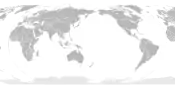
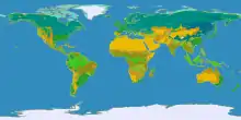 Clickable world map (with climate classification)
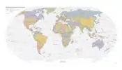 A simple political map of the world
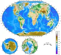 Topographical map of the world
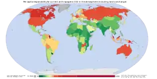 Map of anthropogenic CO2 emission by country
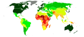 UN Human Development Index by country as of 2016
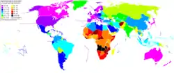 World map showing life expectancy
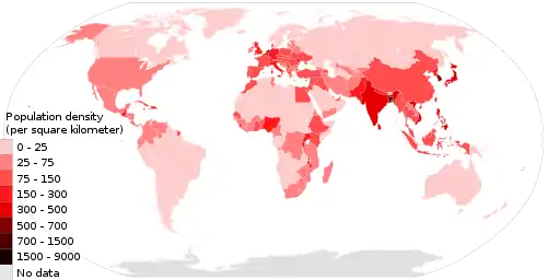 Population density (people per km2) by country, 2018
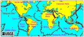 Volcano map
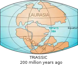 World map showing the continents as of 200 million years ago (Triassic period)
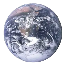
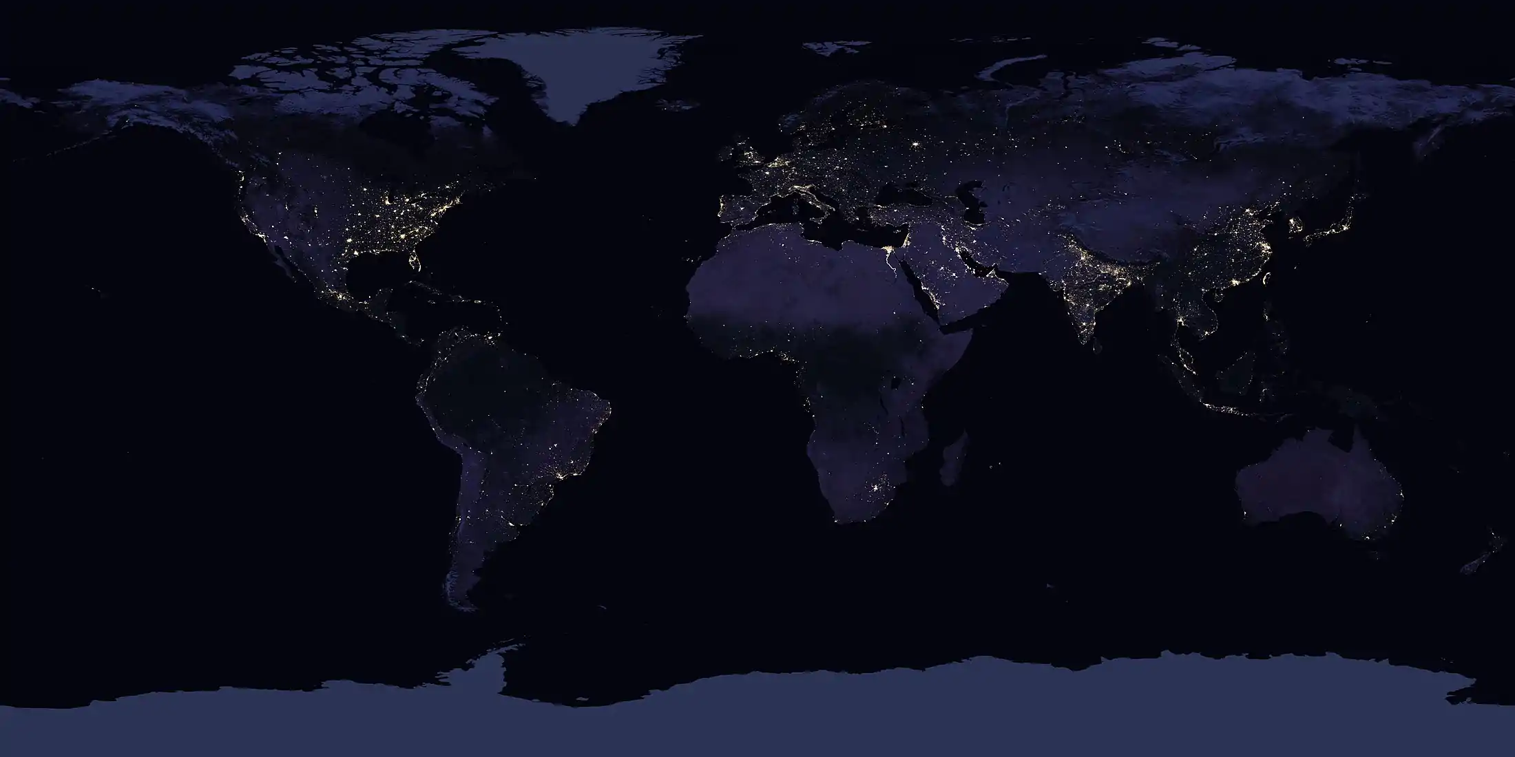 Satellite image of Earth at night
Historical maps
Early world maps cover depictions of the world from the Iron Age to the Age of Discovery and the emergence of modern geography during the early modern period. Old maps provide information about places which were known in past times, as well as the philosophical and cultural basis of the map, which were often much different from modern cartography. Maps are one means by which scientists distribute their ideas and pass them on to future generations.[4]
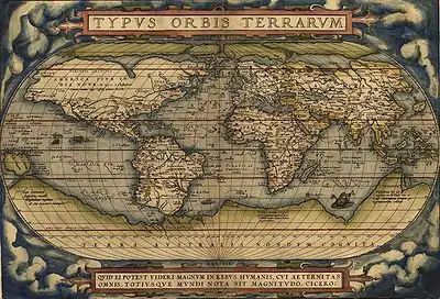 The world, Abraham Ortelius's Typus Orbis Terrarum, first published in 1564.
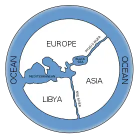 Hypothetical reconstruction of the world map of Anaximander (610–546 BC)
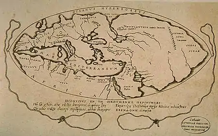 World map according to Posidonius (150–130 BC), drawn in 1628.
 Ideal reconstruction of medieval T-and-O maps (from Meyers Konversationslexikon, 1895) (Asia shown on the right)
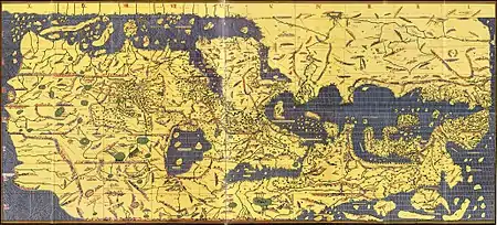 Tabula Rogeriana world map by Muhammad al-Idrisi in 1154. Note that north is to the bottom
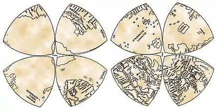 World map in Octant projection (1514). From Leonardo da Vinci's Windsor papers.
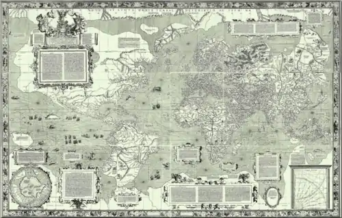 World map by Gerardus Mercator (1569), first map in the well known Mercator projection.
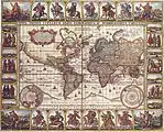 1652 world map by Claes Janszoon Visscher
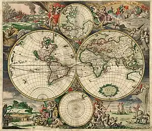 A historical map of the world by Gerard van Schagen, 1689
See also
 Geography portal
- Wikipedia's clickable world map
- Global Map
- Globe
- International Map of the World
- List of map projections
- List of world map changes
- Mappa mundi
- Maps of the world
- Rhumbline network
- Time zone
References
- Large-Scale Distortions in Map Projections, 2007, David M. Goldberg & J. Richard Gott III, 2007, V42 N4.
- American Cartographic Association's Committee on Map Projections (1988). Choosing a World Map. Falls Church: American Congress on Surveying and Mapping. pp. 1–2.
- Thematic Maps Map Collection & Cartographic Information Services Unit. University Library, University of Washington. Accessed 27 December 2009.
- "History of maps and cartography". emporia.edu.
Further reading
- Edson, Evelyn (2011). The World Map, 1300–1492: The Persistence of Tradition and Transformation. JHU Press. ISBN 1421404303
- Harvey, P. D. A. (2006). The Hereford world map: medieval world maps and their context. British Library. ISBN 0712347607
External links
| Wikimedia Commons has media related to Maps of the world. |
| Wikibooks has more on the topic of: World map |
| Continents |  | |
|---|---|---|
| Oceans | ||
| Geology | ||
| Atmosphere | ||
| Environment | ||
| Cartography | ||
| Culture and society | ||
| Planetary science | ||
| ||
