Yarnell, Oregon
Yarnell is an unincorporated historic locale in Lane County, Oregon, United States.[1] It was located about 5 miles south of Mohawk, in the Mohawk Valley.[2]
Yarnell, Oregon | |
|---|---|
 Yarnell  Yarnell | |
| Coordinates: 44°4′59″N 122°57′44″W | |
| Country | United States |
| State | Oregon |
| County | Lane |
| Established | 1901 |
| Elevation | 472 ft (144 m) |
| Time zone | UTC-8 (Pacific (PST)) |
| • Summer (DST) | UTC-7 (PDT) |
| GNIS feature ID | 1130823[1] |
Yarnell was a station on the now-defunct Marcola line of the Southern Pacific Railroad.[3] It was established in 1901, and was likely named for Jere Yarnell, a local resident listed as living in the area in the 1880 census.[3] There was a Yarnell covered bridge about a mile north of the station that carried Hill Road over the Mohawk River.[4][5] The bridge was built in 1916 and demolished in 1958.[4][5] In 1915 there was a Yarnell School.[6]
References
- "Yarnell (historical)". Geographic Names Information System. United States Geological Survey. May 22, 1986. Retrieved January 25, 2015.
- Google (January 25, 2015). "Directions from Yarnell to Mohawk" (Map). Google Maps. Google. Retrieved January 25, 2015.
- McArthur, Lewis A.; McArthur, Lewis L. (2003) [1928]. Oregon Geographic Names (7th ed.). Portland, Oregon: Oregon Historical Society Press. ISBN 978-0875952772.
- "Yarnell". Guide to U.S. Covered Bridges. National Center for Wood Transportation Structures. Retrieved January 25, 2015.
- "Yarnell, Lane County". Lostbridges.org. Retrieved January 25, 2015.
- "Pupils Increase Spelling Record". The Lane County News. Springfield, Oregon. February 11, 1915. Retrieved January 25, 2015.
External links
- Historic images of The Yarnell Covered Bridge from Salem Public Library
- Images of Yarnell from Flickr
- Mohawk Valley history, including several items about Yarnell
- History of the Southern Pacific Wendling-Mohawk branch from Abandoned Railroads of the Pacific Northwest
Municipalities and communities of Lane County, Oregon, United States | ||
|---|---|---|
| Cities | 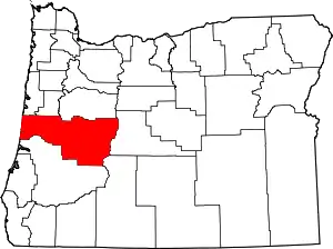 Lane County map | |
| Unincorporated communities |
| |
| Ghost towns | ||
| Indian reservation | ||
| Footnotes | ‡This populated place also has portions in an adjacent county or counties | |
| ||
This article is issued from Wikipedia. The text is licensed under Creative Commons - Attribution - Sharealike. Additional terms may apply for the media files.