Yoakum, Texas
Yoakum is a city in Lavaca and DeWitt counties in the U.S. state of Texas. The population was 5,815 at the 2010 census.[2]
Yoakum, Texas | |
|---|---|
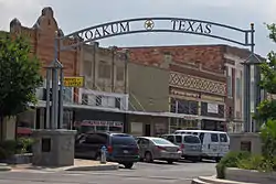 City center | |
 Seal | |
| Nickname(s): Leather Capital of Texas, Hub City of South Texas | |
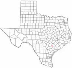 Location of Yoakum, Texas | |
 | |
| Coordinates: 29°17′28″N 97°8′50″W | |
| Country | |
| State | |
| Counties | Lavaca, DeWitt |
| Incorporated | May 13, 1889 |
| Government | |
| • Type | Council-Manager |
| • City council | Mayor Anita R. Rodriguez Elorine Sitka Rodney Jahn Tim Faulkner |
| • City manager | Kevin Coleman |
| Area | |
| • Total | 4.59 sq mi (11.89 km2) |
| • Land | 4.58 sq mi (11.86 km2) |
| • Water | 0.01 sq mi (0.02 km2) |
| Elevation | 365 ft (111.3 m) |
| Population | |
| • Total | 5,815 |
| • Estimate (2019)[3] | 5,940 |
| • Density | 1,296.66/sq mi (500.70/km2) |
| • Demonym | Yoakumite |
| Time zone | UTC-6 (Central (CST)) |
| • Summer (DST) | UTC-5 (CDT) |
| ZIP code | 77995 |
| Area code(s) | 361 |
| FIPS code | 48-80560 |
| GNIS feature ID | 1377671 |
| Website | www |
History
The area was sparsely settled until a townsite was laid out with the construction of the San Antonio and Aransas Pass Railway in 1887, and named for Benjamin F. Yoakum, a vice president of the line. The railroad built a roundhouse and maintenance shops there, employing hundreds of workers. The town was incorporated in 1889. According to the Handbook of Texas Online, "By 1896 Yoakum had a cotton mill, three cotton gins, a compress, several churches, a bank, an ice factory, specialty and general stores, two weekly newspapers and one daily, a school system with 700 pupils, and a population of 3,000. By 1914 the number of residents had reached 7,500."[4] In the early 20th century, the Tex-Tan company, later part of the Tandy Corporation, manufactured saddles, bridles, harnesses, belts, and wallets. Other industries included a dairy, a cannery, meat-packing and food-processing plants, and a metalworking shop. Beginning in 1926, tomato farming in the surrounding area became a major agricultural business, with Yoakum being known as "the tomato capital of south central Texas."[4]
Geography
Yoakum is located on the border of Lavaca and DeWitt counties at 29°17′28″N 97°8′50″W (29.291052, -97.147315).[5] U.S. Route 77 Alternate forms the northwest boundary of the city and leads northeast 17 miles (27 km) to Hallettsville and southwest 16 miles (26 km) to Cuero. Texas State Highway 111 passes through the center of Yoakum, leading southeast 39 miles (63 km) to Edna and west 9 miles (14 km) to Hochheim. Texas State Highway 95 leaves US 77A at the north end of Yoakum and leads north 8 miles (13 km) to Shiner.
According to the United States Census Bureau, Yoakum has a total area of 4.6 square miles (11.9 km2), of which 0.01 square miles (0.02 km2), or 0.20%, is covered by water.[2]
Climate
The climate in this area is characterized by hot, humid summers and generally mild to cool winters. According to the Köppen climate classification, Yoakum has a humid subtropical climate, Cfa on climate maps.[6]
Demographics
| Historical population | |||
|---|---|---|---|
| Census | Pop. | %± | |
| 1890 | 1,745 | — | |
| 1900 | 3,499 | 100.5% | |
| 1910 | 4,657 | 33.1% | |
| 1920 | 6,184 | 32.8% | |
| 1930 | 5,656 | −8.5% | |
| 1940 | 4,733 | −16.3% | |
| 1950 | 5,231 | 10.5% | |
| 1960 | 5,761 | 10.1% | |
| 1970 | 5,755 | −0.1% | |
| 1980 | 6,148 | 6.8% | |
| 1990 | 5,611 | −8.7% | |
| 2000 | 5,731 | 2.1% | |
| 2010 | 5,815 | 1.5% | |
| 2019 (est.) | 5,940 | [3] | 2.1% |
| U.S. Decennial Census[7] | |||
As of the census[8] of 2000, 5,731 people, 2,156 households, and 1,515 families resided in the city. The population density was 1,256.2 people per square mile (485.3/km2). The 2,529 housing units averaged 554.3 per square mile (214.1/km2). The racial makeup of the city was 73.29% White, 11.88% African American, 0.38% Native American, 0.17% Asian, 0.05% Pacific Islander, 12.41% from other races, and 1.81% from two or more races. Hispanics or Latinos of any race were 33.89% of the population.
Of the 2,156 households, 35.7% had children under the age of 18 living with them, 49.3% were married couples living together, 15.7% had a female householder with no husband present, and 29.7% were not families. About 26.8% of all households were made up of individuals, and 15.0% had someone living alone who was 65 years of age or older. The average household size was 2.61 and the average family size was 3.15.
In the city, the population was distributed as 29.1% under the age of 18, 9.0% from 18 to 24, 24.8% from 25 to 44, 19.8% from 45 to 64, and 17.2% who were 65 years of age or older. The median age was 35 years. For every 100 females, there were 90.8 males. For every 100 females age 18 and over, there were 85.0 males.
The median income for a household in the city was $25,680, and for a family was $30,556. Males had a median income of $23,226 versus $15,594 for females. The per capita income for the city was $14,835. About 16.0% of families and 20.6% of the population were below the poverty line, including 28.4% of those under age 18 and 16.7% of those age 65 or over.
Notable people
- Pappy Daily, country music producer
- Wayne Graham, Major League Baseball player and baseball coach at Rice University[9]
- Charlie Hall, linebacker for Cleveland Browns and University of Houston
- Hubert Renfro Knickerbocker, Pulitzer Prize-winning journalist and author[10]
- Obert Logan, former NFL safety for the Dallas Cowboys and the New Orleans Saints[11]
- Inez Beverly Prosser, pioneering educator and psychologist, first African-American female to receive a PhD in psychology
- Damion Ratley, wide receiver for the Cleveland Browns
- Carl St. Clair, music director of the Pacific Symphony Orchestra
- Ryan Wagner, relief pitcher for the Cincinnati Reds and the Washington Nationals
Media and journalism
- Yoakum Herald-Times, area newspaper
References
- "2019 U.S. Gazetteer Files". United States Census Bureau. Retrieved August 7, 2020.
- "Total Population: 2010 Census DEC Summary File 1 (P1), Yoakum city, Texas". data.census.gov. U.S. Census Bureau. Retrieved January 15, 2021.
- "Population and Housing Unit Estimates". United States Census Bureau. May 24, 2020. Retrieved May 27, 2020.
- Orozco-Vallejo, Mary M. "Yoakum, TX". Handbook of Texas Online. Texas State Historical Association. Retrieved 24 January 2019.
- "US Gazetteer files: 2010, 2000, and 1990". United States Census Bureau. 2011-02-12. Retrieved 2011-04-23.
- Climate Summary for Yoakum, Texas
- "Census of Population and Housing". Census.gov. Retrieved June 4, 2015.
- "U.S. Census website". United States Census Bureau. Retrieved 2008-01-31.
- "Wayne Graham Stats". Baseball Almanac. Retrieved December 10, 2012.
- Walter Prescott Webb, Eldon Stephen Branda, The Handbook of Texas vol. 3 (1952), p. 482
- "Obert Logan". databaseFootball.com. Archived from the original on November 2, 2012. Retrieved December 10, 2012.
External links
| Wikimedia Commons has media related to Yoakum, Texas. |
- Official website
- Yoakum Chamber of Commerce
- Orozco-Vallejo, Mary M. "Yoakum, Benjamin Franklin," Handbook of Texas Online, Texas State Historical Association.
Municipalities and communities of DeWitt County, Texas, United States | ||
|---|---|---|
| Cities | 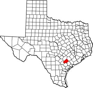 DeWitt County map | |
| Unincorporated communities | ||
| Ghost towns | ||
| Footnotes | ‡This populated place also has portions in an adjacent county or counties | |
| ||
Municipalities and communities of Lavaca County, Texas, United States | ||
|---|---|---|
| Cities | 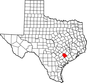 Lavaca County map | |
| Town | ||
| Unincorporated communities | ||
| Ghost towns | ||
| Footnotes | ‡This populated place also has portions in an adjacent county or counties | |
| ||
| Authority control |
|---|