Álvares Florence
Álvares Florence is a municipality in the state of São Paulo, Brazil. It has a population of 3,647 inhabitants (IBGE/2020) and an area of 362.9 km².[2]
Álvares Florence | |
|---|---|
Municipality | |
 Flag  Seal | |
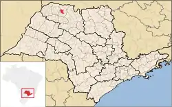 Location of Álvares Florence | |
 Álvares Florence Location of Álvares Florence | |
| Coordinates: 20°19′14″S 49°54′34″W | |
| Country | |
| Region | Southeast |
| State | |
| Mesoregion | São José do Rio Preto |
| Government | |
| • Mayor | Alberto César de Caires (DEM) |
| Area | |
| • Total | 362.9 km2 (140.1 sq mi) |
| Population (2020 [1]) | |
| • Total | 3,647 |
| • Density | 10.74/km2 (27.8/sq mi) |
| Time zone | UTC-3 (UTC-3) |
| • Summer (DST) | UTC-2 (UTC-2) |
| Postal Code | 15540-000 |
| Area code(s) | +55 17 |
| Website | Prefecture of Álvares Florence |
The city is located on the northwest of the state, 538 km from the city of São Paulo. Álvares Florence belongs to the Microregion of Votuporanga.
History
At the end of the 19th century, Joaquim Pedro da Silva built the first residence on the region. With the time a village appeared, being named São João Batista do Marinheiro.
In 1926, the village was elevated to district of Tanabi, with the name of Vila Monteiro, and in November 30, 1944, the name changed to Igapira, being a district of the newly created city of Votuporanga.
The city was officially established as a municipality on December 24, 1948, changing its name to the current form. On April 10, 1949, the municipal chamber was installed.[3]
Economy
The Tertiary sector corresponds to 43.88% of the Álvares Florence GDP. Agriculture and livestock is 29.45% of the GDP and the Industry corresponds to 26.67%.[4]
References
- IBGE 2020
- "Population at "Censo 2010"" (PDF) (in Portuguese). IBGE.gov.br. Retrieved 13 Jul 2011.
- "History of the City on the Prefecture's Site". alvaresflorence.sp.gov.br. Retrieved 13 July 2011.
- "Municipal Profile at SEADE". SEADE. Retrieved 14 July 2011.