2018–19 South-West Indian Ocean cyclone season
The 2018–19 South-West Indian Ocean cyclone season was the costliest and the most active season ever recorded since reliable records began in 1967. Additionally, it is also the deadliest cyclone season recorded in the South-West Indian Ocean, surpassing the 1891–92 season, in which the 1892 Mauritius cyclone devastated the island of Mauritius.[1] The season was an event of the annual cycle of tropical cyclone and subtropical cyclone formation in the South-West Indian Ocean basin. It officially began on November 15, 2018, and ended on April 30, 2019, with the exception for Mauritius and the Seychelles, which it ended on May 15, 2019. These dates conventionally delimit the period of each year when most tropical and subtropical cyclones form in the basin, which is west of 90°E and south of the Equator. Tropical and subtropical cyclones in this basin are monitored by the Regional Specialised Meteorological Centre in Réunion.
| 2018–19 South-West Indian Ocean cyclone season | |
|---|---|
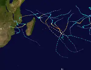 Season summary map | |
| Seasonal boundaries | |
| First system formed | September 13, 2018 |
| Last system dissipated | May 1, 2019 |
| Strongest storm | |
| Name | Kenneth |
| • Maximum winds | 215 km/h (130 mph) (10-minute sustained) |
| • Lowest pressure | 934 hPa (mbar) |
| Seasonal statistics | |
| Total disturbances | 15 |
| Total depressions | 15 |
| Total storms | 15 (record high) |
| Tropical cyclones | 11 (record high) |
| Intense tropical cyclones | 9 (record high) |
| Total fatalities | 1,382 total (Deadliest South-West Indian Ocean cyclone season on record) |
| Total damage | ≥ $2.311 billion (2019 USD) (Costliest South-West Indian Ocean cyclone season on record) |
| Related articles | |
Two tropical cyclones existed outside the conventional bounds of the season, with Moderate Tropical Storm 01 in September and the remnants of Tropical Cyclone Lorna in May. From all of these cyclones during the season, all but Haleh and Savannah produced impacts on land, with Idai causing at least 1,303 deaths and leaving at least 2,262 people missing, and causing US$2.2 billion in damages in Mozambique, Zimbabwe, Malawi, and Madagascar.[2][3][4] The season set a new record of nine intense tropical cyclones, the largest number since the start of reliable satellite coverage in 1967, surpassing the 2006–07 season.
Seasonal summary

The first tropical cyclone was an unnamed moderate tropical storm that formed northeast of Madagascar on September 13, 2018, two months before the official start of the season. Two cyclones formed in the month of November, with Intense Tropical Cyclone Alcide forming on November 5, and Severe Tropical Storm Bouchra entering the basin from the Australian region on November 9. Two tropical cyclones formed in the month of December, Cilida and Kenanga. Intense Tropical Cyclone Kenanga crossed into the basin from the Australian region, retaining its name assigned by TCWC Jakarta. Two moderate tropical storms formed in January, Desmond and Eketsang. Five more intense tropical cyclones formed during February and March: Funani, Gelena, Haleh, Idai, and Joaninha. In addition, Savannah crossed into the basin from the Australian basin as an intense tropical cyclone in March. In April 21, 2019, final two storms of the season formed at the same time, Kenneth and Lorna.
Systems
Moderate Tropical Storm 01
| Moderate tropical storm (MFR) | |
| Tropical storm (SSHWS) | |
  | |
| Duration | September 13 – September 17 |
|---|---|
| Peak intensity | 75 km/h (45 mph) (10-min) 1004 hPa (mbar) |
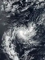
On September 11, a disturbance formed in the open waters of Indian Ocean. On the next day, the system intensified to a tropical depression formed to the southwest of Diego Garcia.[5] The system tracked west-southwestward, organizing slowly over marginally warm waters of 26–27 degrees Celsius and moderate wind shear.[6] On September 16, the tropical depression began to quickly weaken after encountering unfavorable conditions. On the next day, both the MFR and the JTWC issued their final warnings, and the system was downgraded to an extratropical low. The remains of the system dissipated a few hours later north of Madagascar.[7] In post-storm analysis, the system was upgraded into a moderate tropical storm, although it remained unnamed.[8]
Intense Tropical Cyclone Alcide
| Intense tropical cyclone (MFR) | |
| Category 4 tropical cyclone (SSHWS) | |
  | |
| Duration | November 5 – November 12 |
|---|---|
| Peak intensity | 165 km/h (105 mph) (10-min) 965 hPa (mbar) |
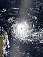
On November 6, a tropical depression formed well to the east-northeast of Madagascar.[9] The system continued to track generally west-southwestward into more favorable conditions for the next few hours, before strengthening into a Moderate Tropical Storm and was named Alcide later that day.[10] On November 7 at 06:00 UTC, Alcide strengthened into a tropical cyclone, or a Category 1-equivalent tropical cyclone on the Saffir–Simpson hurricane wind scale (SSHWS)[11] On November 8 at 06:00 UTC, Alcide strengthened into an intense tropical cyclone, or a Category 3-equivalent tropical cyclone on the SSHWS, with maximum 10-minute sustained winds of 90 knots (165 km/h; 105 mph) and a minimum central pressure of 965 hPa(mbar).[12] It was downgraded to a tropical cyclone 6 hours later, mostly due to cooler sea temperatures and generally less favorable conditions.[13] Alcide continued to weaken as it began an anticyclonic loop east of the northern tip of Madagascar, falling to tropical storm status at 12:00 UTC on November 9.[14] The system rapidly deteriorated thereafter, falling to tropical depression status at 00:00 UTC on November 11; Meteo-France discontinued advisories at noon that day.[15][16] The system continued east as a remnant low until November 13, when the remaining convection vanished, due to wind shear.
Severe Tropical Storm Bouchra
| Severe tropical storm (MFR) | |
| Tropical storm (SSHWS) | |
  | |
| Duration | November 9 (Entered basin) – November 19 |
|---|---|
| Peak intensity | 95 km/h (60 mph) (10-min) 990 hPa (mbar) |
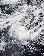
A weak low-pressure system developed in the equatorial Indian Ocean in Météo-France's area of responsibility on November 1 and moved slowly eastwards over the following few days while showing little signs of intensification.[17] Late on November 9, as the developing precursor depression to Very Severe Cyclonic Storm Gaja in the Bay of Bengal moved further away and the competing low-level airflow convergence associated with it diminished, which was earlier associated with the westerly wind burst on either side of Indian Ocean. [18] the system's structure organised sufficiently to be classified as a tropical disturbance by Météo-France.[19] Very shortly afterwards, the system crossed the 90th meridian east and entered the Australian region, where it was classified by TCWC Jakarta as a tropical depression on November 10 local time.[20] Later the same day, the JTWC assessed the developing low as having attained tropical storm status on the Saffir-Simpson Hurricane Wind Scale, and assigned the system the unofficial designation 04S.[21] A few hours later, at 10:00 UTC, the system moved back westwards and returned to the South-West Indian Ocean basin,[22] where it gained the name 'Bouchra' from Météo-France and underwent a twelve-hour phase of rapid intensification to severe tropical storm status.[23]
Over the following days, Bouchra fought increasingly unfavorable atmospheric conditions, and underwent a gradual weakening trend.[24] During this time, the cyclone proceeded to track in a slow cyclonic loop just to the west of the border of the Australian region in weak overall steering influences, and was often quasi-stationary.[24] After meandering here for a number of days, the system re-entered the Australian region late on November 12.[25] By this stage, the system had weakened significantly from its peak intensity, and was only at tropical depression strength.[26] The period of residence in the Australian basin proved to be short-lived once again, however, with Météo-France indicating that Ex-Tropical Storm Bouchra had returned to the far eastern part of their area of responsibility early on November 13.[25] In the early hours of November 14, the Australian Bureau of Meteorology noted that the system had crossed back into the Australian region basin.[27] However, on November 17, Bouchra crossed back over into the South-West Indian Ocean basin, as the storm began taking a southwestward trajectory.
Intense Tropical Cyclone Kenanga
| Intense tropical cyclone (MFR) | |
| Category 4 tropical cyclone (SSHWS) | |
  | |
| Duration | December 16 (Entered basin) – December 22 |
|---|---|
| Peak intensity | 185 km/h (115 mph) (10-min) 942 hPa (mbar) |
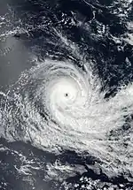
On December 14, a tropical low formed southwest of Sumatra in the Australian region basin.
It slowly strengthened and on the next day, the system was officially named Kenanga as it tracked roughly southwestward. Continuing on this course, Kenanga entered the South-West Indian basin on December 16. On the next day, the system quickly intensified into an intense tropical cyclone, and Kenanga maintained this intensity for another day.
The storm reached peak intensity on December 17, with 10-minute sustained wind speeds of 115 miles per hour (185 km/h), and a minimum central pressure of 942 mbar (hPa). On the morning of the next day, the system encountered high wind shear and started weakening, and Kenanga was downgraded to a Moderate Tropical Storm by the evening of that day. The system was finally downgraded to an extratropical low on December 19.
On the next day, Kenanga re-intensified into tropical depression. On December 22, Kenanga lost its remaining convection and dissipated. The system did not affect any land areas, and caused no damage or fatalities.
Intense Tropical Cyclone Cilida
| Intense tropical cyclone (MFR) | |
| Category 4 tropical cyclone (SSHWS) | |
  | |
| Duration | December 16 – December 24 |
|---|---|
| Peak intensity | 215 km/h (130 mph) (10-min) 940 hPa (mbar) |
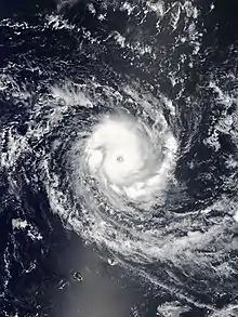
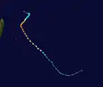
On December 16, Meteo-France tracked a low-pressure area inside an area of possible tropical cyclone development. While tracking southwest, it then intensified to tropical storm status and then cyclone status. On December 23, it passed east of Mauritius, bringing beneficial rainfall and gusting winds that knocked down tree branches. It then turned southeast and weakened, later dissipating in the far southern reaches of the basin.[28][29]
Moderate Tropical Storm Desmond
| Moderate tropical storm (MFR) | |
| Tropical storm (SSHWS) | |
  | |
| Duration | January 17 – January 22 |
|---|---|
| Peak intensity | 65 km/h (40 mph) (10-min) 995 hPa (mbar) |
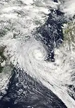
A tropical depression formed near the east coast of Mozambique on January 17. During the next couple of days, the storm made a counterclockwise loop towards the west, before turning northward. The system intensified into a moderate tropical storm on January 19 and was named Desmond. The system gradually intensified as it drifted northward. The storm reached peak intensity on January 20, as a moderate tropical storm with 10-minute sustained winds of 65 km/h (40 mph) wind and a minimum central pressure of 995 mbar. On the next day, Desmond made landfall in Mozambique. Afterward, the storm rapidly weakened and was downgraded to a remnant low on January 22. Later that day, Desmond turned eastward back towards the coast, while continuing to weaken. A few hours later, Desmond lost all of its remaining convection and dissipated.[30] The system dissipated on January 22.
Moderate Tropical Storm Eketsang
| Moderate tropical storm (MFR) | |
| Tropical storm (SSHWS) | |
  | |
| Duration | January 22 – January 24 |
|---|---|
| Peak intensity | 75 km/h (45 mph) (10-min) 992 hPa (mbar) |
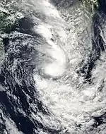
A disturbance formed over Madagascar on January 21. On the next day, the storm emerged into the Mozambique Channel and organized into a tropical depression. On January 23, the system strengthened into a moderate tropical storm and was named Eketsang. The system tracked southwestward while strengthening, reaching its peak intensity later that day, with 10-minute sustained winds of 75 km/h(45 mph) and a minimum central pressure of 993 mbar. On the same day, the storm turned to the southeast, back towards Madagascar. On January 24, the storm curved around the south coast of Madagascar and weakened into a subtropical depression. Afterward, the storm began accelerating southeastward, before dissipating on January 26. 27 deaths were reported from the storm, and 1 person went missing, mostly due to landslides.[31]
Intense Tropical Cyclone Funani
| Intense tropical cyclone (MFR) | |
| Category 4 tropical cyclone (SSHWS) | |
  | |
| Duration | February 3 – February 10 |
|---|---|
| Peak intensity | 195 km/h (120 mph) (10-min) 940 hPa (mbar) |
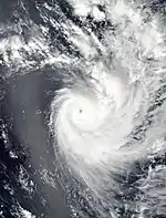
On February 2, a disturbance formed in the open Indian Ocean. The system in countered favorable conditions and began to rapidly intensified, reaching moderate tropical storm status on February 3 and further intensified into an intense tropical cyclone the next day. The storm recurved east and degan to move southwestwards. The system accelerated as it moved into an area of low sea surface temperature on February 7. The next day, it was downgraded to moderate tropical storm two days later. The storm transitioned to an Extratropical cyclone on February 10 before dissipating later that day.[32]
Intense Tropical Cyclone Gelena
| Intense tropical cyclone (MFR) | |
| Category 4 tropical cyclone (SSHWS) | |
  | |
| Duration | February 4 – February 14 (Exited basin) |
|---|---|
| Peak intensity | 205 km/h (125 mph) (10-min) 942 hPa (mbar) |
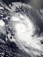
Gelena was the second storm to affect the island of Rodrigues in a week, following Intense Tropical Cyclone Funani. Gelena brought strong winds that destroyed 90% of the electric grid on the island.[33] Overall damage on the island were about US$1 million.[34]
Intense Tropical Cyclone Haleh
| Intense tropical cyclone (MFR) | |
| Category 4 tropical cyclone (SSHWS) | |
  | |
| Duration | February 28 – March 7 |
|---|---|
| Peak intensity | 175 km/h (110 mph) (10-min) 945 hPa (mbar) |
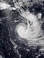
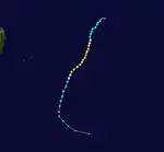
On February 28, Tropical Depression 10 formed in the south central Indian Ocean, south of the Maldives. On March 2, the system strengthened into Moderate Tropical Storm Haleh, before intensifying further into a severe tropical storm later that day. On March 3, Haleh intensified into a tropical cyclone. Finding itself in favourable conditions, Haleh continued to intensify and reached its peak intensity on March 4, as a Category 4-equivalent intense tropical cyclone, with 1-minute sustained winds of 215 km/h (130 mph). On March 5, Haleh meandered into hostile conditions with low sea surface ocean heat content and medium vertical wind shear, and the system weakened back to a Category 1 tropical cyclone. Haleh gradually weakened over the next couple of days, eventually degenerating into a post-tropical low late on March 7.
Intense Tropical Cyclone Idai
| Intense tropical cyclone (MFR) | |
| Category 4 tropical cyclone (SSHWS) | |
  | |
| Duration | March 4 – March 16 |
|---|---|
| Peak intensity | 195 km/h (120 mph) (10-min) 940 hPa (mbar) |
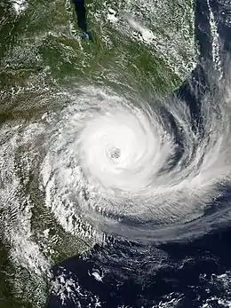
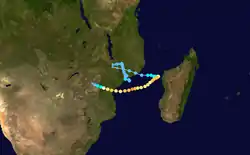
Tropical Depression 11 formed off the east coast of Mozambique on March 4. Afterward, the tropical depression drifted northeastward very slowly, making landfall on Mozambique later that day. On March 6, Tropical Depression 11 was given a yellow tropical cyclone development warning by the Joint Typhoon Warning Center (JTWC). On March 7, the storm turned west-southwestward, while continuing to retain its tropical identity overland. On March 8, Tropical Depression 11 weakened and turned back towards the east. Early on March 9, the tropical depression emerged into the Mozambique Channel and began to organize. On the same day, the JTWC stated that the system had a high probability for genesis into a tropical cyclone, and later on the same day, the system strengthened into a moderate tropical storm and received the name Idai. On March 10, Idai began to rapidly intensify, strengthening into a tropical cyclone near Madagascar, and the system made yet another turn westward, moving to the southwest. On the next day, the storm intensified into the seventh intense tropical cyclone of the season, and soon reached its peak intensity as a Category 4-equivalent tropical cyclone. On March 12, Idai began to weaken, as the system underwent an eyewall replacement cycle. On March 13, Idai began accelerating westward. At 00:00 UTC on March 15, the MFR reported that Idai had made landfall near Beira, Mozambique, with 10-minute sustained winds of 165 km/h (105 mph).[35] Idai quickly weakened after landfall, degenerating into a tropical depression later that day. Afterward, Idai slowly moved inland while dumping large amounts of rain, resulting in flash flooding. Late on March 16, Idai degenerated into a remnant low, but the storm's remnant continued dumping rain across the region. On March 17, Idai's remnant turned eastward once again, eventually re-emerging into the Mozambique Channel a second time on March 19. On March 21, Idai's remnants dissipated.[36][37]
As a tropical depression, Idai affected Malawi and Mozambique, during its first landfall. At least 56 people died, and 577 others were injured due to flooding in Malawi. About 83,000 people were displaced. The southern districts of Chikwawa and Nsanje became isolated by floodwaters.[38] In Mozambique, 66 people were killed by the flooding, and affected 141,000 people. The Council of Ministers required 1.1 billion metical (US$17.6 million) to help those who were affected by the flooding.[39] In total, Idai killed at least 1,297 people and left thousands more missing, becoming one of the deadliest tropical cyclones in the modern history of Africa and the Southern Hemisphere as a whole.[40][41][42][4] With this death toll, Idai is the deadliest tropical cyclone recorded in the South-West Indian Ocean basin, and the second-deadliest tropical cyclone overall in the Southern Hemisphere, behind only Cyclone Flores in 1973.[1] In addition, the total damages from the cyclone are expected to exceed US$2 billion (2019 USD), which would make Idai the costliest cyclone on record in the basin.[2][3]
Tropical Cyclone Savannah
| Tropical cyclone (MFR) | |
| Category 2 tropical cyclone (SSHWS) | |
  | |
| Duration | March 18 (entered basin) – March 20 |
|---|---|
| Peak intensity | 140 km/h (85 mph) (10-min) 966 hPa (mbar) |
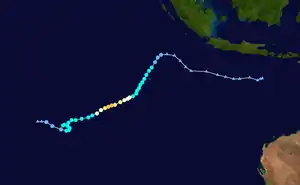
On March 18, Severe Tropical Cyclone Savannah crossed over from the Australian region basin into the South-West Indian basin, shortly after reaching its peak intensity. Savannah was classified as an tropical cyclone on the South-West Indian Ocean scale after it entered the basin. Savannah weakened soon after reaching its peak intensity. On March 19, Savannah transitioned into a post-tropical cyclone, with the system continuing southwestward. On the next day, Savannah's remnant looped eastward, before turning westward on March 21. The system weakened afterward, with Savannah's remnant dissipating on March 23.
Intense Tropical Cyclone Joaninha
| Intense tropical cyclone (MFR) | |
| Category 4 tropical cyclone (SSHWS) | |
  | |
| Duration | March 18 – March 30 |
|---|---|
| Peak intensity | 185 km/h (115 mph) (10-min) 939 hPa (mbar) |
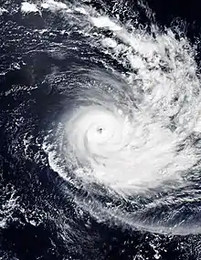
On March 18, Tropical Depression 13 formed to the east of Madagascar. After a few days of meandering to the west and then the southeast, the system intensified into Moderate Tropical Storm Joaninha on March 22, turning southward as it did so. On March 23, Joaninha strengthened into a severe tropical storm. Early on March 24, Joaninha strengthened further into a tropical cyclone on the MFR scale. On the next day, Joaninha intensified into an intense tropical cyclone. After moving over cooler waters, Joaninha slowly began to weaken, dropping to severe tropical storm intensity on the MFR scale on March 29. On March 30, Joaninha became post-tropical, shortly after merging with an upper-level low.
Joaninha passed within approximately 80 km (50 mi) of the Mauritian island of Rodrigues, producing wind gusts on the northern side of the island at Port Mathurin up to 161 km/h (100 mph), including gusts in excess of 100 km/h (60 mph) for 33 hours. Nearly 200 mm (8 in) of rain fell across the island during the passage of the system.[43]
Intense Tropical Cyclone Kenneth
| Intense tropical cyclone (MFR) | |
| Category 4 tropical cyclone (SSHWS) | |
  | |
| Duration | April 21 – April 29 |
|---|---|
| Peak intensity | 215 km/h (130 mph) (10-min) 934 hPa (mbar) |
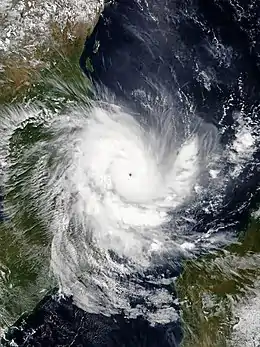
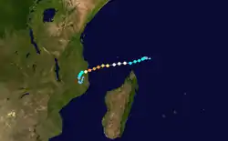
On April 21, Météo-France (MFR) initiated advisories on Tropical Disturbance 14, which was situated to the northeast of Madagascar. The system drifted westward, organizing as it did so. Early on April 23, the system strengthened into a tropical depression. Later that day, at 12:00 UTC, the tropical depression strengthened into a moderate tropical storm as was named Kenneth, becoming the fourteenth tropical storm of the season. Early on April 24, Kenneth strengthened into a tropical cyclone. Kenneth rapidly organized while approaching Mozambique, reaching Category 3-equivalent tropical cyclone intensity within several hours.[44][45] On the same day, Kenneth was projected to strike Mozambique within a day and bring more flooding and wind damage to the nation, about a month after Cyclone Idai had devastated the region, raising fears that the ongoing humanitarian crisis there could be worsened by the storm.[46][47] On the next day, Kenneth reached its peak intensity, becoming a Category 4-equivalent intense tropical cyclone, as the storm began to near landfall in Mozambique. However, at about that time, Kenneth initiated an eyewall replacement cycle and gradually began to weaken, just prior to landfall. Later that day, at 18:15 UTC, Kenneth made landfall as a Category 4-equivalent intense tropical cyclone in Mozambique, with 1-minute sustained winds of 220 km/h (140 mph), just north of Pemba.[46] This made Kenneth the most intense landfalling storm in Mozambique's recorded history.[48] Kenneth's landfall also marked the second time in Mozambique's recorded history in which two storms have made landfall during the same season at tropical cyclone intensity or higher.[49]
Kenneth underwent extremely rapid weakening upon making landfall, despite the relatively favorable atmospheric environment and flat terrain of northern Mozambique. The system's maximum ten-minute sustained winds decreased from 205 km/h (125 mph) to just 65 km/h (40 mph) in just ten hours after landfall, weakening the storm to tropical storm intensity.[50] On April 26, Kenneth weakened to tropical depression intensity, while continuing its southward motion. On April 27, Kenneth began drifting northward, also developing some thunderstorms off the coast of Mozambique.[51] Kenneth continued to weaken, dissipating by 12:00 UTC on April 29.[52]
Kenneth killed at least 52 people; seven on the island of Comoros,[53] and at least 45 people in Mozambique.[54][55] In Mozambique, Kenneth caused widespread damage in the city of Pemba, including extensive power outages and numerous felled trees.[56] Kenneth is estimated to have caused at least $100 million in damages.[57]
Tropical Cyclone Lorna
| Tropical cyclone (MFR) | |
| Category 2 tropical cyclone (SSHWS) | |
  | |
| Duration | April 21 – May 1 |
|---|---|
| Peak intensity | 150 km/h (90 mph) (10-min) 964 hPa (mbar) |
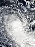
On April 21, Tropical Depression 15 formed to the southeast of the Maldives. The system moved southeastward, before turning south-southeastward on April 22, while slowly strengthening. On the next day, the system intensified into Moderate Tropical Storm Lorna, making the 2018–19 season the most active cyclone season recorded in the South-West Indian Ocean in the satellite era, surpassing the previous record set by the 1993–94 season. Lorna resumed a southeasterly direction on April 24, while continuing to organise. On April 25, Lorna then intensified into a severe tropical storm. On the same day, Lorna began to interact with a smaller tropical low to the east, in the Australian region basin, before absorbing the weaker system early on the next day.[58][59] On April 26, the JTWC upgraded Lorna to Category 1 status, while Lorna began turning towards the south. Soon afterward, Lorna encountered relatively strong vertical wind shear and steadily decreasing sea temperatures as it continued to track southwards, causing its gradual intensification trend to halt, and the JTWC to downgrade the system to a high-end tropical storm.
On 28 April, somewhat unexpectedly, and contradicting forecasts by MFR and the JTWC, the system developed a clearly defined eye and underwent steady intensification. Consequently, MFR upgraded the system to a tropical cyclone, and the JTWC upgraded Lorna to Category 2 status on the Saffir–Simpson scale. Around this time, Lorna deviated from its predominantly southwards motion, and assumed a track to the south-southeast. Due to the system being located on the very eastern edge of the South-West Indian Ocean basin during the previous two days, this slight easterly motion caused the cyclone to become centred directly over the 90th meridian east—the boundary of the Australian Bureau of Meteorology's area of responsibility. Lorna strengthened to peak intensity while tracking southwards along the boundary between the two regions, attaining ten-minute sustained winds of 150 km/h (90 mph) by 18:00 UTC on April 28.
By 29 April, the structure of the cyclone had degraded significantly, primarily due to strong vertical wind shear and resulting dry air intrusion.[60] As a result, the system was downgraded by the MFR to a severe tropical storm.[60] Very strong vertical wind shear, analysed at 40 knots (75 km/h; 45 mph) at 09:00 UTC on April 29,[61] caused Lorna to become devoid of deep convection later that day.[62] Having lost tropical characteristics, the system was downgraded by the MFR at 12:00 UTC to a powerful storm-force post-tropical depression. Gale-force winds ceased by 12:00 UTC on April 30,[63] and Ex-Tropical Cyclone Lorna exited the basin into the Australian region by 06:00 UTC on May 1.[64][65] Soon afterward, Lorna became an extratropical low,[66] before merging with another low-pressure system in the central southern Indian Ocean later that day.[64]
Storm names
Within the South-West Indian Ocean, tropical depressions and subtropical depressions that are judged to have 10-minute sustained windspeeds of 65 km/h (40 mph) by the Regional Specialized Meteorological Center on La Réunion Island, France (RSMC La Réunion) are usually assigned a name. However, it is the Sub-Regional Tropical Cyclone Advisory Centers in Mauritius and Madagascar who name the systems. The Sub-Regional Tropical Cyclone Advisory Center in Mauritius names a storm should it intensify into a moderate tropical storm between 55°E and 90°E. If instead a cyclone intensifies into a moderate tropical storm between 30°E and 55°E then the Sub-Regional Tropical Cyclone Advisory Center in Madagascar assigns the appropriate name to the storm. Beginning from the 2016–17 season, name lists within the South-West Indian Ocean will be rotated on a triennial basis. Storm names are only used once, so any storm name used this year will be removed from rotation and replaced with a new name for the 2021–22 season. The unused names are expected to be reused in the list for the 2021–22 season.[67]
|
|
|
Kenanga entered this basin as a moderate tropical storm from the Australian region on December 16, retaining its name assigned by TCWC Jakarta. Similarly, Savannah entered this basin as an intense tropical cyclone from the Australian region on March 17, retaining its name assigned by TCWC Perth. Furthermore, Moderate Tropical Storm 01 which formed in September was not assigned a name because it was not classified as a moderate tropical storm until the post-analysis was completed.
After the season, the twelve names used were automatically retired and were replaced with Ana, Batsirai, Cliff, Damako, Emnati, Fezile, Gomba, Halima, Issa, Jasmine, Karim and Letlama, respectively for the 2021–22 season.
Seasonal effects
This table lists all of the tropical cyclones and subtropical cyclones that were monitored during the 2018–2019 South-West Indian Ocean cyclone season. Information on their intensity, duration, name, areas affected, primarily comes from RSMC La Réunion. Death and damage reports come from either press reports or the relevant national disaster management agency while the damage totals are given in 2018 or 2019 USD.
| Name | Dates active | Peak classification | Sustained wind speeds |
Pressure | Areas affected | Damage (USD) |
Deaths | Refs |
|---|---|---|---|---|---|---|---|---|
| 01 | September 13 – 17 | Moderate tropical storm | 75 km/h (45 mph) | 1004 hPa (29.65 inHg) | None | None | None | |
| Alcide | November 5 – 12 | Intense tropical cyclone | 165 km/h (105 mph) | 965 hPa (28.50 inHg) | Agaléga, Madagascar, Tanzania | None | None | |
| Bouchra | November 9 – 19 | Severe tropical storm | 95 km/h (60 mph) | 990 hPa (29.23 inHg) | None | None | None | |
| Kenanga | December 16 – 22 | Intense tropical cyclone | 185 km/h (115 mph) | 942 hPa (27.81 inHg) | None | None | None | |
| Cilida | December 16 – 24 | Intense tropical cyclone | 215 km/h (130 mph) | 940 hPa (27.76 inHg) | Mauritius | Minimal | None | |
| Desmond | January 17 – 22 | Moderate tropical storm | 65 km/h (40 mph) | 995 hPa (29.38 inHg) | Mozambique, Madagascar | Unknown | None | |
| Eketsang | January 22 – 24 | Moderate tropical storm | 75 km/h (45 mph) | 993 hPa (29.32 inHg) | Madagascar | Unknown | 27 | |
| Funani | February 3 – 10 | Intense tropical cyclone | 195 km/h (120 mph) | 940 hPa (27.76 inHg) | Rodrigues | Minimal | None | |
| Gelena | February 4 – 14 | Intense tropical cyclone | 205 km/h (125 mph) | 942 hPa (27.82 inHg) | Madagascar, Mauritius, Rodrigues | $1 million | None | |
| Haleh | February 28 – March 7 | Intense tropical cyclone | 175 km/h (110 mph) | 945 hPa (27.91 inHg) | None | None | None | |
| Idai | March 4 – 16 | Intense tropical cyclone | 195 km/h (120 mph) | 940 hPa (27.76 inHg) | Mozambique, Malawi, Madagascar, Zimbabwe | ≥$2.2 billion | 1,303 | [68] |
| Savannah | March 18 – 20 | Tropical cyclone | 140 km/h (85 mph) | 966 hPa (28.53 inHg) | None | None | None | |
| Joaninha | March 18 – 30 | Intense tropical cyclone | 185 km/h (115 mph) | 939 hPa (27.73 inHg) | Rodrigues | None | None | |
| Kenneth | April 21 – 29 | Intense tropical cyclone | 215 km/h (130 mph) | 934 hPa (27.58 inHg) | Seychelles, Madagascar, Comoros, Mozambique, Tanzania, Malawi | ≥$100 million | 52 | [53][57] |
| Lorna | April 21 – May 1 | Tropical cyclone | 150 km/h (90 mph) | 964 hPa (28.47 inHg) | None | None | None | |
| Season aggregates | ||||||||
| 15 systems | September 13 – May 1 | 215 km/h (130 mph) | 934 hPa (27.58 inHg) | ≥$2.311 billion | 1,382 | |||
See also
- Tropical cyclones in 2018 and 2019
- List of Southern Hemisphere cyclone seasons
- Atlantic hurricane seasons: 2018, 2019
- Pacific hurricane seasons: 2018, 2019
- Pacific typhoon seasons: 2018, 2019
- North Indian Ocean cyclone seasons: 2018, 2019
- 2018–19 Australian region cyclone season
- 2018–19 South Pacific cyclone season
- 1999–2000 South-West Indian Ocean cyclone season – The third-deadliest South-West Indian Ocean cyclone season
Footnotes
References
- Masters, Jeff. "Africa's Hurricane Katrina: Tropical Cyclone Idai Causes an Extreme Catastrophe". Weather Underground. Retrieved 23 March 2019.
- "Cyclone Idai damages estimated at $2 billion: World Bank". Yahoo Finance. 12 April 2019. Retrieved 1 May 2019.
- Lynsey Chutel (16 April 2019). "One month later: Cyclone Idai's devastation by the numbers". Quartz Africa. Retrieved 1 May 2019.
- Centre for Research on the Epidemiology of Disasters. "EM-DAT: The Emergency Events Database". Université catholique de Louvain.
- http://www.meteo.fr/temps/domtom/La_Reunion/webcmrs9.0/francais/activiteope/bulletins/cmrs/CMRSF_201809140600_1_1_20182019.pdf (in French)
- http://www.meteo.fr/temps/domtom/La_Reunion/webcmrs9.0/francais/activiteope/bulletins/cmrs/CMRSF_201809150600_3_1_20182019.pdf (in French)
- http://www.meteo.fr/temps/domtom/La_Reunion/webcmrs9.0/francais/activiteope/bulletins/cmrs/CMRSF_201809170600_7_1_20182019.pdf (in French)
- "Saisons cycloniques archivées: Tempête Tropicale Modérée 01" (in French). Météo-France. 2018. Retrieved November 8, 2018.
- http://www.meteo.fr/temps/domtom/La_Reunion/webcmrs9.0/francais/activiteope/bulletins/cmrs/CMRSF_201811060600_1_2_20182019.pdf (in French)
- http://www.meteo.fr/temps/domtom/La_Reunion/webcmrs9.0/francais/activiteope/bulletins/cmrs/CMRSF_201811061800_ALCIDE.pdf (in French)
- http://www.meteo.fr/temps/domtom/La_Reunion/webcmrs9.0/francais/activiteope/bulletins/cmrs/CMRSF_201811070600_ALCIDE.pdf (in French)
- http://www.meteo.fr/temps/domtom/La_Reunion/webcmrs9.0/francais/activiteope/bulletins/cmrs/CMRSF_201811080600_ALCIDE.pdf (in French)
- http://www.meteo.fr/temps/domtom/La_Reunion/webcmrs9.0/francais/activiteope/bulletins/cmrs/CMRSF_201811081200_ALCIDE.pdf (in French)
- http://www.meteo.fr/temps/domtom/La_Reunion/webcmrs9.0/francais/activiteope/bulletins/cmrs/CMRSF_201811091200_ALCIDE.pdf (in French)
- http://www.meteo.fr/temps/domtom/La_Reunion/webcmrs9.0/francais/activiteope/bulletins/cmrs/CMRSF_201811110000_EX-ALCIDE.pdf (in French)
- http://www.meteo.fr/temps/domtom/La_Reunion/webcmrs9.0/francais/activiteope/bulletins/cmrs/CMRSF_201811111200_EX-ALCIDE.pdf (in French)
- "12 UTC Gradient Level Wind Analysis Chart". Bureau of Meteorology. 1 November 2018.
- "Tropical Activity Bulletin" (PDF). Météo-France La Réunion. 9 November 2018.
- "Moderate Tropical Storm Bouchra Forecast Track Map". Météo-France La Réunion. 10 November 2018. Archived from the original on 11 November 2018.
- "Current Tropical Cyclone Basin Activity". Meteorology, Climatology and Geophysical Agency. 10 November 2018. Archived from the original on 23 October 2018.
- "Tropical Cyclone 04S Warning #1". Joint Typhoon Warning Center. 10 November 2018. Archived from the original on 10 November 2018.
- "Tropical Activity Bulletin" (PDF). Météo-France La Réunion. 10 November 2018.
- "Bouchra Analysis Bulletin #2" (PDF). Météo-France La Réunion. 11 November 2018.
- "Tropical Storm Bouchra Advisory (12 UTC)" (PDF). Météo-France La Réunion. 11 November 2018. Retrieved 14 November 2018.
- "Tropical Activity Bulletin" (PDF). Météo-France La Réunion. 13 November 2018. Retrieved 13 November 2018.
- "Western Region Tropical Cyclone Outlook". Bureau of Meteorology. 13 November 2018. Archived from the original on 13 November 2018. Retrieved 13 November 2018.
- "Western Region Tropical Cyclone Outlook". Bureau of Meteorology. 14 November 2018. Archived from the original on 14 November 2018. Retrieved 14 November 2018.
- "Cilida: un petit tour puis s'en va". Le Express. December 23, 2018. Retrieved January 3, 2019.
- Shabneeze Oozeear (December 25, 2018). "Cilida : les pluies apportées par le cyclone bénéfique aux plantations". Mauritius Broadcasting Corporation. Retrieved January 3, 2019.
- Hélia Chopo (January 23, 2019). "Mais de 400 famílias afectadas pela tempestade "Desmond" em Sofala" (in Portuguese). O PAÍS. Retrieved January 30, 2019.
- "Madagascar : 27 morts suite au fortes pluies et à la Tempête EKETSANG" (in French). Cyclone Ocean Indien. January 31, 2019. Retrieved February 3, 2019.
- "Cyclone Funani : Air Mauritius annule six vols de Rodrigues" (in French). Le Mauricien. February 7, 2019. Retrieved February 11, 2019.
- Whitfield, Kate (February 10, 2019). "Mauritius cyclone satellite tracker: Rodrigues SMASHED by Cyclone Gelena - SHOCK charts". Daily Express. Retrieved February 11, 2019.
- Austin, Nick (March 28, 2019). "Small island damaged by second cyclone this year". FreightWaves. Retrieved March 31, 2019.
- "Intense Tropical Cyclone Idai Warning 26" (PDF). Meteo France La Reunion. 15 March 2019. Archived from the original (PDF) on 15 March 2019. Retrieved 15 March 2019.
- "Bulletin for Cyclonic Activity and Significant Tropical Weather in the Southwest Indian Ocean" (PDF). Meteo France La Reunion. 21 March 2019. Archived from the original (PDF) on 23 March 2019. Retrieved 23 March 2019.
- "Bulletin for Cyclonic Activity and Significant Tropical Weather in the Southwest Indian Ocean" (PDF). Meteo France La Reunion. 22 March 2019. Archived from the original (PDF) on 23 March 2019. Retrieved 23 March 2019.
- Phiri, Frank (March 13, 2019). "Malawi flooding death toll rises to 56, braced for Cyclone Idai". Reuters. Retrieved March 13, 2019.
- "Floods kill 66 in Mozambique". Gulf Times. March 13, 2019. Retrieved March 13, 2019.
- Funes, Yessenia. "Cyclone Idai Poised to Become Southern Hemisphere's Deadliest Tropical Storm, With More Than 1,000 Feared Dead". Earther. Retrieved 20 March 2019.
- Alan Yuhas (19 March 2019). "Cyclone Idai May Be 'One of the Worst' Disasters in the Southern Hemisphere". New York Times. Retrieved 19 March 2019.
- Zenaida Machado (3 April 2019). "Thousands Missing in Mozambique Following Cyclone Idai". Human Rights Watch. Retrieved 3 April 2019.
- "Tropical Cyclone Joaninha slams Indian Ocean island of Rodrigues". www.aljazeera.com. Retrieved 2019-03-28.
- Tropical Cyclone 24S (Kenneth) Warning 008. Joint Typhoon Warning Center (Report). Naval Meteorology and Oceanography Command. 24 April 2019. Archived from the original on 24 April 2019. Retrieved 24 April 2019.
- Intense Tropical Cyclone 14 (Kenneth): Warning 10 (PDF). Meteo France la Reunion (Report). 25 April 2019. Archived from the original (PDF) on 25 April 2019. Retrieved 25 April 2019.
- Jonathan Belles (24 April 2019). "Tropical Cyclone Kenneth to Bring Feet of Rain, Damaging Winds to Mozambique Weeks After Idai Brings Humanitarian Crisis". The Weather Company. Retrieved 24 April 2019.
- Brandon Miller; Bukola Adebayo (24 April 2019). "Another tropical cyclone is taking aim at storm-wrecked Mozambique". Cable News Network. Retrieved 24 April 2019.
- Brandon Miller (25 April 2019). "Cyclone Kenneth: Thousands evacuated as Mozambique is hit with the strongest storm in its history". Cable News Network. Retrieved 25 April 2019.
- "Tens of thousands evacuated as Cyclone Kenneth hits Mozambique". Al-Jazeera News. 25 April 2019. Retrieved 25 April 2019.
- Overland Depression 14 (Ex-Kenneth): Warning 14 (PDF). Meteo France la Reunion (Report). 26 April 2019. Archived from the original (PDF) on 26 April 2019. Retrieved 26 April 2019.
- Bulletin for Cyclonic Activity and Significant Tropical Weather in the Southwest Indian Ocean (PDF). Meteo France la Reunion (Report). 27 April 2019. Archived from the original (PDF) on 27 April 2019. Retrieved 27 April 2019.
- Bulletin for Cyclonic Activity and Significant Tropical Weather in the Southwest Indian Ocean (PDF). Meteo France la Reunion (Report). 29 April 2019. Archived from the original (PDF) on 30 April 2019. Retrieved 30 April 2019.
- "Comoros: Humanitarian Situation Report No #2 - Cyclone Kenneth". Relief Web. UN Children's Fund. 25 April 2019. Retrieved 28 April 2019.
- "Southern Africa: Tropical Cyclone Kenneth Flash Update No. 13 (12 May 2019)". Relief Web. UN Office for the Coordination of Humanitarian Affairs. Retrieved 14 May 2019.
- Aaro, David (27 April 2019). "Cyclone Kenneth roars through Mozambique, kills at least 5". Fox News. Fox News Network. Retrieved 28 April 2019.
- "Cyclone Kenneth: Storm-battered Mozambique hit again". BBC News. 25 April 2019. Retrieved 25 April 2019.
- Global Catastrophe Recap April 2019 (PDF). AON Benfield (Report). Retrieved 17 May 2019.
- "Indian Ocean Tropical Weather Advisory". Joint Typhoon Warning Center. 25 April 2019. Archived from the original on 26 April 2019. Retrieved 26 April 2019.
- "Western Region Tropical Cyclone Outlook". Bureau of Meteorology. 26 April 2019. Archived from the original on 26 April 2019. Retrieved 26 April 2019.
- "Tropical Cyclone Analysis Bulletin #26 (Lorna)" (PDF). Météo-France (in French). 29 April 2019. Retrieved 29 April 2019.
- "Tropical Cyclone Analysis Bulletin #27 (Lorna)" (PDF). Météo-France (in French). 29 April 2019. Retrieved 29 April 2019.
- "Tropical Cyclone Warning #24 (Lorna)". Joint Typhoon Warning Center. 29 April 2019. Archived from the original on 29 April 2019. Retrieved 29 April 2019.
- "South-West Indian Ocean Cyclonic Activity Bulletin" (PDF). Météo-France. 30 April 2019. Retrieved 30 April 2019.
- "Western Area High Seas Forecast (11Z)". Bureau of Meteorology. 1 May 2019. Archived from the original on 1 May 2019. Retrieved 1 May 2019.
- "South-West Indian Ocean Cyclone Activity Bulletin" (PDF). Météo-France (in French). 1 May 2019. Retrieved 1 May 2019.
- "Western Area High Seas Forecast (23Z)". Bureau of Meteorology. 1 May 2019. Archived from the original on 2 May 2019. Retrieved 2 May 2019.
- Regional Association I Tropical Cyclone Committee (2016). "Tropical Cyclone Operational Plan for the South-West Indian Ocean" (PDF). World Meteorological Organization. Retrieved 2016-10-05.
- "Global Catastrophe Recap: First Half of 2019" (PDF). Aon Benfield. Retrieved 12 August 2019.
External links
| Wikimedia Commons has media related to 2018-19 South-West Indian Ocean cyclone season. |