Alaca, Çorum
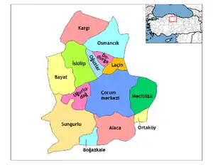
Alaca is one of the largest districts of Çorum Province in the Black Sea region of Turkey. It is located 52 km (32 mi) from the city of Çorum, on a road from the Black Sea coast to central Anatolia. Population is 22,092 as of 2010.[4]
Alaca | |
|---|---|
Town | |
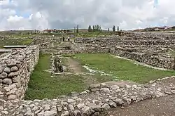
 Alaca Hüyük | |
 Location of Alaca within Turkey. | |
 Alaca Location of Alaca within Turkey. | |
| Coordinates: 40.16833°N 34.84250°E | |
| Country | |
| Region | Black Sea |
| Province | Çorum |
| Government | |
| • Mayor | Muhammet Esat Eyvaz (AKP) |
| Area | |
| • District | 1,361.42 km2 (525.65 sq mi) |
| Population (2012)[2] | |
| • Urban | 21,113 |
| • District | 35,324 |
| • District density | 26/km2 (67/sq mi) |
| Time zone | UTC+2 (EET) |
| • Summer (DST) | UTC+3 (EEST) |
| Postal code | 19x xx |
| Area code(s) | 364 |
| Climate | Dsb[3] |
| Website | |
The ancient Hittite settlement of Alacahöyük is located in Alaca district.
Population
| Population | |||
|---|---|---|---|
| Year | Center | Villages | Total |
| 2007 | |||
| 2000 | 24.983 | 28.210 | 53.193 |
| 1997 | |||
| 1990 | 20.646 | 32.757 | 53.403 |
| 1985 | 18.056 | ||
| 1980 | 15.649 | 41.075 | 56.724 |
| 1975 | 12.552 | ||
| 1970 | 9.674 | 46.983 | 56.657 |
| 1965 | 9.745 | ||
| 1960 | 7.168 | 47.147 | 54.315 |
| 1955 | |||
| 1950 | 3.843 | 42.601 | 46.444 |
| 1945 | |||
| 1940 | |||
| 1935 | |||
| 1927 | 2.066 | 24.721 | 26.787 |
| 1907 | |||
| 1902 | |||
| 1893 | |||
References
- "Area of regions (including lakes), km²". Regional Statistics Database. Turkish Statistical Institute. 2002. Retrieved 2013-03-05.
- "Population of province/district centers and towns/villages by districts - 2012". Address Based Population Registration System (ABPRS) Database. Turkish Statistical Institute. Retrieved 2013-02-27.
- Alaca Climate-Data.org
- Statistical Institute
External links
This article is issued from Wikipedia. The text is licensed under Creative Commons - Attribution - Sharealike. Additional terms may apply for the media files.
