Aledo, Texas
Aledo (/əˈliːdoʊ/ ə-LEE-doh) is a city in Parker County, Texas, United States. The population was 2,716 at the 2010 census.
Aledo, Texas | |
|---|---|
 | |
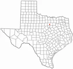 Location of Aledo, Texas | |
 | |
 Aledo, Texas Location of Aledo, Texas  Aledo, Texas Aledo, Texas (the United States) | |
| Coordinates: 32°41′44″N 97°36′12″W | |
| Country | United States |
| State | Texas |
| County | Parker |
| Area | |
| • Total | 2.62 sq mi (6.80 km2) |
| • Land | 2.62 sq mi (6.80 km2) |
| • Water | 0.00 sq mi (0.00 km2) |
| Elevation | 883 ft (269 m) |
| Population (2010) | |
| • Total | 2,716 |
| • Estimate (2019)[2] | 4,985 |
| • Density | 1,899.77/sq mi (733.54/km2) |
| Time zone | UTC-6 (Central (CST)) |
| • Summer (DST) | UTC-5 (CDT) |
| ZIP code | 76008 |
| Area code(s) | 682/817 |
| FIPS code | 48-01744[3] |
| GNIS feature ID | 1329342[4] |
| Website | http://www.aledo-texas.com/ |
The city is served by the Aledo Independent School District.
History
Pronounced [uh LEE do] The Parker post office was established in 1880 by Littleberry Rudolph Fawks. Two years later the name was changed to Aledo, likely suggested by a Texas & Pacific Railway official for Aledo, Illinois. Post office established May 25, 1882 as Aledo, postmaster Eli J. McConnell.
Geography
According to the United States Census Bureau, the city has a total area of 1.9 square miles (4.9 km2), all land.
Climate
| Climate data for Aledo | |||||||||||||
|---|---|---|---|---|---|---|---|---|---|---|---|---|---|
| Month | Jan | Feb | Mar | Apr | May | Jun | Jul | Aug | Sep | Oct | Nov | Dec | Year |
| Average high °F (°C) | 54.9 (12.7) |
59.4 (15.2) |
67.1 (19.5) |
76.1 (24.5) |
83.1 (28.4) |
90.9 (32.7) |
95.9 (35.5) |
96.0 (35.6) |
88.5 (31.4) |
78.6 (25.9) |
66.7 (19.3) |
57.7 (14.3) |
76.2 (24.6) |
| Average low °F (°C) | 31.7 (−0.2) |
36.0 (2.2) |
43.4 (6.3) |
53.3 (11.8) |
61.6 (16.4) |
69.1 (20.6) |
72.8 (22.7) |
72.1 (22.3) |
65.2 (18.4) |
54.5 (12.5) |
43.8 (6.6) |
34.8 (1.6) |
53.2 (11.8) |
| Average precipitation inches (mm) | 1.89 (48) |
2.29 (58) |
2.86 (73) |
2.75 (70) |
4.52 (115) |
3.55 (90) |
2.22 (56) |
2.44 (62) |
3.26 (83) |
3.60 (91) |
2.43 (62) |
2.19 (56) |
33.99 (863) |
| Source: Western Regional Climate Center [5] | |||||||||||||
Demographics
| Historical population | |||
|---|---|---|---|
| Census | Pop. | %± | |
| 1970 | 620 | — | |
| 1980 | 1,027 | 65.6% | |
| 1990 | 1,169 | 13.8% | |
| 2000 | 1,726 | 47.6% | |
| 2010 | 2,716 | 57.4% | |
| 2019 (est.) | 4,985 | [2] | 83.5% |
| U.S. Decennial Census[6] | |||
At the 2000 census there were 1,726 people in 601 households, including 494 families, in the city. The population density was 909.2 people per square mile (350.7/km2). There were 625 housing units at an average density of 329.2 per square mile (127.0/km2). The racial makeup of the city was 97.22% White, 0.29% African American, 0.41% Native American, 0.41% Asian, 0.58% from other races, and 1.10% from two or more races. Hispanic or Latino of any race were 2.55%.[3]
Of the 601 households 49.1% had children under the age of 18 living with them, 67.1% were married couples living together, 12.6% had a female householder with no husband present, and 17.8% were non-families. 15.6% of households were one person and 4.8% had living alone who was 65 or older. The average household size was 2.87 and the average family size was 3.21.
The age distribution was 33.1% under the age of 18, 5.9% from 18 to 24, 34.4% from 25 to 44, 19.9% from 45 to 64, and 6.7% 65 or older. The median age was 34 years. For every 100 females, there were 89.7 males. For every 100 females age 18 and over, there were 90.3 males.
The median household income was $54,327 and the median family income was $56,897. Males had a median income of $41,193 versus $29,671 for females. The per capita income for the city was $21,664. About 1.4% of families and 2.3% of the population were below the poverty line, including 1.1% of those under age 18 and 6.6% of those age 65 or over.
Notable people
- Bill Paxton, an actor and director, most famous for the HBO series Big Love, spent a few years living in Aledo before moving to Fort Worth, Texas.
- David Barton, founder and president of the Wallbuilders organization. He is also an author, evangelical minister, and political activist.
- Daniel Hunter, known for his music project, Analog Rebellion (formerly PlayRadioPlay!)
- Mary Michael Patterson, Broadway actress and singer, known for appearing in The Phantom of the Opera
- E. R. Bills (author), a writer and journalist known for his books on Texas history and his research into the Slocum Massacre.
References
- "2019 U.S. Gazetteer Files". United States Census Bureau. Retrieved August 7, 2020.
- "Population and Housing Unit Estimates". United States Census Bureau. May 24, 2020. Retrieved May 27, 2020.
- "U.S. Census website". United States Census Bureau. Retrieved 2008-01-31.
- "US Board on Geographic Names". United States Geological Survey. 2007-10-25. Retrieved 2008-01-31.
- "Period of Record Monthly Climate Summary". 2017. Retrieved on July 12, 2017.
- "Census of Population and Housing". Census.gov. Retrieved June 4, 2015.
External links
Municipalities and communities of Parker County, Texas, United States | ||
|---|---|---|
| Cities | 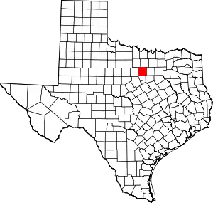 Parker County map | |
| Towns | ||
| CDPs | ||
| Other unincorporated communities | ||
| Footnotes | ‡This populated place also has portions in an adjacent county or counties | |
| ||

| Authority control |
|---|
