Denton County, Texas
Denton County is located in the U.S. state of Texas. As of the 2010 census, its population was 662,614,[1] making it the 9th-most populous county in Texas. The county seat is Denton.[2] The 2019 Census Bureau estimate for Denton County's population is 887,207.[3] The county, which was named for John B. Denton, was established in 1846. Denton County constitutes part of the Dallas–Fort Worth metroplex. In 2007, it was one of the fastest-growing counties in the United States.[4]
Denton County | |
|---|---|
County | |
| Denton County | |
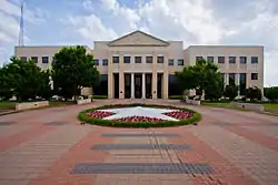 The Denton County Courts Building, built 1998 | |
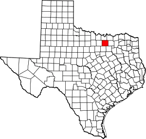 Location within the U.S. state of Texas | |
 Texas's location within the U.S. | |
| Coordinates: 33°12′N 97°07′W | |
| Country | |
| State | |
| Founded | April 11, 1846 |
| Named for | John B. Denton |
| Seat | Denton |
| Largest city | Denton |
| Area | |
| • Total | 953 sq mi (2,470 km2) |
| • Land | 878 sq mi (2,270 km2) |
| • Water | 75 sq mi (190 km2) 7.8% |
| Population (2010) | |
| • Total | 662,614 |
| • Estimate (2019) | 887,207 |
| • Density | 952/sq mi (368/km2) |
| Time zone | UTC−6 (Central) |
| • Summer (DST) | UTC−5 (CDT) |
| Congressional districts | 24th, 26th |
| Website | dentoncounty |
History
Before the arrival of settlers, various Native American peoples, including the Kichai and the Lenape, infrequently populated the area.[5] The area was settled by Peters Colony landowners in the early 1840s.[6] Until the annexation of Texas, the area was considered part of Fannin County.[7] On April 11, 1846, the First Texas Legislature established Denton County.[8] The county was named for John B. Denton, who was killed while raiding a Native American village in Tarrant County in 1841.[9] Originally, the county seat was set at Pickneyville. This was later changed to Alton, where the Old Alton Bridge currently stands, and then moved finally to Denton.
By 1860, the population of the county had increased to 5,031.[10] On March 4, 1861, residents of the county narrowly voted for secession from the Union, with 331 votes cast for and 264 against.[11] The Missouri–Kansas–Texas Railroad reached Lewisville, located in the southern portion of the county, by the early 1880s.[6] The Denton County Courthouse-on-the-Square was built in 1896, and today, the building currently houses various government offices, as well as a museum.[12]
Geography
| Denton, Texas | ||||||||||||||||||||||||||||||||||||||||||||||||||||||||||||
|---|---|---|---|---|---|---|---|---|---|---|---|---|---|---|---|---|---|---|---|---|---|---|---|---|---|---|---|---|---|---|---|---|---|---|---|---|---|---|---|---|---|---|---|---|---|---|---|---|---|---|---|---|---|---|---|---|---|---|---|---|
| Climate chart (explanation) | ||||||||||||||||||||||||||||||||||||||||||||||||||||||||||||
| ||||||||||||||||||||||||||||||||||||||||||||||||||||||||||||
| ||||||||||||||||||||||||||||||||||||||||||||||||||||||||||||
According to the U.S. Census Bureau, the county has a total area of 953 square miles (2,470 km2), of which 878 square miles (2,270 km2) are land and 75 square miles (190 km2) (7.8%) are covered by water.[14] Denton County is located in the northern part of the Dallas-Fort Worth metroplex, about 35 miles south of the border between Texas and Oklahoma.[15] It is drained by two forks of the Trinity River.[16] The largest body of water in Denton County is Lewisville Lake, which was formed in 1954 when the Garza–Little Elm Reservoir was merged with Lake Dallas. The county is on the western edge of the eastern Cross Timbers and also encompasses parts of the Grand Prairie portion of the Texas blackland prairies. Portions of Denton County sit atop the Barnett shale, a geological formation believed to contain large quantities of natural shale gas. Between 1995 and 2007, the number of natural gas wells in the county increased from 156 to 1,820, which has led to some controversy over the pollution resulting from hydraulic fracturing.[17]
Adjacent counties
- Cooke County (north)
- Grayson County (northeast)
- Collin County (east)
- Dallas County (southeast)
- Tarrant County (south)
- Wise County (west)
Demographics
| Historical population | |||
|---|---|---|---|
| Census | Pop. | %± | |
| 1850 | 641 | — | |
| 1860 | 5,031 | 684.9% | |
| 1870 | 7,251 | 44.1% | |
| 1880 | 18,143 | 150.2% | |
| 1890 | 21,289 | 17.3% | |
| 1900 | 28,318 | 33.0% | |
| 1910 | 31,258 | 10.4% | |
| 1920 | 35,355 | 13.1% | |
| 1930 | 32,822 | −7.2% | |
| 1940 | 33,658 | 2.5% | |
| 1950 | 41,365 | 22.9% | |
| 1960 | 47,432 | 14.7% | |
| 1970 | 75,633 | 59.5% | |
| 1980 | 143,126 | 89.2% | |
| 1990 | 273,525 | 91.1% | |
| 2000 | 432,976 | 58.3% | |
| 2010 | 662,614 | 53.0% | |
| 2019 (est.) | 887,207 | [18] | 33.9% |
| U.S. Decennial Census[19] 1850–2010[20] | |||
2015 Texas Population Estimate Program
As of the 2015 Texas Population Estimate Program, the population of the county was 778,846, non-Hispanic whites 459,448 (59.0%), Black Americans 69,040 (8.9%), and other non-Hispanics 85,406 (11.0%). Hispanics and Latinos (of any race) 164,952 (21.2%).[21]
2010 Census
As of the 2010 United States Census,[22] there were 662,614 people, 224,840 households and 256,139 housing units in the county. The population density was 754.3 people per square mile. The racial makeup of the county was 75% White, 8.4% African American, 0.7% Native American, 6.6% Asian, and 3.0% from two or more races. About 18.2% of the population was Hispanic or Latino of any race.[1] Denton County ranked 29th on the US Census Bureau's list of fastest-growing counties between 2000 and 2007, with a 41.4% increase in population.[4]
A Williams Institute analysis of 2010 census data found about 5.2 same-sex couples per 1,000 households in the county.[23]
Government and politics
Government
Denton County, like all counties in Texas, is governed by a commissioners court, which consists of the county judge (the chairperson of the court), who is elected county-wide, and four commissioners who are elected by the voters in each of four districts.
Justices of the peace are county officials with jurisdiction over landlord/tenant issues, small civil claims, certain misdemeanors, and other matters.[24]
County commissioners
| Office | Name | Party | |
|---|---|---|---|
| County Judge | Andy Eads | Republican | |
| Commissioner, Precinct 1 | Ryan Williams | Republican | |
| Commissioner, Precinct 2 | Ron Marchant | Republican | |
| Commissioner, Precinct 3 | Bobbie Mitchell | Republican | |
| Commissioner, Precinct 4 | Dianne Edmondson | Republican | |
County officials
| Office | Name | Party | |
|---|---|---|---|
| District attorney | Paul Johnson | Republican | |
| County clerk | Juli Luke | Republican | |
| District clerk | David Trantham | Republican | |
| Sheriff | Tracy Murphree | Republican | |
| Tax Assessor | Michelle French | Republican | |
| Treasurer | Cindy Yeatts Brown | Republican | |
Justices of the peace
| Office | Name | Party |
|---|---|---|
| Precinct 1 | Joe Holland | Republican |
| Precinct 2 | James R. DePiazza | Republican |
| Precinct 3 | James Kerbow | Republican |
| Precinct 4 | Harris Hughey | Republican |
| Precinct 5 | Mike Oglesby | Republican |
| Precinct 6 | Christopher Lopez | Democrat |
Politics
Denton County, like most suburban counties in Texas, is reliably Republican in statewide and national elections, although becoming less so since the 2018 election, when Beto O'Rourke earned 45.52% of the county's votes and two Democrats were elected.[25] The last Democratic presidential candidate to win the county was native Texan Lyndon B. Johnson in 1964,[26] the only time since 1952 that the county has been carried by a Democrat. Denton swung rapidly into the Republican column at the federal level in the 1950s and 1960s as Dallas and Fort Worth's suburbs spilled into the county.
In 2018, State Representative Michelle Beckley became the first Democrat elected to the state legislature from Denton County since 1984.[27] Her district, the 65th, is located entirely within Denton County, and includes significant portions of Carrollton, Highland Village and Lewisville.[28] Also in 2018, Christopher Lopez, elected to justice of the peace, Precinct 6, became the first Democrat elected at the county level since 2004.[27]
Despite a Republican advantage, Denton continues to trend leftward, as Joe Biden managed 45.2% (to Donald Trump's 53.3%) in the 2020 presidential election, the best result for a losing Democrat and the closest race since 1976. Many other suburban Texas counties, including its immediate neighbors in Collin County and Tarrant County as well as those around Houston and Austin, showed similar swings since 2016.
| Year | Republican | Democratic | Third parties |
|---|---|---|---|
| 2020 | 53.2% 222,480 | 45.1% 188,695 | 1.6% 6,789 |
| 2016 | 57.1% 170,603 | 37.1% 110,890 | 5.7% 17,152 |
| 2012 | 64.9% 157,579 | 33.4% 80,978 | 1.7% 4,224 |
| 2008 | 61.6% 149,935 | 37.5% 91,160 | 0.9% 2,168 |
| 2004 | 70.0% 140,891 | 29.5% 59,346 | 0.6% 1,173 |
| 2000 | 69.6% 102,171 | 27.4% 40,144 | 3.1% 4,475 |
| 1996 | 58.5% 65,313 | 32.4% 36,138 | 9.1% 10,145 |
| 1992 | 41.6% 48,492 | 23.9% 27,891 | 34.5% 40,193 |
| 1988 | 68.2% 57,444 | 31.1% 26,204 | 0.7% 562 |
| 1984 | 75.7% 52,865 | 24.0% 16,772 | 0.2% 159 |
| 1980 | 59.9% 29,908 | 34.8% 17,381 | 5.2% 2,619 |
| 1976 | 51.5% 20,440 | 47.6% 18,887 | 0.9% 365 |
| 1972 | 66.2% 19,138 | 33.6% 9,720 | 0.2% 62 |
| 1968 | 43.6% 8,222 | 39.6% 7,463 | 16.9% 3,178 |
| 1964 | 32.1% 4,335 | 67.7% 9,137 | 0.2% 22 |
| 1960 | 51.5% 5,724 | 48.3% 5,366 | 0.3% 29 |
| 1956 | 51.7% 5,350 | 48.1% 4,972 | 0.2% 24 |
| 1952 | 52.4% 5,840 | 47.5% 5,289 | 0.1% 8 |
| 1948 | 22.0% 1,531 | 65.4% 4,549 | 12.6% 873 |
| 1944 | 10.8% 771 | 78.5% 5,584 | 10.6% 755 |
| 1940 | 12.3% 899 | 87.6% 6,386 | 0.1% 7 |
| 1936 | 8.6% 476 | 90.9% 5,021 | 0.5% 26 |
| 1932 | 9.2% 520 | 90.1% 5,115 | 0.7% 42 |
| 1928 | 51.9% 2,587 | 47.8% 2,384 | 0.3% 15 |
| 1924 | 12.3% 712 | 81.1% 4,708 | 6.6% 385 |
| 1920 | 34.6% 900 | 48.4% 1,257 | 17.0% 443 |
| 1916 | 13.0% 451 | 82.2% 2,844 | 4.8% 167 |
| 1912 | 7.3% 189 | 87.8% 2,287 | 5.0% 130 |
State board of education members
| District | Name | Party | |
|---|---|---|---|
| District 14 | Sue Melton-Malone | Republican | |
Texas State Representatives
| District | Name | Party | Residence | |
|---|---|---|---|---|
| District 63 | Tan Parker | Republican | Flower Mound | |
| District 64 | Lynn Stucky | Republican | Lake Dallas | |
| District 65 | Michelle Beckley | Democrat | Carrollton | |
| District 106 | Jared Patterson | Republican | Frisco | |
Texas state senators
| District | Name | Party | Residence | |
|---|---|---|---|---|
| District 12 | Jane Nelson | Republican | Flower Mound | |
| District 30 | Pat Fallon | Republican | Prosper | |
United States representatives
| District | Name | Party | Residence | |
|---|---|---|---|---|
| Texas's 24th congressional district | Beth Van Duyne | Republican | Irving | |
| Texas's 26th congressional district | Michael Burgess | Republican | Lewisville | |
Education
K-12 schools
These school districts lie entirely within Denton County:
- Argyle Independent School District
- Aubrey Independent School District
- Denton Independent School District
- Lake Dallas Independent School District
- Lewisville Independent School District
- Little Elm Independent School District
- Ponder Independent School District
- Sanger Independent School District
These school districts lie partly within Denton County:
- Carrollton-Farmers Branch Independent School District
- Celina Independent School District
- Era Independent School District
- Frisco Independent School District
- Krum Independent School District
- Northwest Independent School District
- Pilot Point Independent School District
- Prosper Independent School District
- Slidell Independent School District
These private educational institutions serve Denton County:
- Denton Calvary Academy
- Coram Deo Academy
- Lakeland Christian Academy
- Liberty Christian School
- Selwyn College Preparatory School
From around 1997 to 2015, the number of non-Hispanic white children in K-12 schools in the county increased by 20,000 as part of a trend of white flight and suburbanization by non-Hispanic white families.[30]
Colleges and universities
These higher-education institutions serve Denton County:
Transportation
The Denton County Transportation Authority (DCTA) operates a bus service in the county that includes Denton, Lewisville, and Highland Village. SPAN Transit covers areas outside of Denton and Lewisville.
DCTA also operates the A-train, a commuter rail service that runs from Denton to Carrollton, at which station passengers can switch to the Green Line train owned and operated by Dallas Area Rapid Transit (DART). Passengers can transfer to other DART lines (denominated by different colors) at the downtown Dallas DART station.
The county is home to the Denton Municipal Airport and the Northwest Regional Airport in Roanoke. Dallas/Fort Worth International Airport is located a few miles south of the county.
Major Highways
 I-35
I-35 I-35E
I-35E I-35W
I-35W I-35 BL
 US 77
US 77 US 377
 US 380
 SH 114
 SH 121 / Sam Rayburn Tollway
 SH 170
 Loop 288
 Pres. George Bush Turnpike
Communities
Multiple counties
- Carrollton (partly in Dallas County and a small part in Collin County)
- Celina (mostly in Collin County)
- Coppell (mostly in Dallas County)
- Dallas (mostly in Dallas County with small parts in Collin, Kaufman, Rockwall and Denton counties)
- Fort Worth (mostly in Tarrant County with small parts in Parker, Wise and Denton counties)
- Frisco (mostly in Collin County)
- Grapevine (mostly in Tarrant County and a small part in Dallas County)
- Haslet (mostly in Tarrant County)
- Lewisville (small part in Dallas County)
- Plano (mostly in Collin County)
- Southlake (mostly in Tarrant County)
Denton County only
Multiple counties
- Flower Mound (small part in Tarrant County)
- Hebron (small part in Collin County)
- Prosper (mostly in Collin County)
- Trophy Club (small part in Tarrant County)
- Westlake (mostly in Tarrant County)
Denton County only
Census-designated places
- Frisco West
- Lantana
- Paloma Creek
- Paloma Creek South
- Savannah
Unincorporated community
- Alliance (partly in Tarrant County)
- Bolivar
- Navo
Ghost town
Notable people
- Joan Blondell, film and television actress, attended UNT (then North Texas State Teacher's College) in 1926–1927.
- Pat Boone, American pop singer, briefly attended UNT.
- Terry Bradshaw, former Pittsburgh Steelers quarterback
- Mason Cox, professional Australian rules footballer, playing for Collingwood in the AFL
- Phyllis George, 1971 Miss America, sportscaster and former First Lady of Kentucky
- Joe Greene, defensive tackle for the Pittsburgh Steelers, 1969–1981; 1969 defensive rookie of the year; 1972 and 1974 defensive player of the year; NFL 1970s all-decade team; Hall of Fame
- Jim Hightower, former Texas Agriculture Commissioner
- Norah Jones, UNT jazz major
- Gordon McLendon, radio broadcaster and pioneer, B-movie producer, and conservative political financier
- Laina Morris - the Overly Attached Girlfriend
- Bill Moyers, White House press secretary in the Johnson Administration (1965–67), attended UNT
- Anne Rice, author, attended TWU and UNT, married in Denton
- Sly Stone, the musician and frontman of Sly and the Family Stone
- Rex Tillerson, former CEO of ExxonMobil and 69th United States Secretary of State, resident of Bartonville
- Von Erich family
- Charles Denton Watson, central member of the Manson family and leader of the Sharon Tate murder
See also
References
- Quickfacts 2012.
- "Find a County". National Association of Counties. Retrieved 2011-06-07.
- "Population and Housing Unit Estimates". Archived from the original on May 29, 2017. Retrieved June 9, 2017.
- Census 2007.
- Bridges 1978, pp. 1–26.
- Odom 2010.
- Bates 1918, p. 2.
- Bolz & Bolz 2010, p. 7.
- Bates 1918, pp. 18–24.
- Hervey 2002, p. 9.
- Bridges 1978, p. 96.
- Bolz & Bolz 2010, p. 9.
- Weather 2012.
- "US Gazetteer files: 2010, 2000, and 1990". United States Census Bureau. 2011-02-12. Retrieved 2011-04-23.
- Cowling 1936, p. 1.
- Ripley, George; Dana, Charles A., eds. (1879). . The American Cyclopædia.
- Sales 2007, pp. 4–5.
- "Population and Housing Unit Estimates". United States Census Bureau. May 24, 2020. Retrieved May 27, 2020.
- "U.S. Decennial Census". Census.gov. Retrieved April 27, 2014.
- Almanac 2010.
- Estimates of the Population by Age, Sex, and Race/Ethnicity for July 1, 2015 for State of Texas. Texas Demographic Center, U.S. Bureau of the Census State Data Center Program (PDF), July 15, 2015, archived from the original (PDF) on May 4, 2017, retrieved June 8, 2017
- "U.S. Census website". United States Census Bureau. Retrieved 2011-05-14.
- Where Same-Sex Couples Live, June 26, 2015, archived from the original on June 29, 2015, retrieved July 6, 2015
- https://www.county.org/About-Texas-Counties/%E2%80%8BAbout-Texas-County-Officials/%E2%80%8BTexas-Justice-of-the-Peace#:~:text=What%20is%20a%20Justice%20of,and%20may%20perform%20marriage%20ceremonies.
- "Denton County, TX Elections". www.votedenton.com. Retrieved 2020-07-05.
- Sullivan, Robert David; ‘How the Red and Blue Map Evolved Over the Past Century’ Archived 2016-11-16 at the Wayback Machine; America Magazine in The National Catholic Review; June 29, 2016
- Writers, Peggy Heinkel-Wolfe, Caitlyn Jones and Dalton LaFerney Staff. "Five takeaways for Denton County voters after Tuesday's election". Denton Record-Chronicle. Retrieved 2020-07-05.
- "Texas House District 65". Texas Tribune. Retrieved 12 July 2019.
- Leip, David. "Dave Leip's Atlas of U.S. Presidential Elections". uselectionatlas.org. Archived from the original on 23 March 2018. Retrieved 25 April 2018.
- Nicholson, Eric (2016-05-03). "In Dallas, White Flight Never Ends". Dallas Observer. Retrieved 2019-10-29.
Further reading
- "Texas Almanac: Population History of Counties from 1850–2010" (PDF). TexasAlmanac.com. 2010. Retrieved 2012-04-16.
- Bates, Edward (1918). History and Reminiscences of Denton County. Denton, Texas: McNitzky Printing Company. LCCN 19004337. OCLC 2133818. OL 23400877M.
- Bolz, Jim; Bolz, Tricia (2010). Denton County. Postcard History. Charleston, South Carolina: Arcadia Publishing. ISBN 978-0-7385-8452-2. OCLC 620741494. Retrieved 2011-10-26.
- Bridges, Clarence (1978). History of Denton, Texas From Its Beginning to 1960. Waco, Texas: Texian Press. ASIN B0006CU42G. OCLC 004235340. Retrieved 2011-11-04.
- "Table 8: Population Estimates for the 100 Fastest Growing U.S. Counties with 10,000 or More Population in 2007: April 1, 2000 to July 1, 2007" (XLS). United States Census Bureau. Retrieved 2008-07-15.
- Cowling, Mary Jo (1936). Geography of Denton County. Dallas, Texas: Banks, Upshaw, and Company. ASIN B003F8JBE0. LCCN 36-15037. OCLC 2672035. Retrieved 2011-09-23. Alt URL
- Hervey, Hollace (2002). Historic Denton County: An Illustrated History. San Antonio, Texas: Historical Pub Network. ISBN 978-1-893619-07-4. LCCN 2002101353. OCLC 52948987. OL 3572319M. Retrieved 2011-09-17.
- "Denton County QuickFacts from the US Census Bureau". United States Census Bureau. 2012-01-31. Retrieved 2012-04-16.
- Odom, E. Dale (1996). An Illustrated History of Denton County, Texas: From Peters Colony to Metroplex (First ed.). ISBN 0-9651324-0-4.
- Odom, Dale (2010). "Denton County". Texas State Historical Association. Retrieved 2012-04-16.
- Sales, Joshua (August 2007). Determining the Suitability of Functional Landscapes and Wildlife Corridors Utilizing Conservation GIS Methods in Denton County, Texas (M.S. thesis). University of North Texas. OCLC 191674292. Retrieved 2012-04-16. Alt URL
- "Monthly Averages for Denton, TX". The Weather Channel. Retrieved 2012-04-17.
External links
| Wikimedia Commons has media related to Denton County, Texas. |
- Denton County government's website
- Headlines about Denton County from The Dallas Morning News
- Denton County entry in the Handbook of Texas Online at the University of Texas
- Denton County Texas Almanac Page
- Historic Denton County materials, hosted by the Portal to Texas History.
- Captain John B. Denton, preacher, lawyer and soldier. His life and times in Tennessee, Arkansas and Texas by Wm. Allen., published 1905, hosted by the Portal to Texas History
Places adjacent to Denton County, Texas | ||||||||||
|---|---|---|---|---|---|---|---|---|---|---|
| ||||||||||
Municipalities and communities of Denton County, Texas, United States | ||
|---|---|---|
| Cities | Denton County map | |
| Towns | ||
| CDPs | ||
| Other unincorporated communities | ||
| Ghost towns | ||
| Footnotes | ‡This populated place also has portions in an adjacent county or counties | |
| ||

| Authority control |
|---|