Andouillé
Andouillé is a commune in the Mayenne department in northwestern France.
Andouillé | |
|---|---|
 Church of Saint Matthew | |
Location of Andouillé 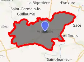
| |
 Andouillé  Andouillé | |
| Coordinates: 48°11′00″N 0°47′00″W | |
| Country | France |
| Region | Pays de la Loire |
| Department | Mayenne |
| Arrondissement | Mayenne |
| Canton | Ernée |
| Intercommunality | L'Ernée |
| Government | |
| • Mayor (2014-2020) | Bertrand Lemaître |
| Area 1 | 36.54 km2 (14.11 sq mi) |
| Population (2017-01-01)[1] | 2,300 |
| • Density | 63/km2 (160/sq mi) |
| Time zone | UTC+01:00 (CET) |
| • Summer (DST) | UTC+02:00 (CEST) |
| INSEE/Postal code | 53005 /53240 |
| Elevation | 52–155 m (171–509 ft) (avg. 110 m or 360 ft) |
| 1 French Land Register data, which excludes lakes, ponds, glaciers > 1 km2 (0.386 sq mi or 247 acres) and river estuaries. | |
Geography
Andouillé is located 15 kilometers from Laval, capital of the department of Mayenne, to which it is connected by the RD 131 and RD 115, and by the river, Mayenne. Bordered on the east by the Mayenne, it is crossed by the Ernée. The winding valley of the river is dominated by the hills of Saudraie and Lattan Crennes.
Population
| Year | Pop. | ±% |
|---|---|---|
| 1793 | 2,447 | — |
| 1800 | 2,643 | +8.0% |
| 1806 | 2,617 | −1.0% |
| 1821 | 2,436 | −6.9% |
| 1831 | 2,751 | +12.9% |
| 1836 | 2,857 | +3.9% |
| 1841 | 2,888 | +1.1% |
| 1846 | 3,023 | +4.7% |
| 1851 | 3,044 | +0.7% |
| 1856 | 3,063 | +0.6% |
| 1861 | 3,287 | +7.3% |
| 1866 | 3,192 | −2.9% |
| 1872 | 2,960 | −7.3% |
| 1876 | 2,872 | −3.0% |
| 1881 | 2,605 | −9.3% |
| 1886 | 2,570 | −1.3% |
| 1891 | 2,558 | −0.5% |
| 1896 | 2,526 | −1.3% |
| 1901 | 2,444 | −3.2% |
| 1906 | 2,371 | −3.0% |
| 1911 | 2,253 | −5.0% |
| 1921 | 1,898 | −15.8% |
| 1926 | 1,856 | −2.2% |
| 1931 | 1,872 | +0.9% |
| 1936 | 1,845 | −1.4% |
| 1946 | 1,804 | −2.2% |
| 1954 | 1,765 | −2.2% |
| 1962 | 1,728 | −2.1% |
| 1968 | 1,691 | −2.1% |
| 1975 | 1,746 | +3.3% |
| 1982 | 1,822 | +4.4% |
| 1990 | 1,926 | +5.7% |
| 1999 | 2,042 | +6.0% |
| 2009 | 2,300 | +12.6% |
International relations
Andouillé is twinned with the Nottinghamshire village of Farnsfield in England.
See also
References
- "Populations légales 2017". INSEE. Retrieved 6 January 2020.
| Wikimedia Commons has media related to Andouillé. |
| Authority control |
|---|
This article is issued from Wikipedia. The text is licensed under Creative Commons - Attribution - Sharealike. Additional terms may apply for the media files.
