Livré-la-Touche
Livré-la-Touche is a commune in the Mayenne department in north-western France. Prior to October 6, 2008, it was known as Livré.[2]
Livré-la-Touche | |
|---|---|
Location of Livré-la-Touche 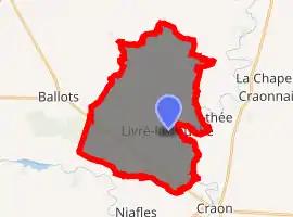
| |
 Livré-la-Touche  Livré-la-Touche | |
| Coordinates: 47°52′55″N 0°58′48″W | |
| Country | France |
| Region | Pays de la Loire |
| Department | Mayenne |
| Arrondissement | Château-Gontier |
| Canton | Cossé-le-Vivien |
| Government | |
| • Mayor (2020–2026) | Michel Raimbault |
| Area 1 | 30.08 km2 (11.61 sq mi) |
| Population (2017-01-01)[1] | 745 |
| • Density | 25/km2 (64/sq mi) |
| Time zone | UTC+01:00 (CET) |
| • Summer (DST) | UTC+02:00 (CEST) |
| INSEE/Postal code | 53135 /53400 |
| Elevation | 39–90 m (128–295 ft) (avg. 100 m or 330 ft) |
| 1 French Land Register data, which excludes lakes, ponds, glaciers > 1 km2 (0.386 sq mi or 247 acres) and river estuaries. | |
Geography
The Oudon River forms most of the commune's eastern border.
References
- "Populations légales 2017". INSEE. Retrieved 6 January 2020.
- "Recherche sur une zone géographique - Insee". www.insee.fr. Retrieved 5 October 2017.
See also
| Wikimedia Commons has media related to Livré-la-Touche. |
This article is issued from Wikipedia. The text is licensed under Creative Commons - Attribution - Sharealike. Additional terms may apply for the media files.