Champgenéteux
Champgenéteux is a commune in the Mayenne department in north-western France.
Champgenéteux | |
|---|---|
Location of Champgenéteux 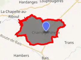
| |
 Champgenéteux  Champgenéteux | |
| Coordinates: 48°17′28″N 0°21′44″W | |
| Country | France |
| Region | Pays de la Loire |
| Department | Mayenne |
| Arrondissement | Mayenne |
| Canton | Évron |
| Government | |
| • Mayor (2008–2014) | Daniel Chemineau |
| Area 1 | 25.11 km2 (9.70 sq mi) |
| Population (2017-01-01)[1] | 515 |
| • Density | 21/km2 (53/sq mi) |
| Time zone | UTC+01:00 (CET) |
| • Summer (DST) | UTC+02:00 (CEST) |
| INSEE/Postal code | 53053 /53160 |
| Elevation | 142–277 m (466–909 ft) |
| 1 French Land Register data, which excludes lakes, ponds, glaciers > 1 km2 (0.386 sq mi or 247 acres) and river estuaries. | |
See also
References
- "Populations légales 2017". INSEE. Retrieved 6 January 2020.
| Wikimedia Commons has media related to Champgenéteux. |
| Authority control |
|---|
This article is issued from Wikipedia. The text is licensed under Creative Commons - Attribution - Sharealike. Additional terms may apply for the media files.
