Araby, Arizona
Araby is a populated place now situated within the city limits of Yuma in Yuma County, Arizona.[2] It has an estimated elevation of 217 feet (66 m) above sea level.
Araby, Arizona | |
|---|---|
Populated place | |
 Araby, Arizona Location of Araby in Arizona | |
| Coordinates: 32°40′32″N 114°31′20″W | |
| Country | United States |
| State | Arizona |
| County | Yuma |
| Elevation | 217 ft (66 m) |
| Time zone | UTC-7 (Mountain (MST)) |
| • Summer (DST) | UTC-7 (MST) |
| Area code(s) | 520 |
| FIPS code | 04-03040 |
| GNIS feature ID | 24307 |
Created as a stop on the Southern Pacific Railroad, it is named for its supposed resemblance to an Arabian desert.[3] Originally east of Yuma, it now lays inside the larger city limits of that city, at the intersection of Arizona State Route 195, which is named Araby Road, and the railroad, just adjacent to the intersection with Interstate 8.[4]
References
- "Feature Detail Report for: Araby". Geographic Names Information System. United States Geological Survey.
- "Araby (in Yuma County, AZ) Populated Place Profile". AZ Hometown Locator. Retrieved January 20, 2016.
- Arizonology (knowledge of Arizona), p. 12 (1933)
- (8 August 2018). In Yuma, eastbound I-8 ramps at Araby Road closing until September, Arizona Department of Transportation
Municipalities and communities of Yuma County, Arizona, United States | ||
|---|---|---|
| Cities | 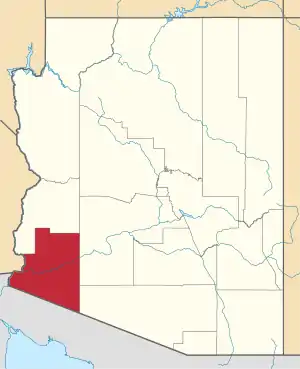 | |
| Town | ||
| CDPs | ||
| Populated places | ||
| Indian reservations | ||
| Ghost towns | ||
| Footnotes | ‡This populated place also has portions in an adjacent county or counties | |
| ||
This article is issued from Wikipedia. The text is licensed under Creative Commons - Attribution - Sharealike. Additional terms may apply for the media files.