Roll, Arizona
Roll is a populated place in central Yuma County, Arizona, United States. It is part of the Yuma Metropolitan Statistical Area. Named for early settler John H. Roll,[1] it lies along the lower Gila River, between the Yuma Proving Ground and the Barry M. Goldwater Air Force Range. Local roads connect Roll to Interstate 8, east of the city of Yuma, the county seat of Yuma County.[2] Its elevation is 262 feet (80 m).[1] Although Roll is unincorporated, it has a post office. Roll has the ZIP Code of 85347; in the 2000 census, the population of the 85347 ZCTA was 1,235.[3]
Roll, Arizona | |
|---|---|
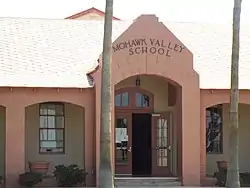 Historic Mohawk Valley School | |
 Roll, Arizona Location within the state of Arizona  Roll, Arizona Roll, Arizona (the United States) | |
| Coordinates: 32°45′6″N 113°59′21″W | |
| Country | United States |
| State | Arizona |
| County | Yuma |
| Elevation | 262 ft (80 m) |
| Population (2000) | |
| • Total | 1,235 |
| Time zone | UTC-7 (Mountain (MST)) |
| ZIP codes | 85347 |
| GNIS feature ID | 10481[1] |
Roll is served by the Mohawk Valley Elementary School District. The historic Mohawk Valley School, which is located on 5151 South Ave. 39 East in Roll was listed in the National Register of Historic Places in December 29, 1986, reference: #86003525. The Welton Mohawk middle school is its sister school
ROLL, Arizona history: http://www.rollroots.com/azmaps.htm
Images
- Historic Roll

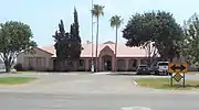
Mohawk Valley Community Church bell
 Mohawk Valley School
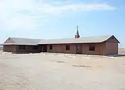 Mohawk Valley Community Church
References
- "Roll, Arizona". Geographic Names Information System. United States Geological Survey.
- Rand McNally. The Road Atlas '08. Chicago: Rand McNally, 2008, p. 8-9.
- "Archived copy". Archived from the original on 2020-02-12. Retrieved 2010-07-12.CS1 maint: archived copy as title (link)
Municipalities and communities of Yuma County, Arizona, United States | ||
|---|---|---|
| Cities | 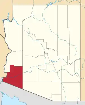 | |
| Town | ||
| CDPs | ||
| Populated places | ||
| Indian reservations | ||
| Ghost towns | ||
| Footnotes | ‡This populated place also has portions in an adjacent county or counties | |
| ||