Aztec, Arizona
Aztec is a census designated place situated in Yuma County, Arizona. It had a population of 47 as of the 2010 U.S. Census. As of July 2015 it had an estimated population of 52.[4] It has an estimated elevation of 509 feet (155 m) above sea level.[2] It is located along Interstate 8.
Aztec, Arizona | |
|---|---|
Census designated place | |
 Location of Aztec in Yuma County, Arizona. | |
 Aztec, Arizona Location of Aztec in Arizona | |
| Coordinates: 32°48′29″N 113°26′34″W | |
| Country | United States |
| State | Arizona |
| County | Yuma |
| Area | |
| • Total | 6.16 sq mi (15.94 km2) |
| • Land | 6.16 sq mi (15.94 km2) |
| • Water | 0.00 sq mi (0.00 km2) |
| Elevation | 509 ft (155 m) |
| Population (2010) | |
| • Total | 47 |
| • Estimate (2016)[3] | N/A |
| Time zone | UTC-7 (Mountain (MST)) |
| • Summer (DST) | UTC-7 (MST) |
| Area code(s) | 520 |
| FIPS code | 04-04930 |
| GNIS feature ID | 2582734 |
Demographics
| Historical population | |||
|---|---|---|---|
| Census | Pop. | %± | |
| 1920 | 62 | — | |
| 1930 | 296 | 377.4% | |
| 2010 | 47 | — | |
| U.S. Decennial Census[5] | |||
Aztec first appeared on the 1920 U.S. Census as the Aztec Precinct of Yuma County.[6] It appeared again in 1930, and recorded having a Spanish/Hispanic majority[7] (the census would not separately feature that racial demographic again until 1980). With the combination of all county precincts into 3 districts in 1940, it did not formally appear again until 2010, when it was made a census-designated place (CDP).
References
- "2016 U.S. Gazetteer Files". United States Census Bureau. Retrieved Jul 18, 2017.
- "Feature Detail Report for: Aztec". Geographic Names Information System. United States Geological Survey.
- "Population and Housing Unit Estimates". Retrieved June 9, 2017.
- "Aztec, AZ Profile: Facts, Map & Data". AZ Hometown Locator. Archived from the original on January 25, 2016. Retrieved January 24, 2016.
- "Census of Population and Housing". Census.gov. Retrieved June 4, 2016.
- http://www2.census.gov/prod2/decennial/documents/06229686v1-7ch02.pdf
- https://www2.census.gov/prod2/decennial/documents/10612963v3p1ch02.pdf
Municipalities and communities of Yuma County, Arizona, United States | ||
|---|---|---|
| Cities | 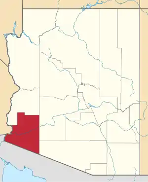 | |
| Town | ||
| CDPs | ||
| Populated places | ||
| Indian reservations | ||
| Ghost towns | ||
| Footnotes | ‡This populated place also has portions in an adjacent county or counties | |
| ||
This article is issued from Wikipedia. The text is licensed under Creative Commons - Attribution - Sharealike. Additional terms may apply for the media files.