Arifiye
Arifiye is a district center of Sakarya Province, Turkey. It is also included in Greater Sakarya Proper.
Arifiye | |
|---|---|
District | |
 Arifiye Location in Turkey | |
| Coordinates: 40°43′N 30°22′E | |
| Country | |
| Province | Sakarya Province |
| Elevation | 40 m (130 ft) |
| Population (2012)[1] | |
| • Urban | 32,557 |
| • District | 38,293 |
| Time zone | UTC+3 (TRT) |
| Postal code | 54580 |
| Area code(s) | 264 |
| Licence plate | 54 |
| Climate | Cfa |
Geography
Arifiye is situated at 40°43′N 30°22′E just at the east of Lake Sapanca. It is almost merged to Adapazarı the center of the province and it is a part of Greater Sakarya. (see Metropolitan centers in Turkey). Arifiye is on Turkish Motorway O-4 and state highway ![]() D.100 both of which connect İstanbul to Ankara. It is also an important railway junction. The population of Arifiye was 32550 [2] as of 2010.
D.100 both of which connect İstanbul to Ankara. It is also an important railway junction. The population of Arifiye was 32550 [2] as of 2010.
History
Arifiye is a part of ancient region of Bithynia. It later on fell to Roman Empire and Byzantine Empire. Several times it was plundered by the Sassanid Persians, Umayyad Arabs and Russians in the Middle Ages. After a brief occupation by the Seljuk Turks it was returned to Byzantines during the First Crusade. In 1326 Ottoman Turks annexed Arifiye. Although an important stop on Silk road in the Middle Ages because of frequent floods of the nearby Lake Sapanca it was not a populous settlement. During Turkish Republic its population increased and by 1956 it was declared a seat of township. In 2008 it was declared a center of district within Greater Sakarya.[3]
Economy
Formerly the major economic sector in Arifiye was agriculture. But after the 1970s Arifiye became an important center of Automotive sub industry. Toyota is making the new C-HR here. The bus terminal of Greater Sakarya is also in Arifiye. A train station is also in Arifiye, which will be the westernmost terminal of the Adana-Istanbul railway from February 2012 to 2015, while construction takes place in Istanbul's Haydarpaşa train station.[4]
Rural Area
There are five villages in the rural area of the district . The total population of the district (urban+rural) is 37864[2]
References
- "Population of province/district centers and towns/villages by districts - 2012". Address Based Population Registration System (ABPRS) Database. Turkish Statistical Institute. Retrieved 2013-02-27.
- "Turkstat". Turkish Statistical Institute. Archived from the original on 2012-12-23. Retrieved 7 January 2012.
- Mayor's page (in Turkish) Archived December 17, 2011, at the Wayback Machine
- Man in Seat Sixty-One, The. "Train Travel in Turkey". Seat61.com.
Arifiye in Sakarya Province of Turkey | |||||||||||||||||||||||||||
|---|---|---|---|---|---|---|---|---|---|---|---|---|---|---|---|---|---|---|---|---|---|---|---|---|---|---|---|
| Districts | 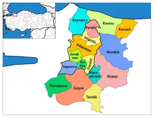 Districts of Sakarya | ||||||||||||||||||||||||||
| |||||||||||||||||||||||||||
Metropolitan municipalities are bolded. | |||||||||||||||||||||||||||
