Ashtead
Ashtead /ˈæʃstɛd/ is a large village in the Mole Valley district of Surrey, England, approximately 15.5 miles (24.9 km) south of central London. The village is on the northern slopes of the North Downs and is on the single-carriageway A24. Ashtead has a large two-part conservation area, including the mansion Ashtead Park House (now occupied by City of London Freemen's School). Amenities include parks, outlying woodland trails and a high street with convenience shopping, cafés and restaurants, a football club and a cricket club. The Rye, a tributary of the River Mole, runs to the north of the village.
| Ashtead | |
|---|---|
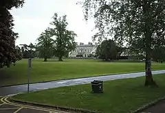
 Ashtead Park House, since 1920s a school | |
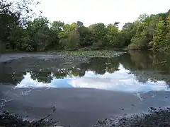
 Barnett Wood Lane with pond to the right | |
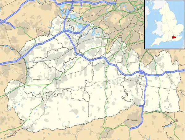
 Ashtead Location within Surrey | |
| Area | 11.59 km2 (4.47 sq mi) |
| Population | 14,169 (2011 census)[1] |
| • Density | 1,223/km2 (3,170/sq mi) |
| OS grid reference | TQ1858 |
| Civil parish |
|
| District | |
| Shire county | |
| Region | |
| Country | England |
| Sovereign state | United Kingdom |
| Post town | Ashtead |
| Postcode district | KT21 |
| Dialling code | 01372 |
| Police | Surrey |
| Fire | Surrey |
| Ambulance | South East Coast |
| UK Parliament | |
Ashtead railway station is on the Mole Valley line between Epsom and Leatherhead. Train services to London Victoria are run by Southern and to London Waterloo by South Western Railway. The M25 motorway runs to the south of the village and may be accessed via junction 9.
History
There has been settlement in Ashtead since at least Roman times, with a Roman villa excavated in what is now Ashtead common.[2] Within a few hundred years of the foundations of Anglo-Saxon England, Ashtead lay within the Copthorne hundred.
Ashtead appears in the Domesday Book of 1086 as Stede. It was held by the Canons of Bayeux from the Bishop of Bayeux. Its Domesday Assets were: 3 hides and 1 virgate; 16 ploughs, 4 acres (1.6 ha) of meadow, woodland worth 7 hogs. Its people rendered £12 in total to its feudal system overlords per year.[3] Its main source of water at the time seems to have been the Rye.
St Giles' Church in Ashtead Park dates from the 12th century, and Ashtead is mentioned twice in Samuel Pepys' diaries. Part of his entry for 25 July 1663 reads:
Towards the evening we bade them adieu and took horse, being resolved that, instead of the race which fails us, we would go to Epsom When we come there we could hear of no lodging, the town so full, but which was better, I went towards Ashsted, and there we got a lodging in a little hole we could not stand upright in While supper was getting I walked up and down behind my cosen [cousin] Pepys's house that was, which I find comes little short of what I took it to be when I was a little boy.
Name variants
Even after the Victorian general harmonisation of spelling, accelerated by the mass distribution of the maps and the printed press, the name of the village had until the early 20th century been more commonly spelt as "Ashsted" and variants. It was recorded in an 1820 map of 24 miles around London "Ashsted"; in one of 1773, of Surrey, "Asted".[4] The suffix '-stead' also written '-sted' is used to form the meaning behind and pronunciation of the place name, as in Sanderstead, Bearsted, Oxted and East Grinstead, and following the spelling of Oxted has settled on minimal instances of 's'; the second s is deemed implicit in place name pronunciation of communities in the region. However, while it may have been implicit in 1967, as with Cheshunt and Wrotham it is an example of a London satellite area with slightly counterintuitive pronunciation. 'Stede' is the earliest spelling, without any first syllable, from the 11th century, see the Domesday Book above.[5]
The village
Elevations and watercourses
Elevations range from the south west crest of the village at 100m AOD (above mean sea level) to 45m AOD at the Leatherhead border outflow of The Rye that rises at a pond at Little Park Farm, Farm Lane, Ashtead. The Rye forms Ashtead's eastern border then turns west, so forms a half-square around the village.
Localities
_-_geograph.org.uk_-_430355.jpg.webp)
Marked on Ordnance Survey maps are three of the four named neighbourhoods of Ashtead: Lower Ashtead, rural Ashtead Common and Ashtead Park. At its centre is the most historic part architecturally with many listed buildings, along Rectory Lane and the slightly bendy thoroughfare, The Street.[6]
The fourth area is Ashtead Village[7] which is contiguous with the rest but at its heart. This is the oldest part of Ashtead and has the main shopping and social area of the village, with two pubs and the Ashtead Village Club which is a C&IU affiliate. It has a small southern conservation area, however outside of this has eight listed brick buildings, each more than two centuries old, including the Old Rectory which has been subdivided (built 1777)[8] and so too has Ashtead Lodge (built 1765 – divided into five)[9] Forge Cottage with Wisteria Cottage here are dated to approximately the 17th century and are also Grade II listed.[10]
The area north of the railway line is Ashtead Common, managed by the City of London Corporation subject to a long-standing preservation order, and is a national nature reserve.
Lower Ashtead is a relatively flat area leading to Ashtead Common that has a recreation ground, a youth club and skate park, a pub, and a number of shops all built near the preserved large square of wood in front of the railway station.
Ashtead Park contains three large listed buildings and four lakes/ponds.
Government and politics
The village lies within the parliamentary constituency of Epsom and Ewell.

Churches
- St Georges Church, Ashtead – Anglican Church. Also known as 'St Georges Christian Centre' which includes a Café.
- St Giles Church, Ashtead – Anglican Church.
- St Michael's Catholic Church, Ashtead
- Ashtead Baptist Church
Business
Ashtead Pottery was produced in the village from 1923 until the company ceased trading in 1935.
The construction company Longcross had its head office in Ashtead but entered administration in 2015.[11]
Activities
The Ashtead Residents' Association founded in 1945 aims to represent the views of all who live in Ashtead through a network of 142 Road Stewards and regular meetings.
Ashtead Players, established for over 50 years, has two distinct elements:
- Adult Ashtead Players, presenting a range of popular theatrical productions.
- Young Ashtead Players (12–18 years), offering a real performance experience for younger members.
1st Ashtead Scout Group was incorporated on 21 June 1920 and is still offering adventurous and educational programmes to young people between the ages of 6 and 18. It has its own headquarters in Lower Ashtead near Ashtead Common.
The Ashtead Psalms were commissioned by Ashtead Choral Society to mark their fiftieth anniversary in the year 2000 from composer Robert Steadman.
In 1887 Ashtead Cricket Club was founded and since then they have progressed into the Premier league of the Surrey Championship.
The Old Freemen's Cricket Club also play cricket in Ashtead, with home fixtures split between the grounds of the City of London Freemen's School in Ashtead Park and at Headley Cricket Club to work around term time use by the School.[12]
Ashtead Football Club's ground is at The Recreation Ground along the high street, next to Ashtead Youth Centre.[13]
In terms of Rugby Union, rugby has been played in Ashtead Park since 1930 as the home of the Old Freemen's RFC[14] former pupils of the City of London Freemen's School make up a large percentage of the player base, but parents, staff and guests are welcome – OFRFC play in the Surrey league and conference.
Hockey – The Old Freemen's Ladies play on the astro-turf in Ashtead Park every Saturday, with training in Clapham.[15]
Ashtead Golf Club (now defunct) first appeared in the late 1890s. The club had ceased to exist by 1904/5.[16]
- Footpaths and Cycle Routes
A footpath from the centre of the village leads to a hilltop intersection of paths along Pebble Lane/Stane Street south of the village. From here accessible from two routes south is the North Downs Way that spans the Mole Gap to Reigate Escarpment SSSI and Box Hill to the south of the village, which can also be accessed via Leatherhead and part of the Mole Gap Trail – which in turn provides cycle and access by foot to a scenic north–south route from Leatherhead to Dorking and beyond. A new Cycleway has been built alongside the A24 between Ashtead and Leatherhead.
Schools
Ashtead's schools include:
- Barnett Wood Infant School[17]
- City of London Freemen's School – associated with City of London Corporation
- St. Giles' (Church of England) Infant School
- The Greville Primary School[18]
- West Ashtead Primary School[19]
- Downsend School
- Ashtead Lodge Division[20]
Parsons Mead School was a former school in the village.
Transport
Rail
Ashtead has a small modern railway station with direct services to London Waterloo, London Victoria, Clapham Junction, Wimbledon, Sutton, Epsom, Dorking, Guildford and Horsham. It is served by both Southern and South Western Railway services. Construction of a new station building began in November 2012 and the new station building has now opened to business. A number of other jobs are still required to be finished to complete the project. In total £2m will have been spent on upgrading the station. This is now the third station building that Ashtead Station has had since the railways arrived.
Demography and housing
| Ward | Detached | Semi-detached | Terraced | Flats and apartments | Caravans/temporary/mobile homes/houseboats | Shared between households[1] |
|---|---|---|---|---|---|---|
| Ashtead Common | 554 | 744 | 70 | 248 | 1 | 0 |
| Ashtead Park | 1,045 | 314 | 82 | 210 | 1 | 2 |
| Ashtead Village | 1,080 | 754 | 217 | 309 | 4 | 4 |
The average level of accommodation in the region composed of detached houses was 28%, the average that was apartments was 22.6%.
| Ward | Population | Households | % Owned outright | % Owned with a loan | hectares[1] |
|---|---|---|---|---|---|
| Ashtead Common | 4,129 | 1,617 | 41 | 44 | 441 |
| Ashtead Park | 4,042 | 1,654 | 48 | 34 | 520 |
| Ashtead Village | 5,998 | 2,368 | 46 | 36 | 198 |
The proportion of households who owned their home outright compares to the regional average of 35.1%. The proportion who owned their home with a loan compares to the regional average of 32.5%. The remaining % is made up of rented dwellings (plus a negligible % of households living rent-free).
Emergency services
Ashtead is served by these emergency services:
- Surrey Police
- South East Coast Ambulance Service
- Surrey Fire & Rescue Service
- Ashtead Hospital, a small private hospital run by Ramsay Health Care UK with no A&E department. The nearest general hospital with an A&E department is in Epsom.
Notable residents
- Samuel Pepys, visited Ashtead in the 17th century and spent some time living there as a boy.[21]
- Sara Jeannette Duncan (Mrs Everard Cotes), Canadian author and journalist[22]
- Evan Davis, journalist and Newsnight presenter, grew up in Ashtead.
- Albert Marshall (1897-2005), The last surviving British cavalryman to have seen battle on the Western Front during the Great War.
- Pete Brown (born 25 December 1940) is an English performance poet, lyricist, and singer best known for his collaborations with Cream and Jack Bruce.
See also
- List of places of worship in Mole Valley
 Surrey portal
References
- Key Statistics; Quick Statistics: Population Density United Kingdom Census 2011 Office for National Statistics Retrieved 20 December 2013
- "Ashtead Common cultural heritage". City of London. Archived from the original on 25 December 2010. Retrieved 27 September 2010.
- Surrey Domesday Book Archived 30 October 2007 at the Wayback Machine
- https://upload.wikimedia.org/wikipedia/commons/e/e9/1773_Kitchin_Map_of_the_Country_30_Miles_around_London%2C_England_-_Geographicus_-_London30MilesRound-kitchin-1773.jpg
- H.E. Malden (editor) (1911). "Parishes: Ashtead". A History of the County of Surrey: Volume 3. Institute of Historical Research. Retrieved 28 December 2013.CS1 maint: extra text: authors list (link)
- OS Map with Listed Buildings and Parks marked Archived 24 April 2012 at the Wayback Machine
- Ashtead Conservation Area Mole Valley
- Old Rectory – Grade II – Historic England. "Details from listed building database (1028655)". National Heritage List for England. Retrieved 16 June 2013.
- Ashtead Lodge – Grade II – Historic England. "Details from listed building database (1028653)". National Heritage List for England. Retrieved 16 June 2013.
- Forge Cottage / Wisteria Cottage – Grade II – Historic England. "Details from listed building database (1028658)". National Heritage List for England. Retrieved 16 June 2013.
- "Longcross: Contact Us". www.longcross.co.uk. Longcross. Archived from the original on 20 October 2012. Retrieved 23 October 2012.
- http://www.oldfreemenscricket.co.uk
- Ashtead F.C. Retrieved 28 December 2013
- http://www.pitchero.com/clubs/oldfreemens/
- http://www.ofhc.co.uk/
- “Ashtead Golf Club”, "Golf's Missing Links".
- "Barnett Wood Infant School". Retrieved 24 April 2008.
- "The Greville School". Archived from the original on 9 May 2008. Retrieved 24 April 2008.
- "West Ashtead Primary School". Retrieved 24 April 2008.
- "Downsend School". Retrieved 25 September 2009.
- The Six Visits of Mr. Pepys
- Dean, Misao (2005). "Duncan, Sara, Jeannette (Cotes)". Dictionary of Canadian Biography. University of Toronto/Université Laval. Retrieved 6 August 2014.
External links
| Wikimedia Commons has media related to Ashtead. |
- Ashtead Residents' Association – Founded in 1945 to represent the views of all who live in Ashtead
- Read a detailed historical record about Ashtead Roman Villa
- Ashtead in the Domesday Book
- Surrey County Council. "Ashtead". Exploring Surrey's Past. Retrieved 24 May 2017.
_-_Geographicus_-_London24-mogg-1820.jpg.webp)
