Aveley
Aveley is a small town within the Thurrock unitary authority in Essex, England, and forms one of its traditional Church of England parishes. It is a suburb of London located 16.3 miles (26.2 km) east of Charing Cross in London and within the eastern bounds of the M25 motorway. In 2019 it had an estimated population of 9461.[1]
| Aveley | |
|---|---|
_-_geograph.org.uk_-_36157.jpg.webp) St Michael's, Aveley | |
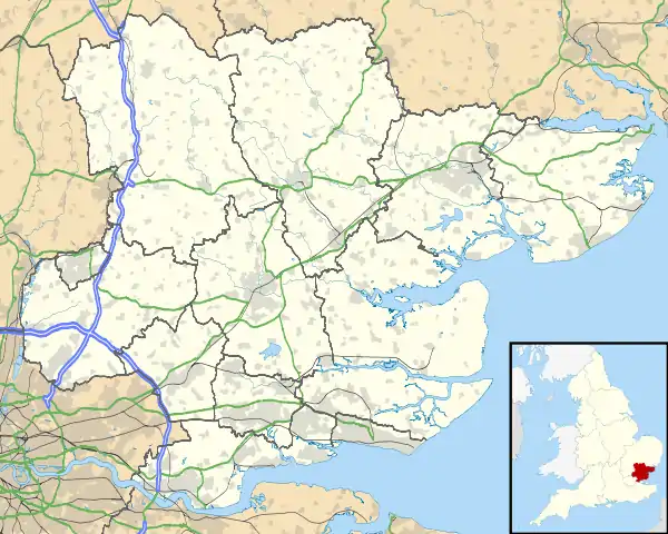 Aveley Location within Essex | |
| Area | 1.64 km2 (0.63 sq mi) |
| Population | 9,461 (2019 estimate) |
| • Density | 5,769/km2 (14,940/sq mi) |
| OS grid reference | TQ565805 |
| Unitary authority | |
| Ceremonial county | |
| Region | |
| Country | England |
| Sovereign state | United Kingdom |
| Post town | SOUTH OCKENDON |
| Postcode district | RM15 |
| Dialling code | 01708 |
| Police | Essex |
| Fire | Essex |
| Ambulance | East of England |
| UK Parliament | |
Position
Aveley is located on the very edge of Greater London and is roughly bounded to the north and west by the London Borough of Havering, to the south by the A13 road and to the east by the M25 motorway. The nearest places are Purfleet, South Ockendon, Wennington and West Thurrock.
Prehistory and history
Aveley has given its name to the Aveley Interglacial period around 200,000 years ago. Important evidence of the local flora and fauna of the period and some signs of occupation by Neanderthal humans have been found there.[2]
In Domesday the name has various spellings – Alvithelea, Alvileia and Alvilea.[3] The name means Aelfgyth's wood clearing.[4] A variation, in 1418, is Alvythele.[5]
After the Second World War the population grew rapidly as the area absorbed London overspill.
Notable people
- Martina Cole, the crime writer, was brought up in Aveley
- Alice Diehl (née Mangold), the novelist and concert pianist, was born in Aveley.[6]
- Kate Evelyn Luard, Royal Red Cross and bar was born in Aveley vicarage.
- John Newton, the author of Amazing Grace, lived in Aveley, which was the home of his father's second wife.[7]
Historic buildings
St Michael's Church
The parish church of St Michael is a Grade 1 listed building dating from the 12th century.[8] It contains a 14th-century memorial brass to Radulphus de Knevynton, which is echoed in the arms of the Thurrock unitary authority. The church was declared unsafe in the 19th century, with the recommendation that it should be pulled down. However, this was averted by its parishioners, who raised £1,000 to save it.[9]
Other listed buildings
Grade 2*[8]
- Brett's Farmhouse
- Sir Henry Gurnett public house
Grade 2[8]
- 79, High Street
- Crown and Anchor public house
- Park Corner House
- 54 and 56 High Street
- Courts Farm, Park Lane
- Court's Farmhouse barn
- Brett's Farmhouse barn
- Aveley Hall

The Old Ship public house at 58 High Street is on the Campaign for Real Ale's National Inventory of Historic Pub Interiors.[10]
Demographics
According to Thurrock Council, the ward of Aveley and Uplands had a population of 8,381 people in 2001.
Sport
Aveley is the home of non-League football club Aveley, which plays at Parkside. It was also home of now defunct Thurrock, who played at Ship Lane.
Belhus golf course is located in Aveley near the site of the former Belhus Mansion. Much of the remaining land from Belhus forms the Belhus Woods Country Park.
Communications
The nearest railway stations are:
Notes
- "Aveley". City Population De. Retrieved 19 November 2020.
- Nick Ashton: Early Humans, New Naturalist series (London: HarperCollins, 2017), pp. 168–70.
- Christopher Harrold (Editor), Exploring Thurrock (Thurrock Local History Society, 2008)
- James Kemble, Essex Place-Names (Historical Publications, 2007)
- Plea Rolls of the Court of Common Pleas; National Archives: CP 40/629; http://aalt.law.uh.edu/H5/CP40no629/aCP40no629fronts/IMG_0489.htm; first entry
- Thurrock Local History Society
- Lewis, Frank (1976). Essex and Suger. Philimore. p. 51.
- "Appendix 7 to Thurrock Development Plan" (PDF). Archived from the original (PDF) on 13 May 2012.
- "St Michael's, Aveley".
- Brandwood, Geoff (2013). Britain's best real heritage pubs. St. Albans: CAMRA. p. 39. ISBN 9781852493042.
External links
| Wikimedia Commons has media related to Aveley. |
| Authority control |
|
|---|