Grade I listed buildings in Essex
There are over 9000 Grade I listed buildings in England. This page is a list of these buildings in the county of Essex.
Essex shown in England
Basildon
| Name | Location | Type | Completed [note 1] | Date designated | Grid ref.[note 2] Geo-coordinates |
Entry number [note 3] | Image |
|---|---|---|---|---|---|---|---|
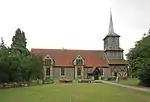
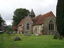
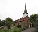
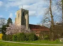
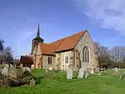
| Church of St Mary Magdalene | Great Burstead | Church | 14th century | 4 July 1955 | TQ6806592239 51°36′14″N 0°25′32″E |
1122255 | 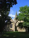 Church of St Mary Magdalene |
| Church of St Nicholas | Laindon | Church | 14th century | 24 March 1950 | TQ6879289515 51°34′45″N 0°26′05″E |
1338377 | 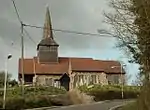 Church of St Nicholas |
Braintree
| Name | Location | Type | Completed [note 1] | Date designated | Grid ref.[note 2] Geo-coordinates |
Entry number [note 3] | Image |
|---|---|---|---|---|---|---|---|
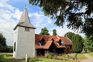
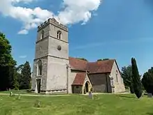
| Parish Church of St Barnabas | Alphamstone, Braintree | Parish church | 12th century | 12 November 1984 | TL8787835461 51°59′09″N 0°44′05″E |
1122865 | 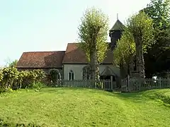 Parish Church of St Barnabas |
| Parish Church of St Augustine of Canterbury | Ashen, Essex | Parish church | 13th century | 21 June 1962 | TL7473642321 52°03′06″N 0°32′49″E |
1123044 | 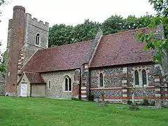 Parish Church of St Augustine of Canterbury |
| Church of St Peter and St Paul | Bardfield Saling, Braintree | Parish church | Decorated | 2 December 1967 | TL6861326514 51°54′42″N 0°27′00″E |
1122802 | 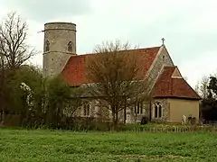 Church of St Peter and St Paul |
| Church of St Ethelbert and All Saints | Belchamp Otten, Braintree | Church | c.1130 | 21 June 1962 | TL8033141765 52°02′42″N 0°37′41″E |
1122381 | 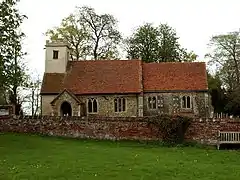 Church of St Ethelbert and All Saints |
| Barn about 50m South West of Paul's Hall | Belchamp St. Paul, Braintree | Barn | c.1200 | 17 May 1984 | TL7972643407 52°03′36″N 0°37′13″E |
1122396 |  |
| Church of St Andrew | Belchamp St. Paul, Braintree | Parish church | Mid-15th century | 21 June 1962 | TL7983343460 52°03′37″N 0°37′18″E |
1166368 | 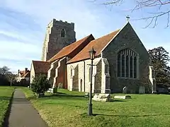 Church of St Andrew |
| Parish Church of St Mary the Virgin | Belchamp Walter, Braintree | Parish church | 13th century | 21 June 1962 | TL8274440700 52°02′05″N 0°39′46″E |
1337867 | 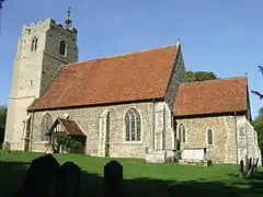 Parish Church of St Mary the Virgin |
| Baythorne Hall | Baythorne End, Birdbrook, Braintree | House | 16th century | 7 August 1952 | TL7194742659 52°03′20″N 0°30′23″E |
1338344 | |
| Stanton's Farmhouse | Black Notley, Braintree | Farmhouse | 15th century | 2 May 1953 | TL7686019813 51°50′56″N 0°33′59″E |
1122817 | |
| Parish Church (dedication unknown) | Borley, Braintree | Parish church | 11th century | 21 June 1962 | TL8475443065 52°03′19″N 0°41′36″E |
1169675 | |
| Parish Church of the Holy Trinity | Bradwell, Braintree | Parish church | Early 12th century | 21 December 1967 | TL8177922156 51°52′06″N 0°38′20″E |
1337594 |  Parish Church of the Holy Trinity |
| Parish Church of St Andrew | Bulmer | Parish church | 12th century | 21 June 1962 | TL8435340114 52°01′44″N 0°41′09″E |
1169705 | 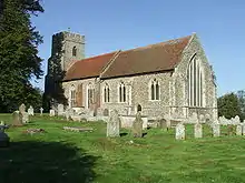 Parish Church of St Andrew |
| Church of St Nicholas | Castle Hedingham, Braintree | Parish church | c.1180 | 21 June 1962 | TL7846935604 51°59′25″N 0°35′52″E |
1338048 |  Church of St Nicholas |
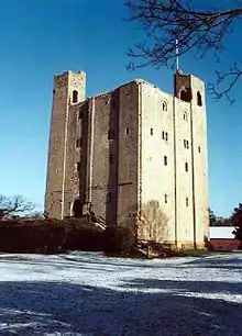
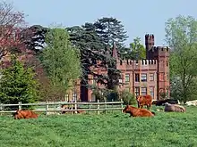
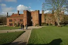
| Hedingham Castle | Castle Hedingham, Braintree | Bailey | 1130–40 | 7 August 1952 | TL7870635868 51°59′33″N 0°36′05″E |
1122959 | |
| Abbey Mill | Coggeshall, Braintree | Silk mill | 1820 | 2 May 1953 | TL8554622145 51°52′01″N 0°41′37″E |
1168354 | 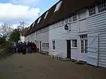 Abbey Mill |
| Church of St Nicholas, Coggeshall Abbey | Coggeshall, Braintree | Abbey chapel | 1140–1538 | 31 October 1966 | TL8536722279 51°52′06″N 0°41′28″E |
1337925 | 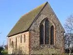 Church of St Nicholas, Coggeshall Abbey |
| Coggeshall Abbey (residence) | Coggeshall, Braintree | House | 1518–28 | 2 May 1953 | TL8553722244 51°52′04″N 0°41′36″E |
1307099 | 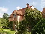 Coggeshall Abbey (residence) |
| Guest House of Coggeshall Abbey | Coggeshall, Braintree | Guest house/boiler house | c.1190 | 2 May 1953 | TL8553522207 51°52′03″N 0°41′36″E |
1307071 | 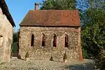 Guest House of Coggeshall Abbey |
| The Abbot's Lodging and Corridor of Coggeshall Abbey | Coggeshall, Braintree | House | Late 16th century | 2 May 1953 | TL8552922241 51°52′04″N 0°41′36″E |
1123191 | |
| Parish Church of St Peter Ad Vincula | Coggeshall, Braintree | Church | 15th century | 31 October 1966 | TL8535023016 51°52′30″N 0°41′28″E |
1337953 | |
| Paycocke's | Coggeshall, Braintree | Jettied house | 15th century | 2 May 1953 | TL8479022501 51°52′14″N 0°40′58″E |
1337597 | 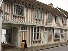 Paycocke's |
| The Grange Barn | Coggeshall, Braintree | Grange barn | C12/early 13th century | 31 October 1966 | TL8490322220 51°52′04″N 0°41′03″E |
1123112 | |
| Parish Church of St Andrew | Colne Engaine, Braintree | Parish church | C12-early 16th century | 21 June 1962 | TL8502630365 51°56′28″N 0°41′25″E |
1123236 | 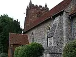 Parish Church of St Andrew |
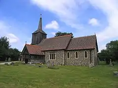
| Parish Church of All Saints | Cressing, Braintree | Parish church | 12th century | 21 December 1967 | TL7942620435 51°51′13″N 0°36′14″E |
1337619 | 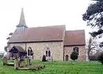 Parish Church of All Saints |
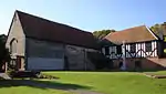
| The Barley Barn, 40m North West of Cressing Temple Farmhouse | Cressing, Braintree | Barn | Early 16th century | 2 May 1953 | TL7989318774 51°50′19″N 0°36′35″E |
1123865 |  The Barley Barn, 40m North West of Cressing Temple Farmhouse |
| The Wheat Barn, 35 Metres North East of Cressing Temple Farmhouse | Cressing, Braintree | Barn | Early 16th century | 2 May 1953 | TL7994218771 51°50′19″N 0°36′38″E |
1123866 | 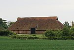 The Wheat Barn, 35 Metres North East of Cressing Temple Farmhouse |
| Parish Church of St Andrew | Earls Colne, Braintree | Parish church | 13th century | 21 June 1962 | TL8606628826 51°55′37″N 0°42′17″E |
1337907 | 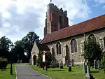 Parish Church of St Andrew |
| Parish Church of St Mary the Virgin | Fairstead, Essex | Church | 16th century | 21 December 1967 | TL7678516689 51°49′15″N 0°33′49″E |
1337780 | 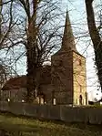 Parish Church of St Mary the Virgin |
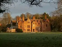
| Faulkbourne Hall | Faulkbourne, Braintree | Country house | Early 15th century | 2 May 1953 | TL8026816434 51°49′03″N 0°36′50″E |
1337782 | |
| Parish Church of St Germanus | Faulkbourne, Braintree | Parish church | 12th century | 21 December 1967 | TL8003016573 51°49′08″N 0°36′38″E |
1337803 | 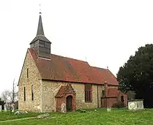 Parish Church of St Germanus |
| Parish Church of All Saints | Feering, Braintree | Parish church | C12/13 | 21 December 1967 | TL8722020417 51°51′03″N 0°43′01″E |
1123841 |  Parish Church of All Saints |
| Parish Church of St John the Baptist | Finchingfield, Braintree | Parish church | C12-C14 | 21 December 1967 | TL6862432806 51°58′05″N 0°27′12″E |
1122729 |  Parish Church of St John the Baptist |
| Spains Hall | Finchingfield, Braintree | House | 17th century | 2 May 1953 | TL6787634017 51°58′45″N 0°26′35″E |
1138980 | |
| The Guildhall | Finchingfield, Braintree | Apartment | 1985 | 21 December 1967 | TL6858032814 51°58′06″N 0°27′09″E |
1115594 |  The Guildhall |
| Church of St Mary the Virgin | Gestingthorpe, Braintree | Parish church | 13th century | 21 June 1962 | TL8122038562 52°00′57″N 0°38′22″E |
1123078 |  Church of St Mary the Virgin |
| Church of St Catherine | Gosfield, Braintree | Parish church | C15/C16 | 21 June 1962 | TL7778129403 51°56′05″N 0°35′05″E |
1338075 | 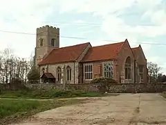 Church of St Catherine |
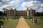
| Gosfield Hall | Gosfield, Braintree | House | Mid-16th century | 1 August 1946 | TL7751229713 51°56′15″N 0°34′51″E |
1122938 | |
| Barn Approximately 45 Metres East of Great Lodge | Great Bardfield, Braintree | Barn | Early 16th century | 2 May 1953 | TL6948929061 51°56′03″N 0°27′50″E |
1335863 | |
| Parish Church of St Mary the Virgin | Great Bardfield, Braintree | Parish church | 12th century | 21 December 1967 | TL6780030368 51°56′47″N 0°26′24″E |
1123494 | 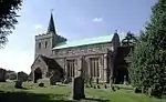 Parish Church of St Mary the Virgin |
| Church of St Giles | Great Maplestead, Braintree | Parish church | 12th century | 21 June 1962 | TL8081734570 51°58′49″N 0°37′53″E |
1337989 | 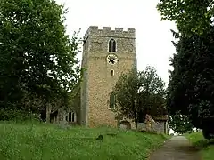 Church of St Giles |
| Parish Church of St Andrew | Great Yeldham, Braintree | Parish church | c.1350 | 21 June 1962 | TL7577838667 52°01′07″N 0°33′37″E |
1123010 | 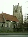 Parish Church of St Andrew |
| Parish Church of St Andrew | Halstead, Braintree | Parish church | 14th century | 24 February 1950 | TL8152330691 51°56′42″N 0°38′23″E |
1338284 | 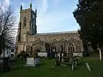 Parish Church of St Andrew |
| Parish Church of St Mary | Kelvedon, Braintree | Parish church | Early 12th century | 21 December 1967 | TL8564518566 51°50′05″N 0°41′35″E |
1337631 | 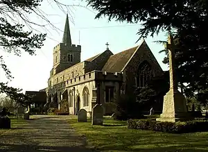 Parish Church of St Mary |
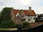
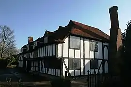
| 1–5 High Street | Kelvedon, Braintree | Abbots summer palace | Early 16th century | 21 December 1967 | TL8590518429 51°50′01″N 0°41′48″E |
1123814 | _High_Street%252C_Kelvedon_(geograph_4355485).jpg.webp) 1–5 High Street |
| Parish Church of the Holy Innocents | Lamarsh, Braintree | Parish church | Early 12th century or earlier | 21 June 1962 | TL8898136059 51°59′27″N 0°45′04″E |
1166331 | 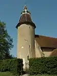 Parish Church of the Holy Innocents |
| Parish Church (dedication unknown) | Liston, Braintree | Parish church | Early 12th century | 21 June 1962 | TL8527444782 52°04′13″N 0°42′06″E |
1122335 |  Parish Church (dedication unknown) |
| Church of All Saints | Middleton, Braintree | Parish church | Mid-12th century | 21 June 1962 | TL8709639675 52°01′26″N 0°43′32″E |
1123271 | 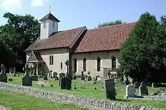 Church of All Saints |
| Panfield Hall | Panfield, Braintree | Great house | 16th century | 2 May 1953 | TL7399425029 51°53′48″N 0°31′39″E |
1337833 | |
| Parish Church of St John the Baptist | Pebmarsh, Braintree | Parish church | Earlier origin | 21 June 1962 | TL8536733489 51°58′08″N 0°41′49″E |
1146603 | 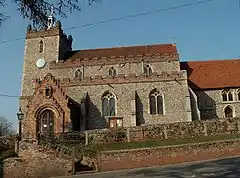 Parish Church of St John the Baptist |
| Church of St Gregory and St George | Pentlow, Braintree | Parish church | 12th century | 21 June 1962 | TL8127246162 52°05′03″N 0°38′39″E |
1232662 | 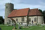 Church of St Gregory and St George |
| Church of All Saints | Rayne Hall Green, Rayne, Braintree | Parish church | c.1510 | 21 December 1967 | TL7330922913 51°52′40″N 0°30′59″E |
1308377 |  Church of All Saints |
| Parish Church of St Laurence | Ridgewell, Braintree | Parish church | 14th century and 15th century | 21 June 1962 | TL7399240908 52°02′21″N 0°32′07″E |
1165620 | 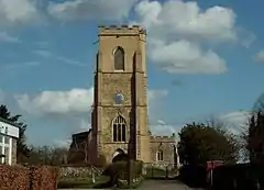 Parish Church of St Laurence |
| Church of St Mary and All Saints | Rivenhall, Braintree | Parish church | 10th century | 1 March 1950 | TL8280017791 51°49′44″N 0°39′05″E |
1169594 | 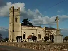 Church of St Mary and All Saints |
| Parish Church of St Andrew | Shalford, Braintree | Church | 12th century | 21 December 1967 | TL7239729245 51°56′06″N 0°30′23″E |
1147647 | 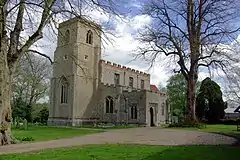 Parish Church of St Andrew |
| Parish Church of St Peter and St Thomas | Stambourne, Braintree | Parish church | Late 11th century | 21 June 1962 | TL7210538858 52°01′17″N 0°30′25″E |
1317130 |  Parish Church of St Peter and St Thomas |
| Moyns Park | Steeple Bumpstead, Braintree | Country house | Late 16th century | 7 August 1952 | TL6943840621 52°02′17″N 0°28′08″E |
1338363 | |
| Parish Church of St Mary the Virgin | Steeple Bumpstead, Braintree | Parish church | 11th century | 21 June 1962 | TL6790241055 52°02′33″N 0°26′48″E |
1166315 | 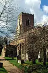 Parish Church of St Mary the Virgin |
| Parish Church of All Saints | Stisted, Braintree | Boundary stone | 17th century | 21 December 1967 | TL7987324601 51°53′27″N 0°36′45″E |
1123870 | 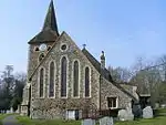 Parish Church of All Saints |
| Parish Church of St Mary the Virgin | Sturmer, Braintree | Parish church | Early 11th century | 21 June 1962 | TL6902243899 52°04′04″N 0°27′52″E |
1122274 | 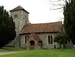 Parish Church of St Mary the Virgin |
| Ringers Farmhouse | Terling, Braintree | Farmhouse | Early 16th century | 2 May 1953 | TL7617113334 51°47′27″N 0°33′11″E |
1123406 | |
| Parish Church of St Maragret | Tilbury Juxta Clare, Braintree | Parish church | 15th century | 21 June 1962 | TL7595540290 52°01′59″N 0°33′49″E |
1122987 |  Parish Church of St Maragret |
| Parish Church of St Margaret of Antioch | Toppesfield, Braintree | Parish church | c.1300 | 21 June 1962 | TL7396337447 52°00′29″N 0°32′00″E |
1165328 |  Parish Church of St Margaret of Antioch |
| Parish Church of St Mary Magdalene | Wethersfield, Braintree | Parish church | 12th century | 21 December 1967 | TL7122131250 51°57′12″N 0°29′25″E |
1337860 |  Parish Church of St Mary Magdalene |
| Church of St Ethelreda | White Notley, Braintree | Parish church | 11th century | 2 January 1985 | TL7854618236 51°50′03″N 0°35′24″E |
1147914 | 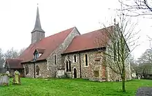 Church of St Ethelreda |
| Church of St Nicolas | Witham, Braintree | Parish church | 14th century Additions | 1 March 1950 | TL8172915378 51°48′27″N 0°38′05″E |
1338236 | 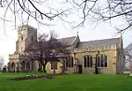 Church of St Nicolas |
| Church of St Mary the Virgin | Church Street, Bocking, Braintree | Parish church | 14th century | 25 October 1951 | TL7568925684 51°54′07″N 0°33′08″E |
1122530 | 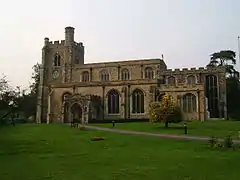 Church of St Mary the Virgin |
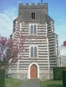
| Bocking Windmill | Church Street, Bocking, Braintree | Post mill | c.1680 | 25 October 1951 | TL7630725967 51°54′16″N 0°33′41″E |
1122492 |


Brentwood
| Name | Location | Type | Completed [note 1] | Date designated | Grid ref.[note 2] Geo-coordinates |
Entry number [note 3] | Image |
|---|---|---|---|---|---|---|---|
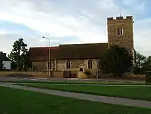
| Church of St Laurence | Blackmore, Hook End and Wyatts Green, Brentwood | Church | Mid-12th century | 20 February 1967 | TL6030501611 51°41′25″N 0°19′04″E |
1197161 | |
| Church of All Saints | Doddinghurst, Brentwood | Church | c.1400 | 20 February 1967 | TQ5892099001 51°40′02″N 0°17′48″E |
1197268 | |
| Thorndon Hall | Thorndon Park, Herongate and Ingrave, Brentwood | Apartments | 1980 | 21 October 1958 | TQ6170591818 51°36′07″N 0°20′01″E |
1297212 | |
| Church of St Edmund and St Mary | Ingatestone, Ingatestone and Fryerning, Brentwood | Parish church | Late 11th century | 10 April 1967 | TQ6512299592 51°40′15″N 0°23′11″E |
1297196 |  Church of St Edmund and St Mary |
| Church of St Mary the Virgin | Fryerning, Ingatestone and Fryerning, Brentwood | Parish church | Late 11th century | 10 April 1967 | TL6384600110 51°40′33″N 0°22′06″E |
1197282 | 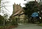 Church of St Mary the Virgin |
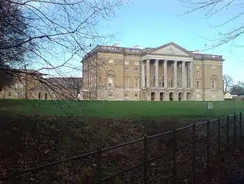
| Ingatestone Hall | Ingatestone, Ingatestone and Fryerning, Brentwood | Country house | 1539 | 29 December 1952 | TQ6542298570 51°39′42″N 0°23′25″E |
1187315 | |
| Kelvedon Hall | Kelvedon Hatch, Brentwood | Country house | c.1743 | 27 August 1952 | TL5584800030 51°40′39″N 0°15′10″E |
1279546 | |
| Church of St Giles | Mountnessing, Brentwood | Parish church | Late 11th century | 10 April 1967 | TQ6483196581 51°38′38″N 0°22′51″E |
1208238 | 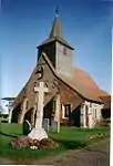 Church of St Giles |
| Church of St Thomas the Apostle | Navestock, Brentwood | Parish church | C11-C12 | 20 February 1967 | TQ5404798374 51°39′47″N 0°13′33″E |
1197342 | 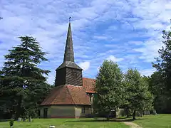 Church of St Thomas the Apostle |
| Church of St Peter and St Paul | Stondon Massey, Brentwood | Church | Saxon/Norman | 20 February 1967 | TL5726501587 51°41′28″N 0°16′26″E |
1297178 | 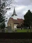 Church of St Peter and St Paul |
| Church of St Peter | Little Warley, West Horndon, Brentwood | Church | 15th century | 21 October 1958 | TQ6044188650 51°34′26″N 0°18′50″E |
1207397 |  Church of St Peter |
| Church of St Mary the Virgin | Great Warley, Brentwood | Church | 1902–04 | 20 February 1976 | TQ5888889990 51°35′11″N 0°17′31″E |
1197210 | 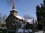 Church of St Mary the Virgin |
May2003.jpg.webp)
Castle Point
| Name | Location | Type | Completed [note 1] | Date designated | Grid ref.[note 2] Geo-coordinates |
Entry number [note 3] | Image |
|---|---|---|---|---|---|---|---|
| Church of St James the Less | Hadleigh | Parish church | Mid-12th century | 7 August 1952 | TQ8101287025 51°33′11″N 0°36′34″E |
1337692 | 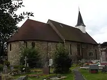 Church of St James the Less |
| Church of St Mary the Virgin | South Benfleet | Parish church | 12th century | 7 August 1952 | TQ7782986138 51°32′46″N 0°33′48″E |
1123690 | 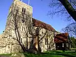 Church of St Mary the Virgin |
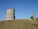
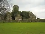
| Hadleigh Castle | Castle Point | Castle | Early 13th century | 7 August 1952 | TQ8097886090 51°32′41″N 0°36′31″E |
1123687 |
Chelmsford
| Name | Location | Type | Completed [note 1] | Date designated | Grid ref.[note 2] Geo-coordinates |
Entry number [note 3] | Image |
|---|---|---|---|---|---|---|---|
| Boreham House | Boreham, Chelmsford | House | Early 19th century | 29 December 1952 | TL7462209152 51°45′14″N 0°31′43″E |
1338403 | |
| Church of St Andrew | Boreham, Chelmsford | Parish church | Late C11-early 12th century | 10 April 1967 | TL7561009614 51°45′28″N 0°32′35″E |
1122215 | 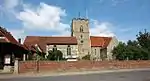 Church of St Andrew |
| New Hall | Boreham, Chelmsford | House | Existing | 29 December 1952 | TL7346010284 51°45′52″N 0°30′44″E |
1338404 |  New Hall |
| Church of St John the Baptist | Danbury, Chelmsford | Church | c.1233 | 10 April 1967 | TL7793005119 51°43′00″N 0°34′28″E |
1122201 | 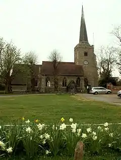 Church of St John the Baptist |
| Barn on Roadside at Falconers Hall and known as the Top Barn & Barn on Roadside at Faulkner's Hall and known as the Granary | Good Easter, Chelmsford | Barn | Late 15th century or early 16th century | 7 August 1978 | TL6260012147 51°47′04″N 0°21′21″E |
1237322 |  Barn on Roadside at Falconers Hall and known as the Top Barn & Barn on Roadside at Faulkner's Hall and known as the Granary |
| Church of St Mary the Virgin | Great Leighs and Little Leighs, Chelmsford | Church | 1330 | 10 April 1967 | TL7384315586 51°48′43″N 0°31′14″E |
1171104 |  Church of St Mary the Virgin |
| Leez Priory | Great Leighs and Little Leighs, Chelmsford | Augustinian monastery | 13th century | 29 December 1952 | TL7007518526 51°50′22″N 0°28′02″E |
1171386 | |
| Leez Priory Inner Gatehouse (that Part in Dunmow Road) | Great Leighs and Little Leighs, Chelmsford | Gatehouse | Early 13th century | 6 August 1984 | TL7015118575 51°50′23″N 0°28′06″E |
1322295 | 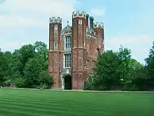 Leez Priory Inner Gatehouse (that Part in Dunmow Road) |
| Leez Priory, Part of Quadrangle, Now a House (that Part in Dunmow Road) | Great Leighs and Little Leighs, Chelmsford | House | post 1536 | 20 February 1967 | TL7006918542 51°50′23″N 0°28′02″E |
1112814 |  Leez Priory, Part of Quadrangle, Now a House (that Part in Dunmow Road) |
| Church of St Mary | Great Baddow, Chelmsford | Parish church | 12th century | 10 April 1967 | TL7295204847 51°42′56″N 0°30′08″E |
1122149 | 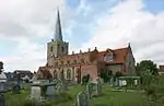 Church of St Mary |
| Black Chapel | North End, Great Waltham, Chelmsford | Chapel | Late 15th century | 10 April 1967 | TL6626117934 51°50′07″N 0°24′42″E |
1338494 | 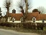 Black Chapel |
| Church of St Mary and Laurence | Great Waltham, Chelmsford | Church | Norman | 10 April 1967 | TL6955713447 51°47′38″N 0°27′26″E |
1122058 | 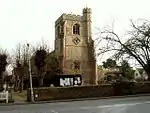 Church of St Mary and Laurence |
| Langleys | Great Waltham, Chelmsford | House | c.1620 | 29 June 1952 | TL6992613664 51°47′45″N 0°27′46″E |
1305533 | 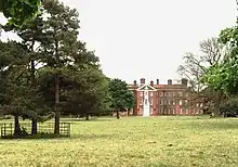 Langleys |
| Church of St Mary the Virgin | Little Baddow, Chelmsford | Church | Late 11th century | 10 April 1967 | TL7644808067 51°44′37″N 0°33′16″E |
1172194 | 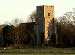 Church of St Mary the Virgin |
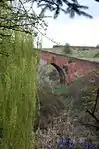
| Pleshey Castle Bridge | Pleshey, Chelmsford | Bridge | 15th century | 19 June 1975 | TL6651514446 51°48′14″N 0°24′49″E |
1235567 | |
| Church of All Saints | Rettendon, Chelmsford | Church | c.1200 | 10 April 1967 | TQ7702296004 51°38′06″N 0°33′24″E |
1235573 | 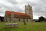 Church of All Saints |
| Church of St Mary | Runwell, Chelmsford | Church | c.1200 | 10 April 1967 | TQ7536094404 51°37′16″N 0°31′54″E |
1235843 | 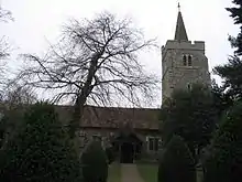 Church of St Mary |
| Church of All Saints | Essex, Chelmsford | Church | Pre-12th-century origins | 10 April 1967 | TQ6877398649 51°39′41″N 0°26′20″E |
1236734 | 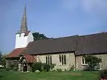 Church of All Saints |
| Church of St Mary | Woodham Ferrers and Bicknacre, Chelmsford | Parish church | 13th century | 10 April 1967 | TQ7978299398 51°39′53″N 0°35′53″E |
1236909 | 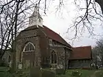 Church of St Mary |
| Aubyns | Writtle, Chelmsford | Jettied house | c.1500 | 10 April 1967 | TL6772406212 51°43′46″N 0°25′38″E |
1237095 | 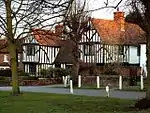 Aubyns |
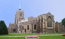
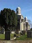
| Cathedral Church of St Mary the Virgin | Chelmsford | Cathedral | 1913 | 20 May 1949 | TL7081406948 51°44′07″N 0°28′20″E |
1328779 |
.jpg.webp)
Colchester
| Name | Location | Type | Completed [note 1] | Date designated | Grid ref.[note 2] Geo-coordinates |
Entry number [note 3] | Image |
|---|---|---|---|---|---|---|---|
| Church of St Peter | Boxted, Colchester | Church | Norman | 7 April 1965 | TL9983733242 51°57′42″N 0°54′26″E |
1238709 | 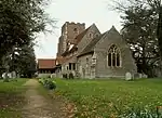 Church of St Peter |
| Songers | Boxted, Colchester | House | 14th century | 30 June 1975 | TM0072032263 51°57′09″N 0°55′10″E |
1238602 | |
| Church of St Barnabas | Chappel, Colchester | Church | 13th century | 7 April 1965 | TL8941628367 51°55′18″N 0°45′11″E |
1238806 | 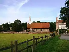 Church of St Barnabas |
| Church of St Mary | Easthorpe, Copford, Colchester | Church | 12th century | 7 April 1965 | TL9124521500 51°51′33″N 0°46′33″E |
1238968 | 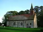 Church of St Mary |
| Church of St Michael and All Angels | Copford, Colchester | Church | 12th century | 7 April 1965 | TL9349822701 51°52′10″N 0°48′33″E |
1274018 | 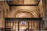 Church of St Michael and All Angels |
| Old Grammar School & Well House | Dedham, Colchester | House | 1732 | 23 June 1952 | TM0580633140 51°57′31″N 0°59′38″E |
1239338 | 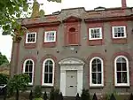 Old Grammar School & Well House |
| Parish Church of St Mary | Dedham, Colchester | Parish church | Perpendicular | 7 April 1965 | TM0572933126 51°57′31″N 0°59′34″E |
1239340 | 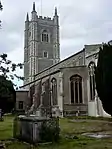 Parish Church of St Mary |
| Shermans | Dedham, Colchester | House | c.1735 | 23 June 1952 | TM0572533177 51°57′32″N 0°59′34″E |
1239328 |  Shermans |
| Southfields & the Flemish Cottages | The Drift, Dedham, Colchester | House | Later | 23 June 1952 | TM0585432849 51°57′22″N 0°59′40″E |
1239217 |  Southfields & the Flemish Cottages |
| Parish Church of St Edmund King and Martyr | East Mersea, Colchester | Church | 12th century | 7 April 1965 | TM0509714182 51°47′19″N 0°58′21″E |
1239659 | 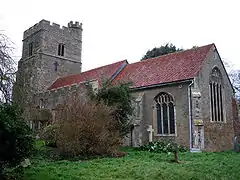 Parish Church of St Edmund King and Martyr |
| Church of St Andrew | Fingringhoe, Colchester | Parish church | 12th century | 7 April 1965 | TM0296720388 51°50′43″N 0°56′43″E |
1239716 | 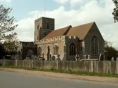 Church of St Andrew |
| Church of All Saints | Fordham, Colchester | Church | c.1340 | 7 April 1965 | TL9275028087 51°55′05″N 0°48′05″E |
1239789 | |
| Church of All Saints | Great Horkesley, Colchester | Lych Gate | c.1901 | 7 April 1965 | TL9714632380 51°57′18″N 0°52′04″E |
1222737 |  Church of All Saints |
| Church of St Barnabas | Great Tey, Colchester | Parish church | 12th century | 7 April 1965 | TL8919925783 51°53′54″N 0°44′55″E |
1223408 |  Church of St Barnabas |
| Church of St Mary | Langham, Colchester | Church | Modern | 7 April 1965 | TM0344833700 51°57′52″N 0°57′36″E |
1223452 | 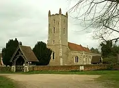 Church of St Mary |
| Church of St Mary the Virgin | Layer Marney, Colchester | Church | Early 16th century | 7 April 1965 | TL9282417418 51°49′20″N 0°47′47″E |
1223987 |  Church of St Mary the Virgin |
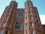
| Layer Marney Tower | Layer Marney, Colchester | House | 20th century | 23 June 1952 | TL9285117480 51°49′22″N 0°47′49″E |
1223988 | |
| Church of St John the Baptist | Layer-de-la-Haye, Colchester | Church | 12th century | 7 April 1965 | TL9649419130 51°50′10″N 0°51′02″E |
1223841 |  Church of St John the Baptist |
| Church of St Andrew | Marks Tey, Colchester | Parish church | Romanesque | 7 April 1965 | TL9112123881 51°52′51″N 0°46′31″E |
1266781 |  Church of St Andrew |
| Church of St James | Little Tey, Marks Tey, Colchester | Church | 19th century | 7 April 1965 | TL8914823753 51°52′49″N 0°44′48″E |
1224521 | 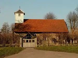 Church of St James |
| Parish Church of All Saints | Inworth, Messing-cum-Inworth, Colchester | Church | 15th century | 7 April 1965 | TL8792917852 51°49′40″N 0°43′33″E |
1224592 | 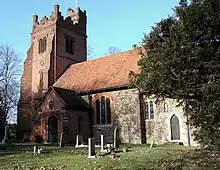 Parish Church of All Saints |
| Church of St John the Baptist | Mount Bures, Colchester | Church | Norman | 7 April 1965 | TL9045932476 51°57′29″N 0°46′14″E |
1224669 | 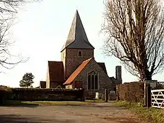 Church of St John the Baptist |
| Church of St Mary the Virgin | Peldon, Colchester | Church | 12th century | 7 April 1965 | TL9894316776 51°48′51″N 0°53′05″E |
1224702 |  Church of St Mary the Virgin |
| Crepping Hall | Wakes Colne, Colchester | House | c.1314 | 23 June 1952 | TL9089828451 51°55′19″N 0°46′29″E |
1266574 |  Crepping Hall |
| Church of St Mary | West Bergholt, Colchester | Church | c.1000 | 7 April 1965 | TL9529828086 51°55′01″N 0°50′18″E |
1225120 | |
| Church of St Peter and St Paul | West Mersea, Colchester | Church | 11th century | 11 October 1949 | TM0091612504 51°46′30″N 0°54′39″E |
1225167 |  Church of St Peter and St Paul |
| Old Garrison House | Wivenhoe, Colchester | Jettied house | c.1600 | 3 May 1949 | TM0388121490 51°51′17″N 0°57′33″E |
1266478 |  Old Garrison House |
| Church of St Andrew | Wormingford, Colchester | Parish church | Norman | 7 April 1965 | TL9329032245 51°57′18″N 0°48′42″E |
1225419 |  Church of St Andrew |
| Bourne Mill | Colchester | House | 1591 | 24 February 1950 | TM0056523846 51°52′38″N 0°54′45″E |
1123673 |  Bourne Mill |
| East Hill House | Colchester | Town House | Early 18th century | 2 December 1971 | TM0008325242 51°53′23″N 0°54′22″E |
1168783 | 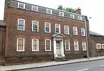 East Hill House |
| East Lodge Gate House | Colchester | House | 17th century | 24 February 1950 | TL9999625266 51°53′24″N 0°54′18″E |
1123612 | 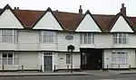 East Lodge Gate House |
| Former Church of Holy Trinity | Colchester | Church | Pre-Conquest | 24 February 1950 | TL9962625118 51°53′20″N 0°53′58″E |
1169575 | 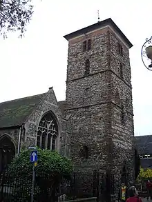 Former Church of Holy Trinity |
| Hollytrees Museum | Castle Park, Colchester | House | Early 18th century | 24 February 1950 | TL9996025268 51°53′24″N 0°54′16″E |
1168810 | |
| Red Lion Hotel | Colchester | Hall House | c.1470 | 24 February 1950 | TL9967325205 51°53′23″N 0°54′01″E |
1123599 | 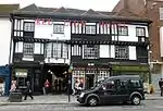 Red Lion Hotel |
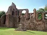
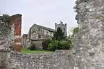
| Ruins of Priory Church of St Botolph | Colchester | Church | Mid-12th century | 2 December 1971 | TL9994824958 51°53′14″N 0°54′15″E |
1337764 | |
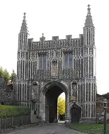
| St John's Abbey Gatehouse | Colchester | Gatehouse | Founded 11th century | 2 December 1971 | TL9976724753 51°53′08″N 0°54′05″E |
1337765 | |
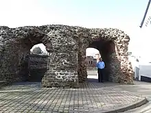
| The Balkerne Gate | Colchester | Gate | C2 | 24 February 1950 | TL9923625186 51°53′23″N 0°53′38″E |
1123668 | |
| Colchester Castle keep (including excavated remains of forebuilding in moat) | Castle Park, Colchester | Keep | c.1080 | 24 February 1950 | TL9986425325 51°53′26″N 0°54′11″E |
1123674 | 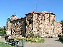 Colchester Castle keep (including excavated remains of forebuilding in moat) |
| The Roman Town Wall | Colchester | Town Wall | Late 3rd century | 2 December 1971 | TL9942125504 51°53′33″N 0°53′48″E |
1123664 | 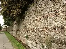 The Roman Town Wall |
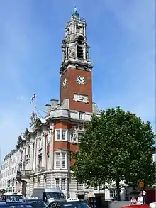
| Town Hall | Colchester | Civic building | 1898 | 25 March 1968 | TL9957725220 51°53′23″N 0°53′56″E |
1337736 | |
| Winnock's Almshouses | Colchester | Almshouse | 1678 | 24 February 1950 | TM0011424714 51°53′06″N 0°54′23″E |
1123565 |  Winnock's Almshouses |
_2013-09-02_23-05-18.jpg.webp)
Epping Forest
| Name | Location | Type | Completed [note 1] | Date designated | Grid ref.[note 2] Geo-coordinates |
Entry number [note 3] | Image |
|---|---|---|---|---|---|---|---|
| Barn North East of Rookwood Hall and South East of Item 2/4 | Abbess Beauchamp and Berners Roding, Epping Forest | Barn | 15th century | 20 February 1967 | TL5609210987 51°46′33″N 0°15′40″E |
1251306 | |
| Fyfield Hall | Fyfield, Epping Forest | Hall House | Medieval | 27 August 1957 | TL5724806873 51°44′19″N 0°16′34″E |
1111326 | |
| Lampetts | Fyfield, Epping Forest | Cross Wing House | Early 14th century | 27 August 1957 | TL5618807217 51°44′31″N 0°15′39″E |
1146540 | |
| Church of St Mary the Virgin | High Ongar, Epping Forest | Parish church | Mid-12th century | 20 February 1967 | TL5652203765 51°42′39″N 0°15′51″E |
1111302 | 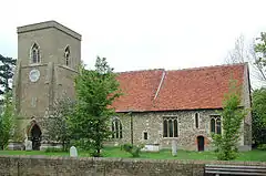 Church of St Mary the Virgin |
| Church of All Saints | Nazeing, Epping Forest | Parish church | Late 12th century | 20 February 1967 | TL4137906974 51°44′37″N 0°02′47″E |
1111135 | 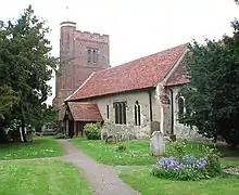 Church of All Saints |
| Church of St Andrew | Greensted, Ongar, Epping Forest | Church | c845 | 11 April 1984 | TL5387902974 51°42′16″N 0°13′32″E |
1124095 | |
| Church of St Martin | Chipping Ongar, Ongar, Epping Forest | Church | Late 11th century | 20 February 1967 | TL5532202956 51°42′14″N 0°14′47″E |
1337485 | |
| Church of St Peter | Roydon, Epping Forest | Parish church | 13th century | 20 February 1967 | TL4078610266 51°46′24″N 0°02′21″E |
1111120 | |
| Netherhall | Roydon, Epping Forest | Moat | Mid-15th century | 4 July 1984 | TL3977608271 51°45′20″N 0°01′25″E |
1182255 |  Netherhall |
| Parish Church of St Mary the Virgin | Sheering, Epping Forest | Parish church | LATE 13th century TO LATE 14th century | 20 February 1967 | TL5085213616 51°48′03″N 0°11′11″E |
1146947 | _-_geograph.org.uk_-_654763.jpg.webp) Parish Church of St Mary the Virgin |
| Church of All Saints | Theydon Garnon, Epping Forest | Priests House | Medieval | 20 February 1967 | TQ4718399379 51°40′26″N 0°07′38″E |
1169440 | 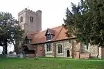 Church of All Saints |
| Church of St Michael the Archangel | Theydon Mount, Epping Forest | Parish church | c.1611 | 20 February 1967 | TQ4926499236 51°40′19″N 0°09′26″E |
1169697 | 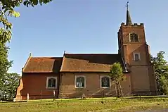 Church of St Michael the Archangel |
| Hill Hall and attached Service Wings to North and West | Theydon Mount, Epping Forest | Country house | c.1569–75 | 11 January 1974 | TQ4892299466 51°40′27″N 0°09′08″E |
1123963 | |
| Church of the Holy Cross and St Lawrence & Ruins to East of Church of Holy Cross and St Lawrence | Waltham Abbey, Epping Forest | Church | Later alteration | 26 January 1956 | TL3811200646 51°41′15″N 0°00′12″W |
1124155 | |
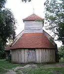
| Ministry of Defence Building L157 (group C Incorporating Mills) | Waltham Abbey Royal Gunpowder Mills, Epping Forest | Gunpowder Works | 1861 | 26 November 1993 | TL3773701167 51°41′33″N 0°00′31″W |
1140098 | .jpg.webp) Ministry of Defence Building L157 (group C Incorporating Mills) |

.jpg.webp)
Harlow
| Name | Location | Type | Completed [note 1] | Date designated | Grid ref.[note 2] Geo-coordinates |
Entry number [note 3] | Image |
|---|---|---|---|---|---|---|---|
| Chapel South West of Harlowbury in Grounds | Harlow | Chapel | c1170/1180 | 5 July 1950 | TL4772912056 51°47′16″N 0°08′26″E |
1111694 | 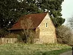 Chapel South West of Harlowbury in Grounds |
| Church of St Andrew | Netteswellbury Farm, Harlow | Church/Learning Centre | 13th century | 5 July 1950 | TL4561109349 51°45′50″N 0°06′31″E |
1111692 | 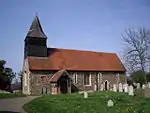 Church of St Andrew |
| Church of St Mary the Virgin | Latton, Harlow | Parish church | 12th century | 5 July 1950 | TL4640410881 51°46′39″N 0°07′15″E |
1337049 | |
| Church of St Mary the Virgin | Great Parndon, Harlow | Church | 15th century | 5 July 1950 | TL4323908906 51°45′38″N 0°04′27″E |
1337051 |  Church of St Mary the Virgin |
| Harlowbury | Harlow | Abbots summer palace | 13th century | 16 June 1977 | TL4774512096 51°47′17″N 0°08′26″E |
1306455 | |
Maldon
| Name | Location | Type | Completed [note 1] | Date designated | Grid ref.[note 2] Geo-coordinates |
Entry number [note 3] | Image |
|---|---|---|---|---|---|---|---|
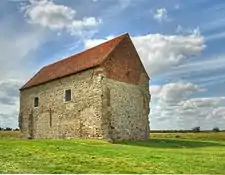
| Chapel of St Peter-on-the-Wall | Bradwell-on-Sea, Maldon District | Chapel | Anglo-Saxon | 30 December 1959 | TM0310008160 51°44′07″N 0°56′24″E |
1110942 | |
| Church of St Peter | Goldhanger, Maldon | Parish church | 11th century | 30 December 1959 | TL9051408842 51°44′45″N 0°45′30″E |
1111097 | 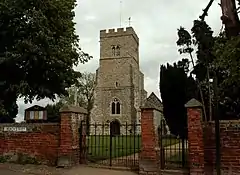 Church of St Peter |
| Church of St Andrew | Heybridge, Maldon | Parish church | 12th century | 2 October 1951 | TL8556808084 51°44′27″N 0°41′11″E |
1256311 | 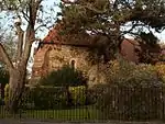 Church of St Andrew |
| Church of St Nicholas | Little Braxted, Maldon | Parish church | 12th century | 30 December 1959 | TL8356114714 51°48′03″N 0°39′39″E |
1111066 | 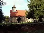 Church of St Nicholas |
| Church of All Saints | Little Totham, Maldon | Parish church | 12th century | 30 December 1959 | TL8841210322 51°45′36″N 0°43′43″E |
1308792 |  Church of All Saints |
| Beeleigh Abbey and attached Wall | Maldon, Maldon | Abbey | Founded c1180 | 2 October 1951 | TL8400807721 51°44′17″N 0°39′49″E |
1257150 | |
| Church of All Saints | Maldon, Maldon | Parish church | 13th century to 15th century | 2 October 1951 | TL8493507072 51°43′55″N 0°40′36″E |
1256816 |  Church of All Saints |
| Church of St Mary | Maldon, Maldon | Parish church | 12th century | 2 October 1951 | TL8569006752 51°43′43″N 0°41′15″E |
1257075 |  Church of St Mary |
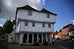
| Moot Hall | Maldon, Maldon | House | 1500 to 1576 | 2 October 1951 | TL8498107046 51°43′54″N 0°40′38″E |
1256887 | .jpg.webp) Moot Hall |
| Plume Library, including Tower of former Church of St Peter | Maldon, Maldon | Public Library | c.1699 | 2 October 1951 | TL8509207055 51°43′54″N 0°40′44″E |
1256632 | .jpg.webp) Plume Library, including Tower of former Church of St Peter |
| St Giles Hospital, Remains | Maldon, Maldon | Chapel | Late 12th century | 2 October 1951 | TL8433206479 51°43′36″N 0°40′03″E |
1256378 |  St Giles Hospital, Remains |
| Redundant Church of St Mary | Mundon, Maldon | Parish church | 14th century and later | 1 November 1953 | TL8797302655 51°41′28″N 0°43′06″E |
1306956 | |
| Parish Church of All Saints | Purleigh, Maldon | Parish church | Before 14th century | 1 November 1953 | TL8413702035 51°41′13″N 0°39′45″E |
1110882 | 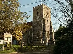 Parish Church of All Saints |
| Church of St Nicholas | Tolleshunt D'Arcy, Maldon | Parish church | Late 14th century | 30 December 1959 | TL9282111702 51°46′15″N 0°47′36″E |
1328214 | 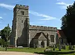 Church of St Nicholas |
| Church of St Nicholas | Tolleshunt Major, Maldon | Parish church | 12th century | 30 December 1959 | TL9087511115 51°45′58″N 0°45′53″E |
1142488 | 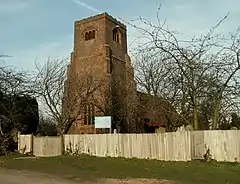 Church of St Nicholas |
Rochford
| Name | Location | Type | Completed [note 1] | Date designated | Grid ref.[note 2] Geo-coordinates |
Entry number [note 3] | Image |
|---|---|---|---|---|---|---|---|
| Rochford Hall and ruins | Rochford, Rochford District | House | 16th century | 4 December 1951 | TQ8706890336 51°34′51″N 0°41′55″E |
1112586 | 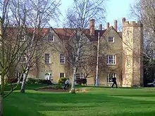 Rochford Hall and ruins |
Southend-on-Sea
| Name | Location | Type | Completed [note 1] | Date designated | Grid ref.[note 2] Geo-coordinates |
Entry number [note 3] | Image |
|---|---|---|---|---|---|---|---|
| Church of St Laurence and All Saints | Eastwood, Southend-on-Sea | Church | 12th century | 23 November 1951 | TQ8616488842 51°34′04″N 0°41′05″E |
1322331 | |
| Church of St Mary | Prittlewell, Southend-on-Sea | Church | 12th century | 23 November 1951 | TQ8768286822 51°32′57″N 0°42′20″E |
1322353 | 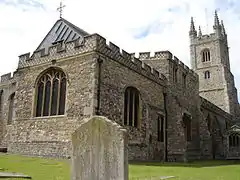 Church of St Mary |
| Porters (Civic House) | Prittlewell, Southend-on-Sea | Manor House | Late 15th century or early 16th century | 23 November 1951 | TQ8861085837 51°32′24″N 0°43′06″E |
1112724 | |
| Prittlewell Priory | Prittlewell, Southend-on-Sea | Priory | 12th century | 23 November 1951 | TQ8764587336 51°33′13″N 0°42′19″E |
1112719 | |
| Southchurch Hall | Southchurch, Southend-on-Sea | Cross Wing House | 13th century | 23 November 1951 | TQ8939885523 51°32′13″N 0°43′46″E |
1306880 |
Tendring
| Name | Location | Type | Completed [note 1] | Date designated | Grid ref.[note 2] Geo-coordinates |
Entry number [note 3] | Image |
|---|---|---|---|---|---|---|---|
| Church of All Saints | Brightlingsea, Tendring | Church | BY 1590 | 18 July 1949 | TM0771418732 51°49′43″N 1°00′47″E |
1337182 | 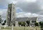 Church of All Saints |
| Jacobes Hall | Brightlingsea, Tendring | House | C15/C16 | 18 July 1949 | TM0887016746 51°48′37″N 1°01′43″E |
1111438 | 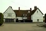 Jacobes Hall |
| Church of St Anne and St Lawrence | Elmstead, Tendring | Parish church | 12th century | 17 November 1966 | TM0650626003 51°53′39″N 0°59′59″E |
1337162 | 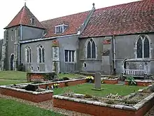 Church of St Anne and St Lawrence |
| Church of St Mary | Great Bentley, Tendring | Parish church | 1130–40 | 17 November 1966 | TM1090921644 51°51′13″N 1°03′40″E |
1306652 | 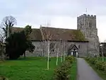 Church of St Mary |
| Church of St George | Great Bromley, Tendring | Parish church | 14th century | 17 November 1966 | TM0836026292 51°53′46″N 1°01′37″E |
1337189 | 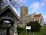 Church of St George |
| Parish Church of All Saints | Great Oakley, Tendring | Church | 12th century | 30 January 1987 | TM1878227318 51°54′05″N 1°10′44″E |
1147170 | 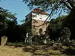 Parish Church of All Saints |
| Guildhall | Harwich, Tendring | Prison | Late 18th century | 25 September 1951 | TM2605632584 51°56′45″N 1°17′16″E |
1298482 | |
| Church of St Mary | Lawford, Tendring | Parish church | 14th century | 17 November 1966 | TM0890331571 51°56′36″N 1°02′17″E |
1261462 | 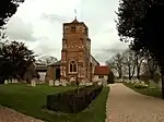 Church of St Mary |
| Lawford Hall | Lawford, Tendring | House | Earlier | 21 February 1950 | TM0877031803 51°56′44″N 1°02′10″E |
1254131 | 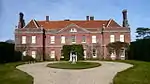 Lawford Hall |
| Church of St Mary | Little Bentley, Tendring | Parish church | 12th century | 17 November 1966 | TM1226424938 51°52′57″N 1°04′58″E |
1111455 | 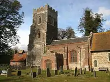 Church of St Mary |
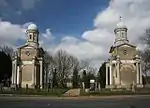
| Mistley Towers, North West Tower | Mistley, Tendring | Tower | c.1735 | 17 November 1966 | TM1158831982 51°56′46″N 1°04′38″E |
1240390 | |
| Mistley Towers, South East Tower | Mistley, Tendring | Tower | c.1735 | 17 November 1966 | TM1160831972 51°56′46″N 1°04′39″E |
1261061 | |
| Parish Church of St Michael | Ramsey and Parkeston, Tendring | Church | Early 12th century | 30 January 1987 | TM2181430438 51°55′42″N 1°13′29″E |
1112103 | 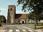 Parish Church of St Michael |
| Church of St Peter and St Paul | St Osyth, Tendring | Parish church | 12th century | 17 November 1966 | TM1227315576 51°47′55″N 1°04′38″E |
1111513 | 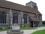 Church of St Peter and St Paul |
| St Clere's Hall | St Clere's Lane, St Osyth, Tendring | House | 16th century | 29 April 1952 | TM1268114840 51°47′30″N 1°04′57″E |
1309039 | |
| St Osyth's Priory Convalescent Home | St Osyth, Tendring | Abbey | c1527 Before 1539 | 21 February 1950 | TM1211415747 51°48′00″N 1°04′30″E |
1337158 | .jpg.webp) St Osyth's Priory Convalescent Home |
| St Osyth's Priory Precinct Wall to South West of Gatehouse | St Osyth, Tendring | Wall | 20th century | 21 February 1950 | TM1210415618 51°47′56″N 1°04′29″E |
1337160 | 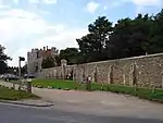 St Osyth's Priory Precinct Wall to South West of Gatehouse |
| St Osyth's Priory Ruined East Range and Tower | St Osyth, Tendring | Abbey Ruins | 16th century | 21 February 1950 | TM1219715738 51°48′00″N 1°04′34″E |
1337159 | |
| St Osyth's Priory the Chapel of St Osyth and Ruins Attached to North | St Osyth, Tendring | Chapel | C19/C20 | 21 February 1950 | TM1217915718 51°47′59″N 1°04′33″E |
1166377 | |
| St Osyth's Priory the Darcy Tower (also known ss Abbot's Tower) and Vaulting to West | St Osyth, Tendring | Tower | c1427 Before 1539 | 21 February 1950 | TM1217615718 51°47′59″N 1°04′33″E |
1146545 | |
| St Osyth's Priory, Barn adjoining the West Range of Gatehouse | St Osyth, Tendring | Barn | 1986 | 21 February 1950 | TM1207115639 51°47′57″N 1°04′27″E |
1308972 | St Osyth's Priory, Barn adjoining the West Range of Gatehouse |
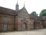
| St Osyth's Priory, Gatehouse and East and West Flanking Ranges | St Osyth, Tendring | Gatehouse | c1527 Before 1539 | 21 February 1950 | TM1212415634 51°47′57″N 1°04′30″E |
1111495 | 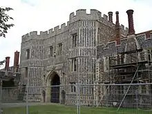 St Osyth's Priory, Gatehouse and East and West Flanking Ranges |
| Church of St John the Baptist | Great Clacton, Tendring | Parish church | 12th century | 4 July 1986 | TM1770816529 51°48′18″N 1°09′23″E |
1317259 | 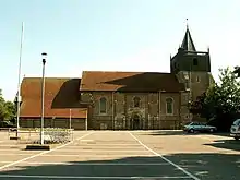 Church of St John the Baptist |
Thurrock
| Name | Location | Type | Completed [note 1] | Date designated | Grid ref.[note 2] Geo-coordinates |
Entry number [note 3] | Image |
|---|---|---|---|---|---|---|---|
| Church of St Clement | West Thurrock, Thurrock | Church | c.1200 | 8 February 1960 | TQ5931377298 51°28′20″N 0°17′33″E |
1147660 | |
| Church of St Giles and All Saints | Orsett, Thurrock | Church | 12th century | 8 February 1960 | TQ6444081971 51°30′46″N 0°22′06″E |
1147049 | 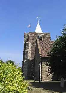 Church of St Giles and All Saints |
| Church of St Katherine | East Tilbury, Thurrock | Church | 12th century | 8 February 1960 | TQ6890776964 51°27′59″N 0°25′49″E |
1337129 | 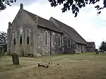 Church of St Katherine |
| Church of St Margaret of Antioch | Stanford-le-Hope, Thurrock | Church | 12th century | 8 February 1960 | TQ6843882264 51°30′51″N 0°25′34″E |
1111653 | 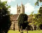 Church of St Margaret of Antioch |
| Church of St Mary | Bulphan, Thurrock | Church | Late 15th century | 8 February 1960 | TQ6367885834 51°32′52″N 0°21′33″E |
1111617 | 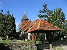 Church of St Mary |
| Church of St Mary | Corringham, Thurrock | Church | 11th century | 8 February 1960 | TQ7098683289 51°31′21″N 0°27′48″E |
1337083 | 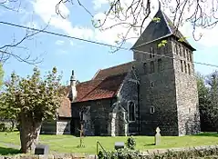 Church of St Mary |
| Church of St Mary | Chadwell St Mary, Thurrock | Church | Early 12th century | 8 February 1960 | TQ6462778498 51°28′53″N 0°22′10″E |
1111576 | |
| Church of St Mary the Virgin | Stifford, Thurrock | Church | 12th century | 8 February 1960 | TQ6045480308 51°29′56″N 0°18′37″E |
1111611 | 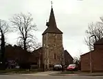 Church of St Mary the Virgin |
| Church of St Michael | Fobbing, Thurrock | Church | 11th century | 8 February 1960 | TQ7180183898 51°31′40″N 0°28′31″E |
1146807 | 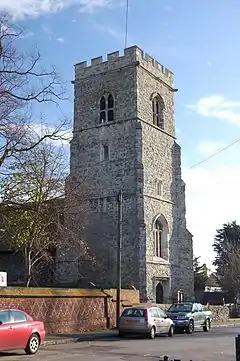 Church of St Michael |
| Church of St Michael | Aveley, Thurrock | Church | 12th century | 8 February 1960 | TQ5675880088 51°29′53″N 0°15′25″E |
1337099 | _-_geograph.org.uk_-_36157.jpg.webp) Church of St Michael |
| Church of St Nicholas | South Ockendon, Thurrock | Church | 12th century | 8 February 1960 | TQ5950082908 51°31′21″N 0°17′52″E |
1111564 |  Church of St Nicholas |
| Church of St Peter and St Paul | Horndon on the Hill, Thurrock | Church | 13th century | 8 February 1960 | TQ6692583298 51°31′26″N 0°24′17″E |
1337109 |  Church of St Peter and St Paul |
| Government Powder Magazine | Purfleet, Thurrock | Powder Magazine | 1763 to 1765 | 10 November 1981 | TQ5488478518 51°29′04″N 0°13′45″E |
1166258 |  Government Powder Magazine |
Uttlesford
| Name | Location | Type | Completed [note 1] | Date designated | Grid ref.[note 2] Geo-coordinates |
Entry number [note 3] | Image |
|---|---|---|---|---|---|---|---|
| Church of All Saints | Church End, Ashdon, Uttlesford | Church | C14-C15 | 21 February 1967 | TL5809941507 52°02′58″N 0°18′15″E |
1170162 |  Church of All Saints |
| Church of St Nicholas | Berden, Uttlesford | Church | Saxon | 21 February 1967 | TL4676929630 51°56′45″N 0°08′02″E |
1170264 | |
| Church of St Mary the Virgin | Chickney, Uttlesford | Church | late C10-early 11th century | 20 February 1967 | TL5742628049 51°55′43″N 0°17′17″E |
1112190 | |
| Church of the Holy Trinity | Chrishall, Uttlesford | Church | C12-C13 | 21 February 1967 | TL4513938634 52°01′38″N 0°06′51″E |
1112444 |  Church of the Holy Trinity |
| Church of St Mary and St Clement | Clavering, Uttlesford | Church | Earlier | 21 February 1967 | TL4707531812 51°57′55″N 0°08′22″E |
1170753 | 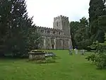 Church of St Mary and St Clement |
| Church of St Mary and All Saints | Debden Park, Debden, Uttlesford | Church | c.1220 | 21 February 1967 | TL5510233229 51°58′33″N 0°15′24″E |
1170838 | 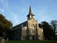 Church of St Mary and All Saints |
| Church of St Mary the Virgin | Elsenham, Uttlesford | Church | Saxon | 21 February 1967 | TL5422825924 51°54′38″N 0°14′27″E |
1112335 | 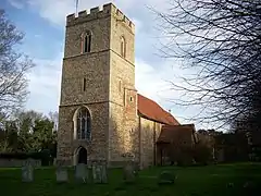 Church of St Mary the Virgin |
| Church of the Holy Cross | Felsted, Uttlesford | Church | Early 12th century | 20 February 1967 | TL6765320387 51°51′25″N 0°25′59″E |
1112864 | 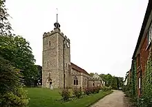 Church of the Holy Cross |
| Gatehouse Farmhouse | Gransmore Green, Felsted, Uttlesford | Cross Wing House | c.1300 | 20 October 1977 | TL6944222577 51°52′34″N 0°27′36″E |
1112849 | |
| Leez Priory Garden Wall | Felsted, Uttlesford | Gate | 1537 | 20 February 1967 | TL7003018494 51°50′21″N 0°28′00″E |
1322296 |  Leez Priory Garden Wall |
| Old School Room and Lych Gate and Building to West | Felsted, Uttlesford | Jettied house | C14-C15 | 7 February 1952 | TL6765420362 51°51′24″N 0°25′59″E |
1146621 | 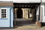 Old School Room and Lych Gate and Building to West |
| The Inner Gatehouse at Leez Priory | Felsted, Uttlesford | Augustinian Monastery | 1536 | 19 June 1975 | TL7006718548 51°50′23″N 0°28′02″E |
1122138 | The Inner Gatehouse at Leez Priory |
| Parish Church of St Mary | Church End, Great Canfield, Uttlesford | Parish church | Early 12th century | 23 February 1967 | TL5939218007 51°50′17″N 0°18′44″E |
1120855 | 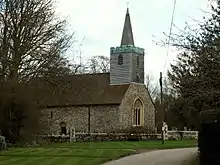 Parish Church of St Mary |
| Church of All Saints | Great Chesterford, Uttlesford | Church | 13th century | 21 February 1967 | TL5059742767 52°03′46″N 0°11′43″E |
1171461 |  Church of All Saints |
| Parish Church of St Mary the Virgin | Church End, Great Dunmow, Uttlesford | Parish church | 13th century | 20 February 1967 | TL6295322963 51°52′53″N 0°21′58″E |
1142471 |  Parish Church of St Mary the Virgin |
| The Clock House | Great Dunmow, Uttlesford | House | Early 17th century | 7 February 1952 | TL6266022759 51°52′47″N 0°21′42″E |
1098272 | |
| Church of St Michael | Great Sampford, Uttlesford | Church | Late 13th century | 21 February 1967 | TL6423435355 51°59′32″N 0°23′26″E |
1322547 | 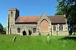 Church of St Michael |
| Church of St Botolph | Hadstock, Uttlesford | Church | Early Anglo-Saxon | 21 February 1967 | TL5588144744 52°04′45″N 0°16′24″E |
1112250 | 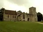 Church of St Botolph |
| Church of St Mary the Virgin | Church Yard, Hatfield Broad Oak, Uttlesford | Church | 1135 | 20 February 1967 | TL5467216625 51°49′37″N 0°14′35″E |
1186272 |  Church of St Mary the Virgin |
| Church of St Mary the Virgin | Henham, Uttlesford | Church | Early 13th century | 21 February 1967 | TL5444628589 51°56′04″N 0°14′42″E |
1278434 | 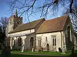 Church of St Mary the Virgin |
| Parish Church of St Mary | High Easter, Uttlesford | Church | 13th century | 20 February 1967 | TL6200714740 51°48′28″N 0°20′55″E |
1308549 | 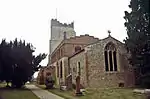 Parish Church of St Mary |
| Porters Farmhouse | High Roding, Uttlesford | Farmhouse | 1967 | 20 February 1967 | TL6060717009 51°49′43″N 0°19′45″E |
1141279 | |
| Church of St Katharine | Little Bardfield, Uttlesford | Parish church | Saxon | 20 February 1967 | TL6554630744 51°57′02″N 0°24′27″E |
1306257 | 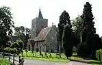 Church of St Katharine |
| The Manor | Little Chesterford, Uttlesford | House | c.1200 | 26 November 1951 | TL5148841696 52°03′11″N 0°12′29″E |
1231793 | .jpg.webp) The Manor |
| Church of St Mary the Virgin | Little Dunmow, Uttlesford | Parish church | 19th century | 20 February 1967 | TL6561221231 51°51′54″N 0°24′14″E |
1307038 |  Church of St Mary the Virgin |
| Church of St Mary the Virgin | Little Easton, Uttlesford | Parish church | 12th century | 20 February 1967 | TL6045423503 51°53′13″N 0°19′48″E |
1097465 | 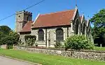 Church of St Mary the Virgin |
| Church of St Mary the Virgin | Little Sampford, Uttlesford | Church | Early 14th century | 21 February 1967 | TL6531133657 51°58′36″N 0°24′20″E |
1277381 | 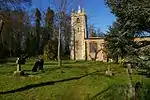 Church of St Mary the Virgin |
| Church of the Holy Trinity | Littlebury, Uttlesford | Church | Saxo-Norman | 21 February 1967 | TL5169439486 52°01′59″N 0°12′36″E |
1231285 | 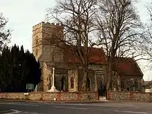 Church of the Holy Trinity |
| Parish Church of St Margaret | Margaret Roding, Uttlesford | Parish church | Late 12th century | 20 February 1967 | TL5989711997 51°47′02″N 0°19′00″E |
1141258 | 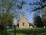 Parish Church of St Margaret |
| Church of St Mary the Virgin | Newport, Uttlesford | Church | 1220–40 | 21 February 1967 | TL5207134107 51°59′05″N 0°12′47″E |
1275990 | 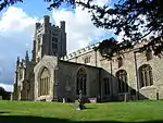 Church of St Mary the Virgin |
| Quendon Hall | Quendon Park, Quendon and Rickling, Uttlesford | House | C16-C17 | 26 November 1951 | TL5153631841 51°57′52″N 0°12′15″E |
1217140 | |
| Audley End House | Audley End, Saffron Walden, Uttlesford | Abbey | 1538 | 1 November 1972 | TL5246738150 52°01′15″N 0°13′14″E |
1196114 | |
| Audley End Stables | Audley End Park, Littlebury, Uttlesford | Stable | Late 16th century | 22 February 1980 | TL5218838268 52°01′19″N 0°13′00″E |
1278179 | |
| Bridge over the River Cam at Tl 521 380, South West of Audley End House | Audley End, Saffron Walden, Uttlesford | Bridge | 1763–64 | 28 November 1951 | TL5218338022 52°01′11″N 0°12′59″E |
1196115 | 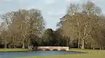 Bridge over the River Cam at Tl 521 380, South West of Audley End House |
| Tea House and Bridge at Tl 522 385, North West of Audley End House | Audley End, Saffron Walden, Uttlesford | Bridge | 1783 | 1 November 1972 | TL5229338534 52°01′28″N 0°13′06″E |
1297800 |  Tea House and Bridge at Tl 522 385, North West of Audley End House |
| Church of St Mary the Virgin | Saffron Walden, Uttlesford | Cross | Anglo-Saxon | 28 November 1951 | TL5373638626 52°01′29″N 0°14′21″E |
1196237 | 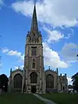 Church of St Mary the Virgin |
| Saint Mark's College | Saffron Walden, Uttlesford | Estate Cottage | 1605–14 | 28 November 1951 | TL5248337738 52°01′02″N 0°13′14″E |
1196246 | .jpg.webp) Saint Mark's College |
| Walden Castle | Saffron Walden, Uttlesford | Castle | Late 11th century or early 12th century | 28 November 1951 | TL5390738722 52°01′32″N 0°14′31″E |
1297737 | |
| Youth Hostel | Saffron Walden, Uttlesford | House | c.1520–25 | 1 November 1972 | TL5357238618 52°01′29″N 0°14′13″E |
1297805 | 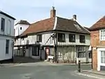 Youth Hostel |
| 25 and 27 Church Street | Saffron Walden, Uttlesford | House | 17th century | 28 November 1951 | TL5379838572 52°01′27″N 0°14′25″E |
1196155 | .jpg.webp) 25 and 27 Church Street |
| 17 Market Hill | Saffron Walden, Uttlesford | Hall House | 14th century | 28 November 1951 | TL5381838582 52°01′28″N 0°14′26″E |
1196218 | 17 Market Hill |
| 29 and 31 Castle Street (Sun Inn) | Saffron Walden, Uttlesford | Inn | 16th century | 28 November 1951 | TL5365838665 52°01′30″N 0°14′17″E |
1205611 |  29 and 31 Castle Street (Sun Inn) |
| St Aylotts | Sewards End, Uttlesford | House | c.1500 | 28 November 1951 | TL5695539918 52°02′08″N 0°17′12″E |
1196110 | |
| Church of St Mary the Virgin | Stebbing, Uttlesford | Church | c.1360 | 20 February 1967 | TL6639424004 51°53′23″N 0°25′00″E |
1112777 | 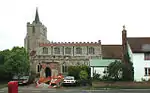 Church of St Mary the Virgin |
| Church of St Mary the Virgin | Strethall, Uttlesford | Church | Saxon | 21 February 1967 | TL4854839827 52°02′13″N 0°09′51″E |
1275078 | 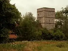 Church of St Mary the Virgin |
| Church of the Holy Trinity | Takeley, Uttlesford | Church | 12th century | 20 February 1967 | TL5552221673 51°52′19″N 0°15′28″E |
1168843 | 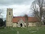 Church of the Holy Trinity |
| Warish Hall and Moat Bridge | Takeley, Uttlesford | Aisled House | Late 13th century | 10 September 1981 | TL5683322098 51°52′31″N 0°16′37″E |
1169063 | |
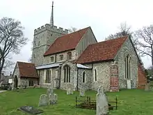
| Church of St John the Baptist | Thaxted, Uttlesford | Church | c.1340 | 20 February 1967 | TL6104431014 51°57′15″N 0°20′32″E |
1112151 | 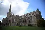 Church of St John the Baptist |
| Clarence House | Thaxted, Uttlesford | House | 1715 | 20 February 1967 | TL6105531059 51°57′17″N 0°20′32″E |
1166193 | 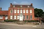 Clarence House |
| Garden Wall to Clarence House Fronting Bell Lane and Margaret Street | Thaxted, Uttlesford | Gate Pier | 1715 | 28 June 1983 | TL6107131085 51°57′18″N 0°20′33″E |
1322228 | |
| Guildhall | Thaxted, Uttlesford | Guildhall | between 1390 and 1410 | 20 February 1967 | TL6113930953 51°57′13″N 0°20′37″E |
1112905 | |
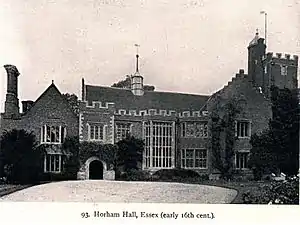
| Horham Hall | Thaxted, Uttlesford | Country house | Early 16th century | 7 February 1952 | TL5885429432 51°56′27″N 0°18′34″E |
1165290 | |
| Horham Hall | Thaxted, Uttlesford | House | c.1470 | 7 February 1952 | TL5884929419 51°56′26″N 0°18′34″E |
1322572 | |
| 2 Stoney Lane | Thaxted, Uttlesford | Jettied house | c.1410 | 20 February 1967 | TL6112830957 51°57′14″N 0°20′36″E |
1166022 | 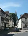 2 Stoney Lane |
| 3 Stoney Lane | Thaxted, Uttlesford | Jettied house | c.1410 | 20 February 1967 | TL6112530959 51°57′14″N 0°20′36″E |
1112934 | 3 Stoney Lane |
| 4 Stoney Lane | Thaxted, Uttlesford | Jettied house | c.1410 | 20 February 1967 | TL6112230961 51°57′14″N 0°20′36″E |
1322240 | 4 Stoney Lane |
| Church of St Mary the Virgin | Tilty, Uttlesford | Church | c.1200 | 20 February 1967 | TL5999126511 51°54′51″N 0°19′29″E |
1169090 | 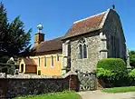 Church of St Mary the Virgin |
| Church of St Mary the Virgin | Wendens Ambo, Uttlesford | Church | Norman | 21 February 1967 | TL5129236390 52°00′19″N 0°12′10″E |
1238157 | |
| Barn to South West of Colville Hall | White Roothing, Uttlesford | Barn | 13th century | 13 June 1983 | TL5534513402 51°47′52″N 0°15′05″E |
1322691 | |
| Stable to West of Colville Hall | White Roothing, Uttlesford | Jettied house | Early 16th century | 7 February 1952 | TL5533313434 51°47′53″N 0°15′04″E |
1147675 | |
| Barn to North West of Prior's Hall | Widdington, Uttlesford | Barn | 1976–77 | 26 November 1951 | TL5369431790 51°57′48″N 0°14′08″E |
1238474 | 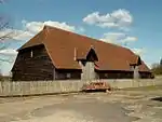 Barn to North West of Prior's Hall |
| Prior's Hall | Widdington, Uttlesford | House | 17th century | 26 November 1951 | TL5372631755 51°57′47″N 0°14′10″E |
1274214 | |
| Church of All Saints | Wimbish, Uttlesford | Church | Early 12th century | 21 February 1967 | TL5902736907 52°00′28″N 0°18′56″E |
1274068 | 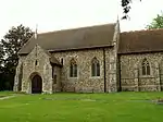 Church of All Saints |
| Tiptofts | Cole End, Wimbish, Uttlesford | House | 16th century | 26 November 1951 | TL5696937393 52°00′46″N 0°17′09″E |
1274093 | |
.jpg.webp)
See also
- Category:Grade I listed buildings in Essex
- Grade II* listed buildings in Essex
Notes
- The date given is the date used by Historic England as significant for the initial building or that of an important part in the structure's description.
- Sometimes known as OSGB36, the grid reference is based on the British national grid reference system used by the Ordnance Survey.
- The "List Entry Number" is a unique number assigned to each listed building and scheduled monument by Historic England.
External links
![]() Media related to Grade I listed buildings in Essex at Wikimedia Commons
Media related to Grade I listed buildings in Essex at Wikimedia Commons
This article is issued from Wikipedia. The text is licensed under Creative Commons - Attribution - Sharealike. Additional terms may apply for the media files.