Ball Club, Minnesota
Ball Club is an unincorporated community and census-designated place (CDP) in Itasca County, Minnesota, United States; located within the Leech Lake Indian Reservation. As of the 2010 census, its population was 342.[2] Ball Club is located between Zemple and Bena.
Ball Club | |
|---|---|
 Ball Club  Ball Club | |
| Coordinates: 47°19′33″N 93°56′10″W | |
| Country | United States |
| State | Minnesota |
| County | Itasca |
| Area | |
| • Total | 2.764 sq mi (7.16 km2) |
| • Land | 2.764 sq mi (7.16 km2) |
| • Water | 0 sq mi (0 km2) |
| Elevation | 1,302 ft (397 m) |
| Population | |
| • Total | 342 |
| • Density | 120/sq mi (48/km2) |
| Time zone | UTC-6 (Central (CST)) |
| • Summer (DST) | UTC-5 (CDT) |
| Area code(s) | 218 |
| GNIS feature ID | 655201[3] |
The center of Ball Club is generally considered at the junction of U.S. Highway 2 and Itasca County Road 39. Ball Club is located 21 miles west of Grand Rapids.
Ball Club received its name from a type of Native American lacrosse stick.[4] The majority of the community is populated by Native Americans of the Leech Lake Band of Ojibwe.
Ball Club's small economy includes a general store and gas station. The community also includes two churches, a clinic, a Headstart office, a community center, a water tower, and a Cordell.
The Mississippi River surrounds Ball Club on both the East and West side of the community. The boundary line between Itasca and Cass counties is in the vicinity.
Rosanna Catherine Payne served as the postmistress for Ball Club; Payne served in the Minnesota House of Representatives from 1927 to 1932.[5]
References
- "US Gazetteer files: 2010, 2000, and 1990". United States Census Bureau. 2011-02-12. Retrieved 2011-04-23.
- "U.S. Census website". United States Census Bureau. Retrieved 2011-05-14.
- "Ball Club, Minnesota". Geographic Names Information System. United States Geological Survey.
- Baker, Lawrence B. (Jul 14, 1969). "Rodney, Oscar, Cecil, Esther Surround Us". Pittsburgh Post-Gazette. p. 23. Retrieved 20 May 2015.
- 'Mrs. R. Payne Dies; Former State Legislator,' Minneapolis Star, November 1, 1954, pg. 17
- Rand McNally Road Atlas – 2007 edition – Minnesota entry
- Official State of Minnesota Highway Map – 2011/2012 edition
- Mn/DOT map of Itasca County – Sheet 2 – 2011 edition
Municipalities and communities of Itasca County, Minnesota, United States | ||
|---|---|---|
| Cities | 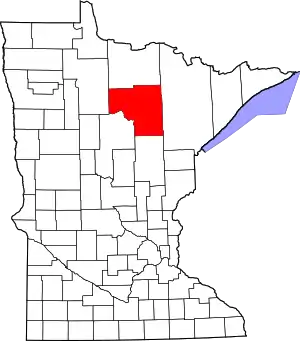 Map of Minnesota highlighting Itasca County | |
| Townships |
| |
| Unorganized territories | ||
| CDPs | ||
| Unincorporated communities | ||
| Indian reservations | ||
| Footnotes | ‡This populated place also has portions in an adjacent county or counties | |
| ||