Max, Minnesota
Max is an unincorporated community in Max Township, Itasca County, Minnesota, United States; located within the Chippewa National Forest and the Leech Lake Indian Reservation.
Max | |
|---|---|
 Max Location of the community of Max within Max Township, Itasca County  Max Max (the United States) | |
| Coordinates: 47°36′53″N 94°04′05″W | |
| Country | United States |
| State | Minnesota |
| County | Itasca |
| Township | Max Township |
| Elevation | 1,371 ft (418 m) |
| Time zone | UTC-6 (Central (CST)) |
| • Summer (DST) | UTC-5 (CDT) |
| ZIP code | 56659 |
| Area code(s) | 218 |
| GNIS feature ID | 657341[1] |
The community is located southeast of Squaw Lake at the junction of Itasca County Roads 4 and 34. State Highway 46 (MN 46) is nearby.
Nearby places include Squaw Lake, Spring Lake, Inger, and Alvwood.
Max is located 3.5 miles southeast of Squaw Lake. Max is also located 25 miles northwest of Deer River.
Media
Television
| Channel | Callsign | Affiliation | Branding | Subchannels | Owner | |
|---|---|---|---|---|---|---|
| (Virtual) | Channel | Programming | ||||
| 13.1 | K36KZ-D (WIRT Translator) |
ABC | WDIO 13 | 13.2 13.3 |
MeTV Ion Television |
EZ-TV, Inc. |
| 21.1 | K33OG-D (KQDS Translator) |
FOX | FOX 21 | 21.2 | Antenna TV | EZ-TV, Inc. |
References
- Rand McNally Road Atlas – 2007 edition – Minnesota entry
- Official State of Minnesota Highway Map – 2011/2012 edition
- Mn/DOT map of Itasca County – Sheet 2 – 2011 edition
Municipalities and communities of Itasca County, Minnesota, United States | ||
|---|---|---|
| Cities | 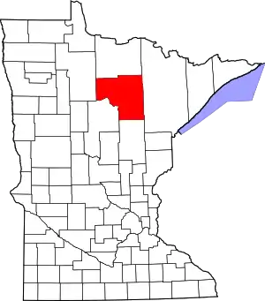 Map of Minnesota highlighting Itasca County | |
| Townships |
| |
| Unorganized territories | ||
| CDPs | ||
| Unincorporated communities | ||
| Indian reservations | ||
| Footnotes | ‡This populated place also has portions in an adjacent county or counties | |
| ||
This article is issued from Wikipedia. The text is licensed under Creative Commons - Attribution - Sharealike. Additional terms may apply for the media files.