Balmoral Parish, New Brunswick
Balmoral is a civil parish in Restigouche County, New Brunswick, Canada.[2]
Balmoral | |
|---|---|
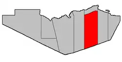 Location within Restigouche County. | |
| Coordinates: 47.6975°N 66.5575°W | |
| Country | |
| Province | |
| County | Restigouche |
| Erected | 1896 |
| Area | |
| • Land | 1,089.41 km2 (420.62 sq mi) |
| Population (2016)[1] | |
| • Total | 278 |
| • Density | 0.3/km2 (0.8/sq mi) |
| • Change 2011 revised - 2016 | |
| • Dwellings | 120 |
| Time zone | UTC-4 (AST) |
| • Summer (DST) | UTC-3 (ADT) |
For governance purposes it is divided between the villages of Atholville, New Brunswick,[3] Balmoral,[3] and Eel River Crossing;[3] the Indian reserve of Moose Meadows 4; and the local service districts of Balmoral-St. Maure, Blair Athol, and the parish of Balmoral,[4][lower-alpha 1] all of which except the Indian reserve are members of the Restigouche Regional Service Commission (RRSC).[6]
Origin of name
The parish may have gotten its name from Balmoral Castle, Scotland, increasingly used by Queen Victoria at the time. William F. Ganong had no idea of its origin, noting only that there was a place of that name in Scotland.[7]
History
Balmoral was erected in 1896 from Dalhousie Parish.[8]
Delineation
Balmoral Parish is defined in the Territorial Division Act[2] as being bounded:
- West by Addington Parish; north by Dalhousie Parish; south by Northumberland County line, and east by the southern prolongation of the eastern line of Dalhousie Parish.
Communities
Parish population total does not include incorporated municipalities (in bold).
- Balmoral including:
- Selwood
- Upper Balmoral
- Blair Athol
- Maltais
- Ramsay Sheds
- Saint-Maure
- Simpsons Field
Demographics
Population
| Canada census – Balmoral Parish, New Brunswick community profile | |||
|---|---|---|---|
| 2016 | 2011 | 2006 | |
| Population: | 278 (+6.9% from 2011) | 602 (-2.7% from 2006) | 619 (+2.3% from 2001) |
| Land area: | 1,089.41 km2 (420.62 sq mi) | 1,098.32 km2 (424.06 sq mi) | 1,098.18 km2 (424.01 sq mi) |
| Population density: | 0.3/km2 (0.78/sq mi) | 0.5/km2 (1.3/sq mi) | 0.6/km2 (1.6/sq mi) |
| Median age: | 45.8 (M: 47.2, F: 45.5) | 44.5 (M: 45.1, F: 42.6) | 41.2 (M: 40.1, F: 42.2) |
| Total private dwellings: | 120 | 251 | 253 |
| Median household income: | $58,880 | $34,474 | $34,663 |
| Notes: 2016 population change is in comparison to revised 2011 population – References: 2016[9] 2011[10] 2006[11] earlier[12] | |||
|
|
| ||||||||||||||||||||||||||||||
| [13][14][1] 2011 rev shows population after boundary changes | ||||||||||||||||||||||||||||||||
Language
| Canada Census Mother Tongue - Balmoral Parish, New Brunswick[13] | ||||||||||||||||||
|---|---|---|---|---|---|---|---|---|---|---|---|---|---|---|---|---|---|---|
| Census | Total | French |
English |
French & English |
Other | |||||||||||||
| Year | Responses | Count | Trend | Pop % | Count | Trend | Pop % | Count | Trend | Pop % | Count | Trend | Pop % | |||||
2016 |
280 |
240 | 85.7% | 35 | 12.5% | 0 | 0% | 5 | 1.8% | |||||||||
2011 |
605 |
570 | 94.21% | 30 | 4.96% | 5 | 0.83% | 0 | 0.00% | |||||||||
2006 |
615 |
565 | 91.87% | 40 | 6.50% | 10 | 1.63% | 0 | 0.00% | |||||||||
2001 |
575 |
540 | 93.91% | 25 | 4.35% | 10 | 1.74% | 0 | 0.00% | |||||||||
1996 |
805 |
775 | n/a | 96.27% | 20 | n/a | 2.48% | 10 | n/a | 1.24% | 0 | n/a | 0.00% | |||||
Access Routes
Highways and numbered routes that run through the parish, including external routes that start or finish at the parish limits:[15]
See also
Notes
- The Taxing Authority is called Balmoral-Maltais;[5] the LSD is often referred to as Maltais.
References
- "Census Profile, 2016 Census Balmoral, Parish [Census subdivision], New Brunswick". Statistics Canada. Retrieved September 29, 2019.
- "Chapter T-3 Territorial Division Act". Government of New Brunswick. Retrieved 13 November 2020.
- "New Brunswick Regulation 85-6 under the Municipalities Act (O.C. 85-45)". Government of New Brunswick. Retrieved 22 July 2020.
- "New Brunswick Regulation 84-168 under the Municipalities Act (O.C. 84-582)". Government of New Brunswick. Retrieved 22 July 2020.
- "2019 Local Government Statistics for New Brunswick" (PDF). Department of Environment and Local Government. p. 62. Retrieved 23 February 2020.
- "Communities in each of the 12 Regional Service Commissions (RSC) / Les communautés dans chacune des 12 Commissions de services régionaux (CSR)" (PDF), Government of New Brunswick, July 2017, retrieved 2 February 2021
- Ganong, William F. (1896). A Monograph of the Place-Nomenclature of the Province of New Brunswick. Royal Society of Canada. p. 219.
- "59 Vic. c. 8 An Act to Revise and Codify an Act to Provide for the Division of the Province into Counties, Towns and Parishes.". Acts of the General Assembly of Her Majesty's Province of New Brunswick. Passed in the Month of March, 1896. Fredericton: Government of New Brunswick. 1896. pp. 86–123.
- "2016 Community Profiles". 2016 Canadian Census. Statistics Canada. February 21, 2017. Retrieved 2019-09-29.
- "2011 Community Profiles". 2011 Canadian Census. Statistics Canada. July 5, 2013. Retrieved 2014-03-16.
- "2006 Community Profiles". 2006 Canadian Census. Statistics Canada. March 30, 2011. Retrieved 2014-03-16.
- "2001 Community Profiles". 2001 Canadian Census. Statistics Canada. February 17, 2012.
- Statistics Canada: 1996, 2001, 2006, 2011 census
- 2011 Statistics Canada Census Profile: Balmoral Parish, New Brunswick
- Atlantic Canada Back Road Atlas ISBN 978-1-55368-618-7 Pages 6, 14-15
External links
Places adjacent to Balmoral Parish, New Brunswick | ||||||||||
|---|---|---|---|---|---|---|---|---|---|---|
| ||||||||||
| Subdivisions | |
|---|---|
| Cities | |
| Counties | |
| |