Dalhousie Parish, New Brunswick
Dalhousie is a civil parish in Restigouche County, New Brunswick, Canada.[2]
Dalhousie | |
|---|---|
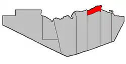 Location within Restigouche County. | |
| Coordinates: 48.0025°N 66.51889°W | |
| Country | |
| Province | |
| County | Restigouche |
| Erected | 1840 |
| Area | |
| • Land | 62.7 km2 (24.2 sq mi) |
| Population (2016)[1] | |
| • Total | 1,067 |
| • Density | 17.0/km2 (44/sq mi) |
| • Change 2011-2016 | |
| • Dwellings | 531 |
| Time zone | UTC-4 (AST) |
| • Summer (DST) | UTC-3 (ADT) |
For governance purposes it is divided between the city of Campbellton; the town of Dalhousie; the villages of Atholville and Charlo; the Indian reserves of Eel River 3 and Indian Ranch; and the local service districts of Dalhousie Junction, McLeods, Point La Nim, and the parish of Dalhousie,[3] all of which except the Indian reserves are members of the Restigouche Regional Service Commission (RRSC).[4]
Origin of name
The parish took its name from the settlement of Dalhousie, which served as shiretown of Restigouche County from its erection. The settlement was named in honour of the Earl of Dalhousie, Governor General of British North America.[5]
History
Dalhousie was erected in 1840 from Addington Parish.[6] Dalhousie comprised all of Restigouche Parish between lines due south from Eel River on the east and Walker Brook on the west.
In 1850 the eastern boundary was altered slightly to run due south from milepost forty-eight on the eastern side of Eel River Gully.[7]
In 1896 the southern part of Dalhousie was erected as Balmoral Parish.[8]
Delineation
Dalhousie Parish is defined in the Territorial Division Act[2] as being bounded:
- West by Addington Parish, north by the Restigouche River; east and south by a line beginning on the east side of Eel River Gully, at the forty-eight mile post placed on the great road[lower-alpha 1] leading from Bathurst to Dalhousie, thence running true south to the southwest limit of Lot Number Five, fronting on Chaleur Bay, granted to Sebastian Doucett, thence in a northwesterly direction following the southwest limits of Lots Numbers Five, Four, Three, Two and One, and said limits of Lots Letters "O", "N", "M", "L" and "K" to the most westerly angle of the last mentioned lot; thence in a northeasterly direction along the northwest limit of said lot to the most easterly angle of the 100 acre lot granted to Archibald Chisholm; thence in a westerly, southerly, westerly and southerly direction following the bounds of said lot to the southeast angle of Lot Number Five, Eel River Crossing,[lower-alpha 2] granted to William Searls; thence in a westerly direction along the south limit of said lot and its prolongation to the east limit of Lot Number Seventy-two, Range One, Balmoral [Settlement], granted to Robert Good; thence in a northerly direction along said limit to the northeast angle of said lot; thence in a westerly direction along the northern limit of Range One, Balmoral, to the Addington Parish Line, including all the islands in front.
Communities
Parish population total does not include incorporated municipalities (in bold or italics).
|
|
Demographics
Population
| Canada census – Dalhousie Parish, New Brunswick community profile | |||
|---|---|---|---|
| 2016 | 2011 | 2006 | |
| Population: | 1,067 (-5.0% from 2011) | 2,247 (-2.9% from 2006) | 2,323 (-9.1% from 2001) |
| Land area: | 62.70 km2 (24.21 sq mi) | 121.32 km2 (46.84 sq mi) | 121.73 km2 (47.00 sq mi) |
| Population density: | 17.0/km2 (44/sq mi) | 18.5/km2 (48/sq mi) | 19.1/km2 (49/sq mi) |
| Median age: | 52.9 (M: 53.5, F: 52.2) | 47.4 (M: 48.0, F: 47.0) | 43.5 (M: 43.6, F: 43.3) |
| Total private dwellings: | 531 | 1,053 | 1,044 |
| Median household income: | $63,360 | $49,743 | $46,609 |
| References: 2016[9] 2011[10] 2006[11] earlier[12] | |||
|
|
| |||||||||||||||||||||||||||||||||
| [13][1] (Adj) adjustment due to boundary change. | |||||||||||||||||||||||||||||||||||
Language
| Canada Census Mother Tongue - Dalhousie Parish, New Brunswick[13] | ||||||||||||||||||
|---|---|---|---|---|---|---|---|---|---|---|---|---|---|---|---|---|---|---|
| Census | Total | French |
English |
French & English |
Other | |||||||||||||
| Year | Responses | Count | Trend | Pop % | Count | Trend | Pop % | Count | Trend | Pop % | Count | Trend | Pop % | |||||
2016 |
1,055 |
535 | 50.7% | 465 | 44.1% | 35 | 3.3% | 20 | 1.9% | |||||||||
2011 |
2,215 |
1,490 | 67.27% | 660 | 29.80% | 40 | 1.80% | 25 | 1.13% | |||||||||
2006 |
2,330 |
1,490 | 63.95% | 785 | 33.69% | 25 | 1.07% | 30 | 1.29% | |||||||||
2001 |
2,510 |
1,585 | 63.15% | 810 | 32.27% | 90 | 3.59% | 25 | 1.00% | |||||||||
1996 |
2,855 |
1,790 | n/a | 62.70% | 1,000 | n/a | 35.03% | 55 | n/a | 1.92% | 10 | n/a | 0.35% | |||||
Access Routes
Highways and numbered routes that run through the parish, including external routes that start or finish at the parish limits:[14]
See also
Notes
- Route 134
- Originally this read Eel River; the error appeared in the 1973 edition of the Revised Statutes of New Brunswick.
References
- "Census Profile, 2016 Census Dalhousie, Parish [Census subdivision], New Brunswick". Statistics Canada. Retrieved September 28, 2019.
- "Chapter T-3 Territorial Division Act". Government of New Brunswick. Retrieved 13 November 2020.
- "New Brunswick Regulation 84-168 under the Municipalities Act (O.C. 84-582)". Government of New Brunswick. Retrieved 22 July 2020.
- "Communities in each of the 12 Regional Service Commissions (RSC) / Les communautés dans chacune des 12 Commissions de services régionaux (CSR)" (PDF), Government of New Brunswick, July 2017, retrieved 2 February 2021
- Ganong, William F. (1896). A Monograph of the Place-Nomenclature of the Province of New Brunswick. Royal Society of Canada. p. 229.
- "2 Vic. c. 19 An Act to divide the County of Restigouche into five Towns or Parishes and to define the boundaries thereof.". Acts of the General Assembly of Her Majesty's Province of New Brunswick, Passed in the Year 1839. Fredericton: Government of New Brunswick. 1839. pp. 63–64.
- "13 Vic. c. 51 An Act to consolidate all the Laws now in force for the division of the Province into Counties, Towns and Parishes.". Acts of the General Assembly of Her Mjaesty's Province of New Brunswick, Passed in the Year 1850. Fredericton: Government of New Brunswick. 1850. pp. 142–152, 145–149. Book was poorly proofread, resulting in title typo and reuse of page numbers 145–152.
- "59 Vic. c. 8 An Act to Revise and Codify an Act to Provide for the Division of the Province into Counties, Towns and Parishes.". Acts of the General Assembly of Her Majesty's Province of New Brunswick. Passed in the Month of March, 1896. Fredericton: Government of New Brunswick. 1896. pp. 86–123.
- "2016 Community Profiles". 2016 Canadian Census. Statistics Canada. February 21, 2017. Retrieved 2019-09-28.
- "2011 Community Profiles". 2011 Canadian Census. Statistics Canada. July 5, 2013. Retrieved 2014-03-16.
- "2006 Community Profiles". 2006 Canadian Census. Statistics Canada. March 30, 2011. Retrieved 2014-03-16.
- "2001 Community Profiles". 2001 Canadian Census. Statistics Canada. February 17, 2012.
- Statistics Canada: 1996, 2001, 2006, 2011 census
- Atlantic Canada Back Road Atlas ISBN 978-1-55368-618-7 Pages 5-6
External links
- Village of Atholville
- City of Campbellton
- Village of Charlo
- Town of Dalhousie
- Village of Eel River Crossing
Places adjacent to Dalhousie Parish, New Brunswick | ||||||||||
|---|---|---|---|---|---|---|---|---|---|---|
| ||||||||||
| Subdivisions | |
|---|---|
| Cities | |
| Counties | |
| |