Addington Parish, New Brunswick
Addington is a civil parish in Restigouche County, New Brunswick, Canada.[2]
Addington | |
|---|---|
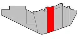 Location within Restigouche County. | |
| Coordinates: 47.707777°N 66.76111°W | |
| Country | |
| Province | |
| County | Restigouche |
| Erected | 1827 |
| Area | |
| • Land | 935.17 km2 (361.07 sq mi) |
| Population (2016)[1] | |
| • Total | 656* |
| • Density | 0.7/km2 (2/sq mi) |
| • Change 2011-2016 | |
| • Dwellings | 333 |
| Time zone | UTC-4 (AST) |
| • Summer (DST) | UTC-3 (ADT) |
| |
For governance purposes it is divided between the city of Campbellton, the villages of Atholville and Tide Head, and the local service districts of Flatlands, Glencoe, and the parish of Addington,[3] all of which are members of the Restigouche Regional Service Commission (RRSC).[4]
Origin of name
The parish was probably named in honour of Henry Addington, former Prime Minister of the United Kingdom and Home Secretary.[5]
History
Addington was erected in 1827 in Gloucester County from Beresford Parish.[6] The parish comprised the area north of the prolongation of the southern line of modern Beresford and between the Benjamin and Upsalquitch Rivers.
In 1840 Restigouche County was reorganised following its erection. Addington was reduced to its modern eastern boundary while having its western boundary changed to a line due south from the mouth of the Upsalquitch River.[7]
In 1879 Eldon Parish was dissolved and the area added to Addington.[8]
In 1896 Eldon was reërected with altered boundaries, giving Addington its modern boundaries.[9]
Delineation
Addington Parish is described in the Territorial Division Act[2] as being bounded
- West by Eldon Parish; north by the Province of Quebec; south by the Northumberland County line; and east by a line running true south from the most eastern point of the western side of the mouth of Walkers Brook,[lower-alpha 1] including all the islands in front in the Restigouche River which belong to this Province.
Communities
Parish population total does not include incorporated municipalities (in bold).
Demographics
Population
| Canada census – Addington Parish, New Brunswick community profile | |||
|---|---|---|---|
| 2016 | 2011 | 2006 | |
| Population: | 656 (-8.5% from 2011) | 2,615 (-4.1% from 2006) | 2,727 (-8.6% from 2001) |
| Land area: | 935.17 km2 (361.07 sq mi) | 1,024.99 km2 (395.75 sq mi) | 1,024.99 km2 (395.75 sq mi) |
| Population density: | 0.7/km2 (1.8/sq mi) | 2.6/km2 (6.7/sq mi) | 2.7/km2 (7.0/sq mi) |
| Median age: | 53.3 (M: 53.6, F: 53.1) | 46.6 (M: 46.6, F: 46.6) | 41.9 (M: 41.7, F: 42.0) |
| Total private dwellings: | 333 | 1,086 | 1,080 |
| Median household income: | $48,640 | $47,794 | $37,279 |
| References: 2016[10] 2011[11] 2006[12] earlier[13] | |||
|
|
| ||||||||||||||||||||||||||||||
| [14][1] | ||||||||||||||||||||||||||||||||
Language
| Canada Census Mother Tongue - Addington Parish, New Brunswick[14] | ||||||||||||||||||
|---|---|---|---|---|---|---|---|---|---|---|---|---|---|---|---|---|---|---|
| Census | Total | French |
English |
French & English |
Other | |||||||||||||
| Year | Responses | Count | Trend | Pop % | Count | Trend | Pop % | Count | Trend | Pop % | Count | Trend | Pop % | |||||
2016 |
660 |
180 | 27.2% | 470 | 71.2% | 5 | 0.8% | 5 | 0.8% | |||||||||
2011 |
2,610 |
1,950 | 74.71% | 630 | 24.14% | 30 | 1.15% | 0 | 0.00% | |||||||||
2006 |
2,720 |
2,000 | 73.53% | 685 | 25.18% | 25 | 0.92% | 10 | 0.37% | |||||||||
2001 |
2,990 |
2,315 | 77.42% | 645 | 21.57% | 20 | 0.67% | 10 | 0.33% | |||||||||
1996 |
2,995 |
2,150 | n/a | 71.79% | 785 | n/a | 26.21% | 40 | n/a | 1.33% | 20 | n/a | 0.67% | |||||
Access Routes
Highways and numbered routes that run through the parish, including external routes that start or finish at the parish limits:[15]
See also
Notes
- Now officially called Walker Brook.
References
- "Census Profile, 2016 Census: Addington, Parish [Census subdivision], New Brunswick". Statistics Canada. Retrieved December 28, 2018.
- "Chapter T-3 Territorial Division Act". Government of New Brunswick. Retrieved 13 November 2020.
- "New Brunswick Regulation 84-168 under the Municipalities Act (O.C. 84-582)". Government of New Brunswick. Retrieved 22 July 2020.
- "Communities in each of the 12 Regional Service Commissions (RSC) / Les communautés dans chacune des 12 Commissions de services régionaux (CSR)" (PDF), Government of New Brunswick, July 2017, retrieved 2 February 2021
- Ganong, William F. (1896). A Monograph of the Place-Nomenclature of the Province of New Brunswick. Royal Society of Canada. p. 217.
- "7 Geo. IV c. 31 An Act for the division of the County of Northumberland into three Counties, and to provide for the Government and Representation of the two new Counties.". Acts of the General Assembly of His Majesty's Province of New-Brunswick, Passed in the Year 1827. Fredericton: Government of New Brunswick. 1827. pp. 97–103.
- "2 Vic. c. 19 An Act to divide the County of Restigouche into five Towns or Parishes and to define the boundaries thereof.". Acts of the General Assembly of Her Majesty's Province of New Brunswick, Passed in the Year 1839. Fredericton: Government of New Brunswick. 1839. pp. 63–64.
- "42 Vic. c. 57 An Act to extend the Parish of Addington, in the County of Restigouche.". Acts of the General Assembly of Her Majesty's Province of New Brunswick. Passed in the Month of April 1879. Fredericton: Government of New Brunswick. 1879. pp. 114–115.
- "59 Vic. c. 8 An Act to Revise and Codify an Act to Provide for the Division of the Province into Counties, Towns and Parishes.". Acts of the General Assembly of Her Majesty's Province of New Brunswick. Passed in the Month of March, 1896. Fredericton: Government of New Brunswick. 1896. pp. 86–123.
- "2016 Community Profiles". 2016 Canadian Census. Statistics Canada. February 21, 2017. Retrieved 2019-09-28.
- "2011 Community Profiles". 2011 Canadian Census. Statistics Canada. July 5, 2013. Retrieved 2014-03-16.
- "2006 Community Profiles". 2006 Canadian Census. Statistics Canada. March 30, 2011. Retrieved 2014-03-16.
- "2001 Community Profiles". 2001 Canadian Census. Statistics Canada. February 17, 2012.
- Statistics Canada: 1996, 2001, 2006, 2011 census
- Atlantic Canada Back Road Atlas ISBN 978-1-55368-618-7 Pages 5, 14
External links
Places adjacent to Addington Parish, New Brunswick | |
|---|---|
| Subdivisions | |
|---|---|
| Cities | |
| Counties | |
| |