Barfleur
Barfleur is a commune in Manche, Normandy, northwestern France.
Barfleur | |
|---|---|
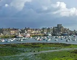 Barfleur harbour | |
Location of Barfleur 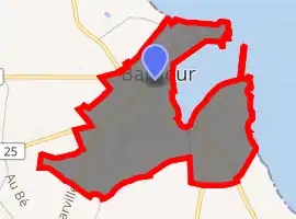
| |
 Barfleur  Barfleur | |
| Coordinates: 49°40′16″N 1°15′48″W | |
| Country | France |
| Region | Normandy |
| Department | Manche |
| Arrondissement | Cherbourg |
| Canton | Val-de-Saire |
| Intercommunality | CA Cotentin |
| Area 1 | 0.6 km2 (0.2 sq mi) |
| Population (2017-01-01)[1] | 570 |
| • Density | 950/km2 (2,500/sq mi) |
| Time zone | UTC+01:00 (CET) |
| • Summer (DST) | UTC+02:00 (CEST) |
| INSEE/Postal code | 50030 /50760 |
| 1 French Land Register data, which excludes lakes, ponds, glaciers > 1 km2 (0.386 sq mi or 247 acres) and river estuaries. | |
History
During the Middle Ages, Barfleur was one of the chief ports of embarkation for England.[2]
- 1066: A large medallion fixed to a rock in the harbour marks the Normans' departure from Barfleur before the battle of Hastings
- 1120: The White Ship, carrying the sole legitimate heir to Henry I of England, William Adelin, went down outside the harbour, setting the stage for the period of civil war in England known as the Anarchy[2]
- 1194: Richard I of England departed from Barfleur on return to England following his captivity by Henry VI, Holy Roman Emperor
- 1692: Action at Barfleur, part of the battles of Barfleur and La Hogue
- 1944: Barfleur was occupied by the Germans during WWII. As allied forces approached following the D-Day invasion, the German commander evacuated the city prior to any confrontation to ensure that it would not be damaged, as he liked the city so much.
Demographics
| Year | Pop. | ±% |
|---|---|---|
| 1793 | 896 | — |
| 1856 | 1,279 | +42.7% |
| 1896 | 1,189 | −7.0% |
| 1946 | 977 | −17.8% |
| 2009 | 648 | −33.7% |
Geography
About two miles (3.2 km) to the north is Cape Barfleur, with a lighthouse 233 ft (71 m) high.[2] It is twinned with Lyme Regis in the UK. A Brittany Ferries vessel is named after the village and operates from nearby Cherbourg-Octeville to Poole in the UK.
See also
Footnotes
- "Populations légales 2017". INSEE. Retrieved 6 January 2020.
- Chisholm, Hugh, ed. (1911). "Barfleur". Encyclopædia Britannica (11th ed.). Cambridge University Press.
External links
| Wikimedia Commons has media related to Barfleur. |
- Official website (in French)
| Authority control |
|
|---|
This article is issued from Wikipedia. The text is licensed under Creative Commons - Attribution - Sharealike. Additional terms may apply for the media files.
