Reffuveille
Reffuveille (French pronunciation: [ʁɛfyvɛj]) is a commune in the Manche department in north-western France.[2]
Reffuveille | |
|---|---|
.JPG.webp) The church of Saint-Léonard | |
Location of Reffuveille 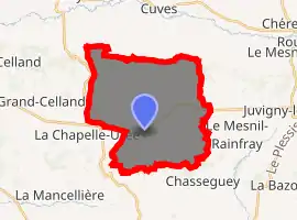
| |
 Reffuveille  Reffuveille | |
| Coordinates: 48°40′09″N 1°06′51″W | |
| Country | France |
| Region | Normandy |
| Department | Manche |
| Arrondissement | Avranches |
| Canton | Isigny-le-Buat |
| Intercommunality | CA Mont-Saint-Michel-Normandie |
| Government | |
| • Mayor (2020–2026) | Jacques Vary |
| Area 1 | 23.34 km2 (9.01 sq mi) |
| Population (2017-01-01)[1] | 509 |
| • Density | 22/km2 (56/sq mi) |
| Demonym(s) | Reffuveillais |
| Time zone | UTC+01:00 (CET) |
| • Summer (DST) | UTC+02:00 (CEST) |
| INSEE/Postal code | 50428 /50520 |
| Elevation | 69–244 m (226–801 ft) (avg. 228 m or 748 ft) |
| 1 French Land Register data, which excludes lakes, ponds, glaciers > 1 km2 (0.386 sq mi or 247 acres) and river estuaries. | |
See also
References
- "Populations légales 2017". INSEE. Retrieved 6 January 2020.
- "REFFUVEILLE - Map of Reffuveille 50520 France". Map-France. Retrieved 27 February 2013.
| Wikimedia Commons has media related to Reffuveille. |
| Authority control |
|---|
This article is issued from Wikipedia. The text is licensed under Creative Commons - Attribution - Sharealike. Additional terms may apply for the media files.
