Brécey
Brécey is a commune in the Manche department in Normandy in northwestern France. It is located on the crossing of the D999 and D911 roads.
Brécey | |
|---|---|
.JPG.webp) View of Brécey and the Sée valley | |
.svg.png.webp) Coat of arms | |
Location of Brécey 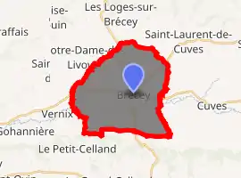
| |
 Brécey  Brécey | |
| Coordinates: 48°43′32″N 1°09′55″W | |
| Country | France |
| Region | Normandy |
| Department | Manche |
| Arrondissement | Avranches |
| Canton | Isigny-le-Buat |
| Government | |
| • Mayor (2008–2014) | Bernard Tréhet |
| Area 1 | 20.96 km2 (8.09 sq mi) |
| Population (2017-01-01)[1] | 2,120 |
| • Density | 100/km2 (260/sq mi) |
| Time zone | UTC+01:00 (CET) |
| • Summer (DST) | UTC+02:00 (CEST) |
| INSEE/Postal code | 50074 /50370 |
| Elevation | 22–111 m (72–364 ft) (avg. 75 m or 246 ft) |
| 1 French Land Register data, which excludes lakes, ponds, glaciers > 1 km2 (0.386 sq mi or 247 acres) and river estuaries. | |
Amenities include a cultural centre and the Collège Pierre Aguiton.
Population
| Year | Pop. | ±% |
|---|---|---|
| 1793 | 2,100 | — |
| 1800 | 2,097 | −0.1% |
| 1806 | 2,040 | −2.7% |
| 1821 | 2,190 | +7.4% |
| 1831 | 2,201 | +0.5% |
| 1836 | 2,172 | −1.3% |
| 1841 | 2,452 | +12.9% |
| 1846 | 2,466 | +0.6% |
| 1851 | 2,338 | −5.2% |
| 1856 | 2,316 | −0.9% |
| 1861 | 2,440 | +5.4% |
| 1866 | 2,446 | +0.2% |
| 1872 | 2,300 | −6.0% |
| 1876 | 2,341 | +1.8% |
| 1881 | 2,399 | +2.5% |
| 1886 | 2,404 | +0.2% |
| 1891 | 2,400 | −0.2% |
| 1896 | 2,300 | −4.2% |
| 1901 | 2,294 | −0.3% |
| 1906 | 2,281 | −0.6% |
| 1911 | 2,200 | −3.6% |
| 1921 | 2,011 | −8.6% |
| 1926 | 2,141 | +6.5% |
| 1931 | 2,159 | +0.8% |
| 1936 | 2,198 | +1.8% |
| 1946 | 2,247 | +2.2% |
| 1954 | 2,122 | −5.6% |
| 1962 | 2,026 | −4.5% |
| 1968 | 2,046 | +1.0% |
| 1975 | 1,958 | −4.3% |
| 1982 | 1,980 | +1.1% |
| 1990 | 2,029 | +2.5% |
| 1999 | 2,113 | +4.1% |
| 2009 | 2,165 | +2.5% |
See also
References
- "Populations légales 2017". INSEE. Retrieved 6 January 2020.
| Wikimedia Commons has media related to Brécey. |
| Authority control |
|
|---|
This article is issued from Wikipedia. The text is licensed under Creative Commons - Attribution - Sharealike. Additional terms may apply for the media files.
