Méautis
Méautis (French: [me.o.ti]) is a commune in the Manche department in Normandy in northwestern France.
Méautis | |
|---|---|
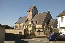 The church of Saint-Hilaire | |
Location of Méautis 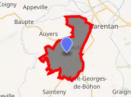
| |
 Méautis  Méautis | |
| Coordinates: 49°16′42″N 1°17′59″W | |
| Country | France |
| Region | Normandy |
| Department | Manche |
| Arrondissement | Saint-Lô |
| Canton | Carentan-les-Marais |
| Intercommunality | Carentan-en-Cotentin |
| Government | |
| • Mayor (2008–2014) | Marie-Christine Mette |
| Area 1 | 16.98 km2 (6.56 sq mi) |
| Population (2017-01-01)[1] | 656 |
| • Density | 39/km2 (100/sq mi) |
| Time zone | UTC+01:00 (CET) |
| • Summer (DST) | UTC+02:00 (CEST) |
| INSEE/Postal code | 50298 /50500 |
| Elevation | 0–29 m (0–95 ft) (avg. 42 m or 138 ft) |
| 1 French Land Register data, which excludes lakes, ponds, glaciers > 1 km2 (0.386 sq mi or 247 acres) and river estuaries. | |
World War II
After the liberation of the area by Allied Forces in 1944, engineers of the Ninth Air Force IX Engineering Command began construction of a combat Advanced Landing Ground outside of the town. Declared operational on 17 August, the airfield was designated as "A-17", it was used by the 50th Fighter Group which flew P-47 Thunderbolts until early September when the unit moved into Central France. Afterward, the airfield was closed.[2][3]
See also
References
- "Populations légales 2017". INSEE. Retrieved 6 January 2020.
- Johnson, David C. (1988), U.S. Army Air Forces Continental Airfields (ETO), D-Day to V-E Day; Research Division, USAF Historical Research Center, Maxwell AFB, Alabama.
- Maurer, Maurer. Air Force Combat Units of World War II. Maxwell AFB, Alabama: Office of Air Force History, 1983. ISBN 0-89201-092-4.
| Wikimedia Commons has media related to Méautis. |
This article is issued from Wikipedia. The text is licensed under Creative Commons - Attribution - Sharealike. Additional terms may apply for the media files.