Battlement Mesa, Colorado
Battlement Mesa is an unincorporated town, a post office, and a census-designated place (CDP) located in and governed by Garfield County, Colorado, United States. The CDP is a part of the Glenwood Springs, CO Micropolitan Statistical Area. The Battlement Mesa post office has the ZIP Codes 81635 and 81636 (for post office boxes).[3] At the United States Census 2010, the population of the Battlement Mesa CDP was 4,471, while the population of the 81635 ZIP Code Tabulation Area was 5,957 including the Town of Parachute.[4] The Battlement Mesa Metropolitan District provides services.
Battlement Mesa, Colorado | |
|---|---|
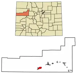 Location of the Battlement Mesa CDP in Garfield County, Colorado. | |
 Battlement Mesa Location of the Battlement Mesa CDP in the United States. | |
| Coordinates: 39°27′02″N 108°00′23″W[1] | |
| Country | |
| State | |
| County | Garfield County |
| Government | |
| • Type | unincorporated town |
| Area | |
| • Total | 11.684 sq mi (30.261 km2) |
| • Land | 11.459 sq mi (29.678 km2) |
| • Water | 0.225 sq mi (0.583 km2) |
| Elevation | 5,837 ft (1,779 m) |
| Population (2010) | |
| • Total | 4,471 |
| • Density | 390/sq mi (151/km2) |
| Time zone | UTC-7 (MST) |
| • Summer (DST) | UTC-6 (MDT) |
| ZIP Code[3] | 81635 and 81636 |
| Area code(s) | 970 |
| GNIS feature[2] | Battlement Mesa CDP |
The community, which bills itself as a "covenant-protected community", is primarily a group of contiguous subdivisions developed in the later decades of the 20th century, catering to families and retirees. It is located on the flank of a hill on the south side of the Colorado River, across from the older town of Parachute. The two communities together are known as "Parachute-Battlement Mesa". The town takes its name from Battlement Mesa, an 11,000-foot-high (3,400 m) basalt-topped mesa that sits to the south of the town.
History
The community was first developed by an oil company as a residence for its workers in the expectation that the rising price of oil would make shale oil extraction economically viable. When adjusted oil prices fell, the housing estate was left as a stranded asset, and the oil company marketed it to retirees in conjunction with a real estate firm.
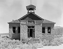
The Battlement Mesa Schoolhouse stands as a testimony to education.
Geography
Battlement Mesa is located in Garfield County on the south side of the Colorado River. It is bordered to the northwest, across the river, by the town of Parachute. Interstate 70 passes through Parachute, providing access to Battlement Mesa from Exit 75. I-70 leads east 42 miles (68 km) to Glenwood Springs, the Garfield County seat, and southwest 45 miles (72 km) to Grand Junction. Denver is 200 miles (320 km) east via I-70.
The Battlement Mesa CDP has an area of 7,478 acres (30.261 km2), including 144 acres (0.583 km2) of water.[1]
Climate
This climatic region is typified by large seasonal temperature differences, with warm to hot summers and cold (sometimes severely cold) winters. According to the Köppen Climate Classification system, Mesa has a humid continental climate, abbreviated "Dfb" on climate maps.[5]
| Climate data for Battlement Mesa, Colorado | |||||||||||||
|---|---|---|---|---|---|---|---|---|---|---|---|---|---|
| Month | Jan | Feb | Mar | Apr | May | Jun | Jul | Aug | Sep | Oct | Nov | Dec | Year |
| Average high °C (°F) | 3 (37) |
8 (46) |
13 (56) |
18 (65) |
24 (75) |
30 (86) |
34 (93) |
32 (90) |
27 (81) |
20 (68) |
12 (53) |
4 (39) |
19 (66) |
| Average low °C (°F) | −11 (12) |
−8 (18) |
−3 (26) |
1 (33) |
4 (40) |
9 (48) |
13 (55) |
12 (53) |
7 (44) |
0 (32) |
−5 (23) |
−11 (13) |
1 (33) |
| Average precipitation mm (inches) | 28 (1.1) |
25 (1) |
33 (1.3) |
28 (1.1) |
36 (1.4) |
20 (0.8) |
23 (0.9) |
28 (1.1) |
36 (1.4) |
33 (1.3) |
30 (1.2) |
28 (1.1) |
340 (13.5) |
| Source: Weatherbase [6] | |||||||||||||
Demographics
The United States Census Bureau initially defined the Battlement Mesa CDP for the 1990 United States Census.
| Year | Pop. | ±% |
|---|---|---|
| 1990 | 1,477 | — |
| 2000 | 3,497 | +136.8% |
| 2010 | 4,471 | +27.9% |
| 2020 | — | |
| Source: United States Census Bureau | ||
See also
- Outline of Colorado
- State of Colorado
- Colorado cities and towns
- Colorado counties
References
- "State of Colorado Census Designated Places - BAS20 - Data as of January 1, 2020". United States Census Bureau. Retrieved December 22, 2020.
- "U.S. Board on Geographic Names: Domestic Names". United States Geological Survey. Retrieved December 4, 2020.
- "Look Up a ZIP Code". United States Postal Service. Retrieved December 4, 2020.
- "2010: DEC Summary File 1". United States Census Bureau. Retrieved December 22, 2020.
- Climate Summary for Battlement Mesa, Colorado
- "Weatherbase.com". Weatherbase. 2013. Retrieved on November 2, 2013.
External links
- Battlement Mesa @ Colorado.com
- Battlement Mesa Homeowners Association
- Battlement Mesa Metropolitan District
- Battlement Mesa Service Association
- Battlement Mesa Golf Club
- Garfield County website
Municipalities and communities of Garfield County, Colorado, United States | ||
|---|---|---|
| Cities | 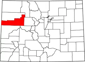 Map of Colorado highlighting Garfield County | |
| Towns | ||
| CDPs | ||
| Unincorporated communities | ||
| ||