Chacra, Colorado
Chacra is an unincorporated community and a census-designated place (CDP) located in and governed by Garfield County, Colorado, United States. The CDP is a part of the Glenwood Springs, CO Micropolitan Statistical Area. The population of the Chacra CDP was 329 at the United States Census 2010.[4] The Glenwood Springs post office (Zip Code 81601) serves the area.[3]
Chacra, Colorado | |
|---|---|
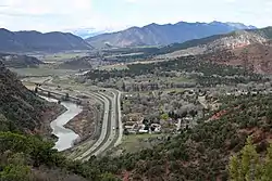 The Colorado River, Interstate 70, and Chacra. | |
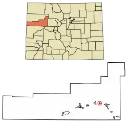 Location of the Chacra CDP in Garfield County, Colorado. | |
 Chacra Location of the Chacra CDP in the United States. | |
| Coordinates: 39°34′37″N 107°27′03″W[1] | |
| Country | |
| State | |
| County | Garfield County |
| Government | |
| • Type | unincorporated community |
| Area | |
| • Total | 0.984 sq mi (2.549 km2) |
| • Land | 0.946 sq mi (2.450 km2) |
| • Water | 0.038 sq mi (0.099 km2) |
| Elevation | 5,732 ft (1,747 m) |
| Population (2010) | |
| • Total | 329 |
| • Density | 348/sq mi (134/km2) |
| Time zone | UTC-7 (MST) |
| • Summer (DST) | UTC-6 (MDT) |
| ZIP Code[3] | Glenwood Springs 81601 |
| Area code(s) | 970 |
| GNIS feature[2] | Chacra CDP |
Geography
Chacra is located on the north side of Colorado River, 8 miles (13 km) west of Glenwood Springs, the county seat. Interstate 70 passes through the community, with access from Exit 109.
The Chacra CDP has an area of 630 acres (2.549 km2), including 24 acres (0.099 km2) of water.[1]
Demographics
The United States Census Bureau initially defined the Chacra CDP for the United States Census 2010.
| Year | Pop. | ±% |
|---|---|---|
| 2010 | 329 | — |
| 2020 | — | |
| Source: United States Census Bureau | ||
See also
- Outline of Colorado
- State of Colorado
- Colorado cities and towns
- Colorado counties
References
- "State of Colorado Census Designated Places - BAS20 - Data as of January 1, 2020". United States Census Bureau. Retrieved December 22, 2020.
- "U.S. Board on Geographic Names: Domestic Names". United States Geological Survey. Retrieved December 22, 2020.
- "Zip Code 81601 Map and Profile". zipdatamaps.com. 2020. Retrieved December 22, 2020.
- "2010: DEC Summary File 1". United States Census Bureau. Retrieved December 22, 2020.
External links
Municipalities and communities of Garfield County, Colorado, United States | ||
|---|---|---|
| Cities | 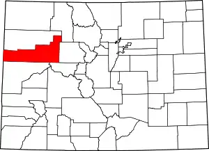 Map of Colorado highlighting Garfield County | |
| Towns | ||
| CDPs | ||
| Unincorporated communities | ||
| ||
This article is issued from Wikipedia. The text is licensed under Creative Commons - Attribution - Sharealike. Additional terms may apply for the media files.