Mulford, Colorado
Mulford is an unincorporated community and a census-designated place (CDP) located in far southeastern Garfield County, Colorado, United States. The population of the Mulford CDP was 174 at the United States Census 2010.[4] Garfield County governs the unincorporated community. The Carbondale post office (Zip Code 81623) serves the area.[3]
Mulford, Colorado | |
|---|---|
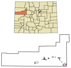 Location of the Mulford CDP in Garfield County, Colorado. | |
 Mulford Location of the Mulford CDP in the United States. | |
| Coordinates: 39°24′23″N 107°09′58″W[1] | |
| Country | |
| State | |
| County | Garfield County |
| Government | |
| • Type | unincorporated community |
| Area | |
| • Total | 0.668 sq mi (1.731 km2) |
| • Land | 0.668 sq mi (1.731 km2) |
| • Water | 0.000 sq mi (0.000 km2) |
| Elevation | 6,237 ft (1,901 m) |
| Population (2010) | |
| • Total | 174 |
| • Density | 260/sq mi (101/km2) |
| Time zone | UTC-7 (MST) |
| • Summer (DST) | UTC-6 (MDT) |
| ZIP Code[3] | Carbondale 81623 |
| Area code(s) | 970 |
| GNIS feature[2] | Mulford CDP |
Geography
Mulford is located in southeastern Garfield County, in the valley of the Roaring Fork River. It is bordered to the east by Catherine. Colorado State Highway 82 forms the northern edge of the Mulford CDP, leading northwest 14 miles (23 km) to Glenwood Springs, the county seat, and southeast 27 miles (43 km) to Aspen. The town of Carbondale is 3 miles (5 km) to the west.
The Mulford CDP has an area of 428 acres (1.731 km2), all land.[1]
Demographics
The United States Census Bureau initially defined the Mulford CDP for the United States Census 2010.
| Year | Pop. | ±% |
|---|---|---|
| 2010 | 174 | — |
| 2020 | — | |
| Source: United States Census Bureau | ||
See also
- Outline of Colorado
- State of Colorado
- Colorado cities and towns
- Colorado counties
References
- "State of Colorado Census Designated Places - BAS20 - Data as of January 1, 2020". United States Census Bureau. Retrieved December 22, 2020.
- "U.S. Board on Geographic Names: Domestic Names". United States Geological Survey. Retrieved December 22, 2020.
- "Zip Code 81623 Map and Profile". zipdatamaps.com. 2020. Retrieved December 22, 2020.
- "2010: DEC Summary File 1". United States Census Bureau. Retrieved December 22, 2020.
External links
Municipalities and communities of Garfield County, Colorado, United States | ||
|---|---|---|
| Cities | 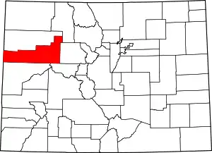 Map of Colorado highlighting Garfield County | |
| Towns | ||
| CDPs | ||
| Unincorporated communities | ||
| ||
