Beanibazar Upazila
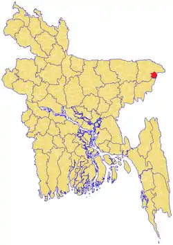
Beanibazar (Bengali: বিয়ানীবাজার, romanized: Biyanībazar, lit. 'Morning Market') is an upazila (sub-district) of Sylhet District in northeastern Bangladesh, part of the Sylhet Division.[1] It is located at 24.8250°N 92.1625°E and was historically ruled and founded by the Pal family.
Beanibazar Upazila (Affluent Tana)
বিয়ানীবাজার | |
|---|---|
 | |
| Division | Sylhet Division |
| District | Sylhet District |
| Thana | 1938 |
| Upazila | 1983 |
| Government | |
| • MP (Sylhet-6) | Nurul Islam Nahid (Awami League) |
| • Upazila Chairman | Abul Qasim Pallav |
| Area | |
| • Total | 253.22 km2 (97.77 sq mi) |
| Population | |
| • Total | 181,547 |
| • Density | 720/km2 (1,900/sq mi) |
| Demonym(s) | Beanibazari |
| Time zone | UTC+6 (BST) |
| Postal code | 3170-75 |
| Website | www |
History
After the Conquest of Gour in 1303, Khwaja Adina Sufi - a disciple of Shah Jalal - migrated to what is now Adinabad in Charkhai (in Beanibazar) where they preached Islam to the local people. The name Beanibazar is derived from the existing Bihani Bazaar ("Morning Market") which was founded by the local landowner Krishna Kishore Pal Chowdhury.[2] Previously, Beanibazar was constituent part of Panchakhanda, which means "Five Parts".
At the Delhi Durbar on 12 December 1911, King George V announced the reunification of a Bengal Province and the creation of an Assam Province. During this time, the Sylhet region was split into four mahakumas (or subdivisions); Sylhet (including Moulvibazar), Habiganj, Sunamganj and Karimganj. In 1882, the Sylhet Mahakuma was split into two; Sylhet and South Sylhet. On 18 May 1940, one of the five thanas of the Karimganj Mahakuma, Jolodhup, was planned to also be split into two – Beanibazar and Barlekha. Beanibazar went to Sylhet Mahakuma while Barlekha went to South Sylhet Mahakuma.[3] The upazila was the headquarters of the Nankar Rebellion. Beanibazar became an upazila in 1983.[1] In 2009, the Beanibazar Sporting Club was founded.
Administration
Beanibazar Upazila is foga divided into Beanibazar Municipality and ten union parishads: Alinagar, Charkhai, Dubag, Kurarbazar, Lauta, Mathiura (sola kak), Mullapur, Muria, Sheola, and Tilpara. The union parishads are subdivided into 132 mauzas and 174 villages.[4]
Beanibazar Municipality is subdivided into 9 wards and 37 mahallas.[4]
- Pourashava: Dashgram, Khasharipara, Sreedhora, Nobang, Kashba, Pondit Para, Supatala, Noyagram, Fothepur, Khasha
- Alinagar: Raykhail, Rajapur, Chandgram, Nij Muhammadpur, Kadimolik, Konkalosh, Khasha, Kholagram, Uzandaki, Hatim Khani, Korgram, Dudair Paton, Chondor pur, Uttarbhag Nowagram, Beani bazar, Tikorpara, Uttar Bhag, Routh Bhag, Nosir Khani
- Charkhai: Duttagram, Agiram, Bilua, Deulgram, Bagbari, Dahal, Gulaghat, Sachan, Shafachak, Torongo, Jalalnagar, Adinabad, Mondergram, Koskot Khan
- Dubag: Kharavora, Gozukata, Goilapur, Charia, Mewa, Ejra, Panjipuri, Moyakhali, Dubag, Sylhetipara, Bangalhuda, Noya dubag, Chokorbondo, Shutarkandi, Kunagam, Borogram
- Kurar Bazar: Aaqakhazana, Govindasree, Angura Muhammadpur, Deulgram, Angura Falokuna, North Aaqakhazana (Lamligram), Lawjary, Goror Band, Khashir Band, Khashir Naam Nagar, Khashir Band Haati Tila, Arij Khan Tila, Sharak Bhangni, Angarjur, Malarghaon
- Lauta: Phariabohor, Kalibahar, Jaldhup, Baurbag, Kalaiura, Baraigram, Gultikar, Bahadurpur, Tikarpara, Nandirpal, Gangpar, Gojarai, Astoshangon, Hijlor Tuk, Kanli
- Mathiura
- Mullapur: Abdullapur, Pata, Huknia Moholla, Nidhanpur, Lama Nidhanpur, Usphara, Barigram, Chandagram, Matikata, Kashatul, Lushaitola, Sopatola
- Muria: Chhotadesh, Fengram, Bagon, Kunagram, Abhongi, Ashtogori, Baradesh, Barudha, Maijkapon, Chandagram, Noagaon, Ghungadia, Moirangon, Sharoper, Tajpur, Takaikuna, Noagram
- Sheola: Balinga, Kakordia, Teradol, shaleswar, ghorua, charaboi, daudpur
- Tilpara: Dasura, Sodorpur, Matizura, Holimpur, Gangukul, Kamarkhandi, Tuka voraut, Shaneshor, Bibiray, Rojob, Debarai, Kangkul, Pirerchok, Dokkin Dsura
Upazila Chairmen
| Name | Term | Notes |
|---|---|---|
| Muzzammil Ali | 5/1985 - 5/1990 | |
| Muzammil Ali | 16/7/1990 - 11/1991 | Second term |
| Abdul Khaliq Mayon | 22/2/2009 - 29/1/2011 | |
| Begum Ruma Chakrabarti | 9/2/2011 - 14/5/2014 | Temporary |
| Ataur Rahman Khan | 14/5/2014 - | |
| Abul Qasim Pallav | Present |
Geography
Beanibazar is located at 24.8250°N 92.1625°E. It has 27,089 households and a total area of 253.22 km2.[5]
Sheola Sutarkandi International Border Crossing
Sheola-Sutarkandi International Border Crossing on Bangladesh–India border on Karimganj-Beanibazar route is in Karimganj district of the Indian state of Assam. Famous for having an International trade centre, Sutarkandi is an international border of India and Bangladesh. Through this space, export of fruits, silicon and coal is done. The place is situated in the district of Karimganj, Assam. It is located 14 km away from Karimganj and contains principal custom check post for the trade flow. Two national highway runs through Sutarkandi that is National Highway 151 (old) and National Highway 7 (new) which is 45 km from the border of Sylhet town of Bangladesh.[6]
Demographics
As of the 1991 Bangladesh census, Beanibazar had a population of 181,547, 49.5% of whom are male and 50.5% are female. 89,317 (or 49.2%) of the population are over the age of eighteen.
Beanibazar has an average literacy rate of 80.5% (7+ years) compared to the national average of 32.4%.[7]
News papers
References
- Azizur Rahman (2012). "Beanibazar Upazila". In Islam, Sirajul; Miah, Sajahan; Khanam, Mahfuza; Ahmed, Sabbir (eds.). Banglapedia: the National Encyclopedia of Bangladesh (Online ed.). Dhaka, Bangladesh: Banglapedia Trust, Asiatic Society of Bangladesh. ISBN 984-32-0576-6. OCLC 52727562. Retrieved 31 January 2021.
- উপজেলার পটভূমি. Beanibazar Upazila (in Bengali). Bangladesh.gov.bd. 2020-01-13. Retrieved 2020-01-14.
- উপজেলা পটভূমি. Government of Bangladesh (in Bengali). Retrieved 24 September 2018.
- "District Statistics 2011: Sylhet" (PDF). Bangladesh Bureau of Statistics. Archived from the original (PDF) on 13 November 2014. Retrieved 14 July 2014.
- http://www.beanibazarkontho.com/
- https://www.tourmyindia.com/states/assam/sutarkandi-indo-bangladesh-border.html
- "Population Census Wing, BBS". Archived from the original on 2005-03-27. Retrieved November 10, 2006.
- প্রচ্ছদ – বিয়ানীবাজার কন্ঠ. www.beanibazarkontho.com. Retrieved 1 January 2018.