Boise, Portland, Oregon
Boise is a neighborhood in the North and Northeast sections of Portland, Oregon. It is approximately bounded by Interstate 5 on the west, N Skidmore St. on the north, NE Rodney Ave. on the east, and N Kerby St. and NE Fremont St. on the south. The southern portion of N Mississippi Ave. forms the commercial core of the area. The neighborhood was named in honor of Reuben P. Boise, a Portland School Board member during the 1850s.[2]
Boise | |
|---|---|
Neighborhood | |
 Historic Mississippi business district street sign topper in the Boise Neighborhood | |
 Boise | |
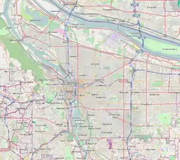
| Coordinates: 45°33′03″N 122°40′16″WPDF map | |
| Country | United States |
| State | Oregon |
| City | Portland |
| Government | |
| • Association | Boise Neighborhood Association |
| • Coalition | Northeast Coalition of Neighborhoods |
| Area | |
| • Total | 0.43 sq mi (1.12 km2) |
| Population (2000)[1] | |
| • Total | 3,119 |
| • Density | 7,200/sq mi (2,800/km2) |
| Housing | |
| • No. of households | 1168 |
| • Occupancy rate | 90% occupied |
| • Owner-occupied | 525 households (45%) |
| • Renting | 643 households (55%) |
| • Avg. household size | 2.67 persons |
In the mid-20th century, Boise residents included a high percentage of African Americans, relative to other Portland neighborhoods. This changed rapidly in the 2000s. The 2000 Census recorded 48% of the population identifying as Black or African American, either alone or mixed with another race. By the time of the 2010 Census, this number had fallen to 26.6%, largely supplanted by Whites.[3] This demographic change has accompanied rapid development and gentrification in the neighborhood.[4]
References
- Demographics (2000)
- Boise-Eliot Community Garden, Portland Parks & Recreation
- "2000 and 2010 Census Profile: Boise". 2010 Census Data for Portland Neighborhoods. City of Portland. p. 3. Retrieved 2016-02-16.
- http://boisevoice.org/reference/articles/A2005_1.htm Boisevoice.org
External links
 Media related to Boise, Portland, Oregon at Wikimedia Commons
- Boise Neighborhood Association official site
- Boise Eliot Neighborhood Guide (PortlandNeighborhood.com)
- Boise Voices Oral History Project (Boise neighborhood oral history project, local youth interview elders from the community)
- Boise Street Tree Inventory Report
|
