Hosford-Abernethy, Portland, Oregon
Hosford-Abernethy is a neighborhood in the inner Southeast section of Portland, Oregon. It borders Buckman and Sunnyside on the north, Richmond on the east, Brooklyn and Creston-Kenilworth on the south, and (across the Willamette River) Downtown Portland and South Portland on the west.
Hosford-Abernethy | |
|---|---|
Neighborhood | |
 Hosford-Abernethy | |
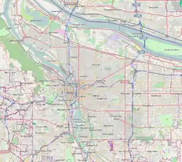
| Coordinates: 45°30′17″N 122°38′42″WPDF map | |
| Country | United States |
| State | Oregon |
| City | Portland |
| Government | |
| • Association | Hosford-Abernethy Neighborhood Development Association (HAND) |
| • Coalition | Southeast Uplift Neighborhood Program |
| Area | |
| • Total | 1.30 sq mi (3.36 km2) |
| Population (2000)[1] | |
| • Total | 6,932 |
| • Density | 5,300/sq mi (2,100/km2) |
| Housing | |
| • No. of households | 3243 |
| • Occupancy rate | 96% occupied |
| • Owner-occupied | 1660 households (51%) |
| • Renting | 1583 households (49%) |
| • Avg. household size | 2.14 persons |
Hosford-Abernethy was named in the 1970s for two schools in the neighborhood, Hosford Middle School[2] (commemorating early Portland resident and Methodist minister Chauncey Hosford) and Abernethy Elementary School[3] (commemorating fellow Methodist minister and Provisional Governor of the Oregon Territory, George Abernethy).
The north central area of the neighborhood, with its distinctive X-shaped street pattern, is known as Ladd's Addition.
The Oregon Museum of Science and Industry is located on the riverfront of Hosford-Abernethy, at the southern end of the Vera Katz Eastbank Esplanade.
References
- Demographics (2000)
- "Archived copy". Archived from the original on 2006-10-02. Retrieved 2006-09-15.CS1 maint: archived copy as title (link)
- http://www.pps.k12.or.us/schools-c/pages/abernethy/
External links
- Hosford-Abernethey Neighborhood Association website
- HOSFORD-ABERNETHY: A brief history, by Val Ballestrem
- Hosford-Abernethy Street Tree Inventory Report
| Buildings |
| ||
|---|---|---|---|
| Business |
| ||
| Geography | |||
| Public art | |||
| Transportation | |||
| Related | |||
| |||