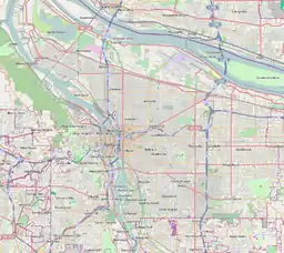
Bridgeton, Portland, Oregon
Bridgeton is a compact neighborhood of detached houses, rowhouses, apartment and condominium complexes, and houseboats in the north and northeast sections of Portland, Oregon. It occupies a narrow strip of land around a levee between the Columbia River (North Portland Harbor) and Bridgeton Slough.
Bridgeton | |
|---|---|
Neighborhood | |
 Bridgeton | |
| Coordinates: 45°36′06″N 122°40′09″W | |
| Country | United States |
| State | Oregon |
| City | Portland |
| Government | |
| • Association | Bridgeton Neighborhood Association |
| • Coalition | North Portland Neighborhood Services |
| Area | |
| • Total | 0.28 sq mi (0.72 km2) |
| Population (2010)[2] | |
| • Total | 725 |
| • Density | 2,600/sq mi (1,000/km2) |
| Housing | |
| • No. of households | 467 |
| • Occupancy rate | 90% occupied |
| • Owner-occupied | 273 households (58%) |
| • Renting | 149 households (32%) |
| • Avg. household size | 1.55 persons |
In 1907, a one-room schoolhouse, the Columbia School, was constructed in the area. Between 1915 and 1930, housing was developed in the area, which was the terminus of the Vancouver Interurban streetcar line. The Faloma post office served the area from August 13, 1921, to June 15, 1935; the USGS still uses this name for the place. Local citizens chose this from the initials of three local landowners (Force, Love and Moore) after the United States Postal Service rejected Bridgeton as too common.[3]
The Bridgeton Neighborhood Association was formed in March 1992 to deal with crime and traffic issues, and shortly thereafter was instrumental in defeating a rezoning request for a superstore to be constructed nearby.
References
- "Bridgeton". PortlandMaps. City of Portland. Retrieved June 16, 2019.
- McArthur, Lewis A.; McArthur, Lewis L. (2003) [1928]. Oregon Geographic Names (7th ed.). Portland, Oregon: Oregon Historical Society Press. p. 345. ISBN 978-0875952772.