Borgo Valsugana
Borgo Valsugana (German: Burg im Suganertal) is a comune (municipality) in Trentino in the northern Italian region Trentino-Alto Adige/Südtirol, located about 30 kilometres (19 mi) east of Trento.
Borgo Valsugana | |
|---|---|
| Comune di Borgo Valsugana | |
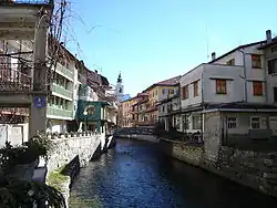 The Brenta river in Borgo Valsugana. | |
 Coat of arms | |
Location of Borgo Valsugana 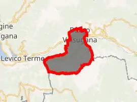
| |
 Borgo Valsugana Location of Borgo Valsugana in Italy 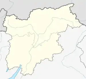 Borgo Valsugana Borgo Valsugana (Trentino-Alto Adige/Südtirol) | |
| Coordinates: 46°3′N 11°27′E | |
| Country | Italy |
| Region | Trentino-Alto Adige/Südtirol |
| Province | Trentino (TN) |
| Frazioni | Olle |
| Government | |
| • Mayor | Fabio Dalledonne |
| Area | |
| • Total | 52.3 km2 (20.2 sq mi) |
| Elevation | 386 m (1,266 ft) |
| Population | |
| • Total | 6,842 |
| • Density | 130/km2 (340/sq mi) |
| Demonym(s) | Borghesani |
| Time zone | UTC+1 (CET) |
| • Summer (DST) | UTC+2 (CEST) |
| Postal code | 38051 |
| Dialing code | 0461 |
| Website | Official website |
Borgo Valsugana borders the following municipalities: Telve, Telve di Sopra, Torcegno, Ronchi Valsugana, Roncegno, Castelnuovo, Novaledo, Levico Terme, and Asiago.
Geography
Borgo is in one of the tightest parts of Valsugana, mount Ciolino and mount Rocchetta, neither very high. It grew on the two sides of river Brenta and its ancient part is the only one in Trentino to occupy both sides of a river (Trento, for instance, is located on only one side of river Adige).
History

Borgo Valsugana, whose ancient name was Ausugum (the main street of the town, indeed, is named "Corso Ausugum"), used to be a Roman settlement along the Claudia Augusta Altinate road which connected Altino to Tridentum (ancient name for Trento) and then to Augsburg, nowadays in Germany.
Thanks to its location at the bottom of an open valley, the town always benefited from trade. Noblemen from Castelnuovo and Caldonazzo and the Welsperg family used to govern the town and its surroundings.
In 1862 a huge fire destroyed a large part of the town, whose buildings were largely built using wood.
From 1943 to 1945 the antifascist partisans fought in the framework of the "Gherlenda" battalion of the Garibaldine brigade "Antonio Gramsci" located in Feltre.
People
- Alcide De Gasperi, president of the Council of ministers
- Matteo Trentin, professional road cyclist
References
- "Superficie di Comuni Province e Regioni italiane al 9 ottobre 2011". Istat. Retrieved 16 March 2019.
- Data from Istat
- "Popolazione Residente al 1° Gennaio 2018". Istat. Retrieved 16 March 2019.
External links
- (in Italian) Official website

| Authority control |
|---|