Campodenno
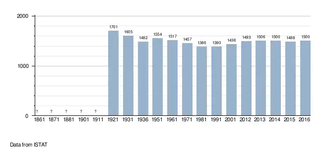
Campodenno (Ladin: Ciampdaden, German: St. Michael or Gampden) is a comune (municipality) in Trentino in the northern Italian region Trentino-Alto Adige/Südtirol, located about 20 kilometres (12 mi) northwest of Trento. As of 31 December 2004, it had a population of 1,454 and an area of 25.4 square kilometres (9.8 sq mi).[3]
Campodenno | |
|---|---|
| Comune di Campodenno | |
Location of Campodenno 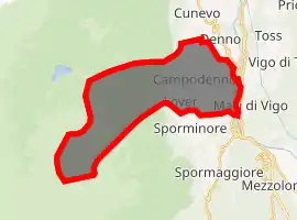
| |
 Campodenno Location of Campodenno in Italy 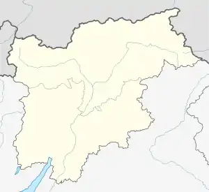 Campodenno Campodenno (Trentino-Alto Adige/Südtirol) | |
| Coordinates: 46°15′N 11°2′E | |
| Country | Italy |
| Region | Trentino-Alto Adige/Südtirol |
| Province | Trentino (TN) |
| Area | |
| • Total | 25.4 km2 (9.8 sq mi) |
| Population (Dec. 2004)[2] | |
| • Total | 1,454 |
| • Density | 57/km2 (150/sq mi) |
| Time zone | UTC+1 (CET) |
| • Summer (DST) | UTC+2 (CEST) |
| Postal code | 38010 |
| Dialing code | 0461 |

Campodenno from Malga Boldrina
It includes the following frazioni (neighborhoods): Dercolo (Dercol), Lover, Quetta (Chèta), and Termon.
Campodenno borders the following municipalities: Tuenno, Denno, Ton, Sporminore, and Spormaggiore.
Demographic evolution
References
- "Superficie di Comuni Province e Regioni italiane al 9 ottobre 2011". Istat. Retrieved 16 March 2019.
- "Popolazione Residente al 1° Gennaio 2018". Istat. Retrieved 16 March 2019.
- All demographics and other statistics: Italian statistical institute Istat.

| Authority control |
|---|
This article is issued from Wikipedia. The text is licensed under Creative Commons - Attribution - Sharealike. Additional terms may apply for the media files.