Sagron Mis
Sagron Mis (German: Sagraun) is a comune (municipality) in Trentino in the northern Italian region Trentino-Alto Adige/Südtirol, located about 70 kilometres (43 mi) east of Trento. As of 31 December 2004, it had a population of 211 and an area of 11.2 square kilometres (4.3 sq mi).[3]
Sagron Mis | |
|---|---|
| Comune di Sagron Mis | |
Location of Sagron Mis 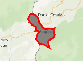
| |
 Sagron Mis Location of Sagron Mis in Italy 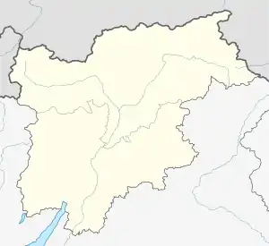 Sagron Mis Sagron Mis (Trentino-Alto Adige/Südtirol) | |
| Coordinates: 46°12′N 11°57′E | |
| Country | Italy |
| Region | Trentino-Alto Adige/Südtirol |
| Province | Trentino (TN) |
| Frazioni | Matiuz, Pante, Vori |
| Area | |
| • Total | 11.2 km2 (4.3 sq mi) |
| Elevation | 1,066 m (3,497 ft) |
| Population (Dec. 2004)[2] | |
| • Total | 211 |
| • Density | 19/km2 (49/sq mi) |
| Demonym(s) | Gnodoli |
| Time zone | UTC+1 (CET) |
| • Summer (DST) | UTC+2 (CEST) |
| Postal code | 38050 |
| Dialing code | 0439 |
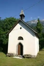
The little church of Our Lady of Caravaggio
The municipality of Sagron Mis contains the frazioni (subdivisions, mainly villages and hamlets) Matiuz, Pante (Penns) and Vori.
Sagron Mis borders the following municipalities: Gosaldo, Cesiomaggiore, Tonadico and Transacqua.
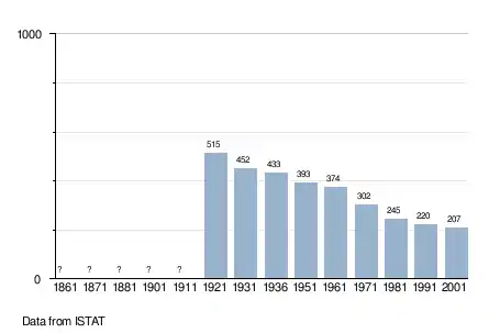
Demographic evolution
References
- "Superficie di Comuni Province e Regioni italiane al 9 ottobre 2011". Istat. Retrieved 16 March 2019.
- "Popolazione Residente al 1° Gennaio 2018". Istat. Retrieved 16 March 2019.
- All demographics and other statistics: Italian statistical institute Istat.

This article is issued from Wikipedia. The text is licensed under Creative Commons - Attribution - Sharealike. Additional terms may apply for the media files.