Breton, Alberta
Breton /ˈbrɛtən/ is a village in central Alberta, Canada. It is located roughly 95 kilometres (59 mi) southwest of Edmonton.
Breton | |
|---|---|
| Village of Breton | |
 Breton Mainstreet | |
 Coat of arms | |
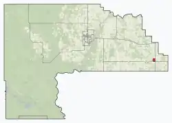
 Location in Brazeau County | |
 Location in Alberta | |
| Coordinates: 53°06′18.0″N 114°28′25.1″W | |
| Country | |
| Province | |
| Region | Central Alberta |
| Census division | 11 |
| Municipal District | Brazeau County |
| Incorporated[1] | |
| • Village | January 1, 1957 |
| Government | |
| • Mayor | James Alan Barker |
| • Governing body | Breton Village Council |
| Area (2016)[3] | |
| • Land | 1.72 km2 (0.66 sq mi) |
| Population (2016)[3] | |
| • Total | 574 |
| • Density | 333.5/km2 (864/sq mi) |
| Time zone | UTC-7 (MST) |
| Postal code span | T0C 0P0 |
| Highways | Highway 20 Highway 616 |
| Website | Official website |
History
Originally called Keystone, it was established in 1909 by a group of African-American immigrants as a block settlement.[4] The new Black Canadian homesteaders arrived from Oklahoma and Texas, just four years after Alberta became a province in 1905.[5]
In 1927 the town was renamed after politician Douglas Breton, in his second year as the region's Member of the Alberta Legislature.[6][7]
Infrastructure
It has one High School (grades 7-12) and one elementary (K-6) school. It has a volunteer fire department, two grocery stores, two golf courses, four restaurants, two hair parlors, a police station with three officers and one secretary.
Demographics
In the 2016 Census of Population conducted by Statistics Canada, the Village of Breton recorded a population of 574 living in 252 of its 292 total private dwellings, a 15.7% change from its 2011 population of 496. With a land area of 1.72 km2 (0.66 sq mi), it had a population density of 333.7/km2 (864.3/sq mi) in 2016.[3]
The Village of Breton's 2012 municipal census counted a population of 581,[8] a 0.3% increase over its 2007 municipal census population of 579.[9]
In the 2011 Census, the Village of Breton had a population of 496 living in 208 of its 218 total dwellings, a -9.8% change from its 2006 population of 550. With a land area of 1.73 km2 (0.67 sq mi), it had a population density of 286.7/km2 (742.6/sq mi) in 2011.[10]
See also
- List of communities in Alberta
- List of villages in Alberta
- Similar 1908 to 1910 Alberta homesteader settlements of Black Canadians:
References
- "Location and History Profile: Village of Breton" (PDF). Alberta Municipal Affairs. October 14, 2016. p. 113. Retrieved October 17, 2016.
- "Municipal Officials Search". Alberta Municipal Affairs. September 22, 2017. Retrieved September 25, 2017.
- "Population and dwelling counts, for Canada, provinces and territories, and census subdivisions (municipalities), 2016 and 2011 censuses – 100% data (Alberta)". Statistics Canada. February 8, 2017. Retrieved February 8, 2017.
- Heritage Community Foundation; Black Pioneers Descendants' Society (2007). "Alberta's Black Pioneer Heritage - Keystone". Heritage Community Foundation and Black Pioneers Descendants' Society. Archived from the original on 2009-11-09. Retrieved 2008-07-09.
- Rowe, Allan (2015-02-12). "African American Immigration to Alberta". Historic Resources Management Branch. Alberta Ministry of Culture and Tourism. Retrieved 2017-02-06.
- "Breton". Alberta Heritage Community Foundation. Archived from the original on June 15, 2011. Retrieved June 30, 2010.
- "Legislative Assembly of Alberta" (PDF). Parliamentary Debates (Hansard). Legislative Assembly of Alberta. 24 August 2006. p. 1,690.
- "2012 Municipal Affairs Population List" (PDF). Alberta Municipal Affairs. 2012-11-22. Retrieved 2012-12-13.
- "Alberta 2009 Official Population List" (PDF). Alberta Municipal Affairs. 2009-09-15. Retrieved 2010-09-14.
- "Population and dwelling counts, for Canada, provinces and territories, and census subdivisions (municipalities), 2011 and 2006 censuses (Alberta)". Statistics Canada. February 8, 2012. Retrieved February 8, 2012.