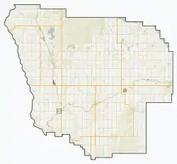
Morrin, Alberta
Morrin is a village in central Alberta, Canada. It is located 26 km north of the town of Drumheller, along Highway 27 and the Railink Central Western railway.
Morrin | |
|---|---|
| Village of Morrin | |
 Morrin  Morrin | |
| Coordinates: 51°39′30″N 112°45′59″W | |
| Country | Canada |
| Province | Alberta |
| Region | Southern Alberta |
| Census Division | No. 5 |
| Municipal district | Starland County |
| Incorporated[1] | |
| • Village | April 16, 1920 |
| Government | |
| • Mayor | Howard Helton |
| • Governing body | Morrin Village Council |
| Area (2016)[2] | |
| • Land | 0.67 km2 (0.26 sq mi) |
| Elevation | 832 m (2,730 ft) |
| Population (2016)[2] | |
| • Total | 240 |
| • Density | 357.2/km2 (925/sq mi) |
| Time zone | UTC-7 (MST) |
| Highways | 27, 9, 56 |
| Waterways | West Michichi Creek, Red Deer River |
The Morrin Bridge Provincial recreation area is located 10 km west of the village, in the Red Deer River valley, and Dry Island Buffalo Jump Provincial Park is located 40 km north.
Morrin was originally named "Blooming Prairie" but was renamed Morrin in honour of the engineer of the first train to the village.[4]
Demographics
In the 2016 Census of Population conducted by Statistics Canada, the Village of Morrin recorded a population of 240 living in 110 of its 132 total private dwellings, a -2% change from its 2011 population of 245. With a land area of 0.67 km2 (0.26 sq mi), it had a population density of 358.2/km2 (927.8/sq mi) in 2016.[2]
In the 2011 Census, the Village of Morrin had a population of 245 living in 112 of its 129 total dwellings, a -3.2% change from its 2006 population of 253. With a land area of 0.82 km2 (0.32 sq mi), it had a population density of 298.8/km2 (773.8/sq mi) in 2011.[5]
References
- "Location and History Profile: Village of Morrin" (PDF). Alberta Municipal Affairs. October 21, 2016. p. 470. Retrieved October 23, 2016.
- "Population and dwelling counts, for Canada, provinces and territories, and census subdivisions (municipalities), 2016 and 2011 censuses – 100% data (Alberta)". Statistics Canada. February 8, 2017. Retrieved February 8, 2017.
- "Alberta Private Sewage Systems 2009 Standard of Practice Handbook: Appendix A.3 Alberta Design Data (A.3.A. Alberta Climate Design Data by Town)" (PDF) (PDF). Safety Codes Council. January 2012. pp. 212–215 (PDF pages 226–229). Retrieved October 8, 2013.
- Morrin and District History Book Committee (1970). Blooming Prairie : a history of Morrin and district. p. 13.
- "Population and dwelling counts, for Canada, provinces and territories, and census subdivisions (municipalities), 2011 and 2006 censuses (Alberta)". Statistics Canada. February 8, 2012. Retrieved February 8, 2012.