Rycroft, Alberta
Rycroft is a village in northern Alberta, Canada. It is located 68 km north of the city of Grande Prairie and 7 km east of Spirit River. Dunvegan Provincial Park is located 20 km north of the community.
Rycroft | |
|---|---|
| Village of Rycroft | |
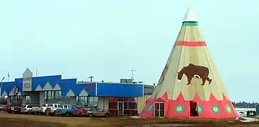 Strip mall and tipi in Rycroft | |
 Seal | |
| Motto(s): Hub of the Peace | |
 Location in M.D. of Spirit River | |
 Rycroft Location of Rycroft in Alberta | |
| Coordinates: 55°45′28″N 118°41′48″W | |
| Country | Canada |
| Province | Alberta |
| Region | Northern Alberta |
| Planning region | Upper Peace |
| Municipal district | Municipal District of Spirit River No. 133 |
| Incorporated[1] | |
| • Village | March 15, 1944 |
| Government | |
| • Mayor | Diahann Potrebenko |
| • Governing body | Rycroft Village Council |
| Area (2016)[3] | |
| • Land | 1.92 km2 (0.74 sq mi) |
| Elevation | 600 m (2,000 ft) |
| Population (2016)[3] | |
| • Total | 612 |
| • Density | 319/km2 (830/sq mi) |
| Time zone | UTC-7 (MST) |
| Highways | 2 49 |
| Waterways | Spirit River |
| Website | Official website |
The post office was originally known as Spirit River. The name was changed to Roycroft in 1920 to honour R.H. Roycroft, a prominent local citizen, and was altered to Rycroft in 1933.[4]
Demographics
| Year | Pop. | ±% |
|---|---|---|
| 1946 | 272 | — |
| 1951 | 372 | +36.8% |
| 1956 | 424 | +14.0% |
| 1961 | 500 | +17.9% |
| 1966 | 539 | +7.8% |
| 1971 | 461 | −14.5% |
| 1976 | 533 | +15.6% |
| 1981 | 649 | +21.8% |
| 1986 | 672 | +3.5% |
| 1991 | 634 | −5.7% |
| 1996 | 667 | +5.2% |
| 2001 | 609 | −8.7% |
| 2006 | 638 | +4.8% |
| 2011 | 628 | −1.6% |
| 2016 | 612 | −2.5% |
| Source: Statistics Canada [5][6][7][8][9][10][11][12][3] | ||
In the 2016 Census of Population conducted by Statistics Canada, the Village of Rycroft recorded a population of 612 living in 274 of its 316 total private dwellings, a -2.5% change from its 2011 population of 628. With a land area of 1.92 km2 (0.74 sq mi), it had a population density of 318.8/km2 (825.6/sq mi) in 2016.[3]
In the 2011 Census, the Village of Rycroft had a population of 628 living in 280 of its 310 total dwellings, a -1.6% change from its 2006 population of 638. With a land area of 1.69 km2 (0.65 sq mi), it had a population density of 371.6/km2 (962.4/sq mi) in 2011.[13]
References
- "Location and History Profile: Village of Rycroft" (PDF). Alberta Municipal Affairs. October 21, 2016. p. 534. Retrieved October 23, 2016.
- "Municipal Officials Search". Alberta Municipal Affairs. September 22, 2017. Retrieved September 25, 2017.
- "Population and dwelling counts, for Canada, provinces and territories, and census subdivisions (municipalities), 2016 and 2011 censuses – 100% data (Alberta)". Statistics Canada. February 8, 2017. Retrieved February 8, 2017.
- Hamilton, William (1978). The Macmillan Book of Canadian Place Names. Toronto: Macmillan. p. 31. ISBN 0-7715-9754-1.
- "Table 5: Population of urban centres, 1916-1946, with guide to locations". Census of the Prairie Provinces, 1946. Volume I: Population. Ottawa: Dominion Bureau of Statistics. 1949. pp. 397–400.
- "Table 6: Population by sex, for census subdivisions, 1956 and 1951". Census of Canada, 1956. Volume I: Population. Ottawa: Dominion Bureau of Statistics. 1958.
- "Table 9: Population by census subdivisions, 1966 by sex, and 1961". 1966 Census of Canada. Western Provinces. Population: Divisions and Subdivisions. Ottawa: Dominion Bureau of Statistics. 1967.
- "Table 3: Population for census divisions and subdivisions, 1971 and 1976". 1976 Census of Canada. Census Divisions and Subdivisions, Western Provinces and the Territories. Population: Geographic Distributions. Ottawa: Statistics Canada. 1977.
- "Table 2: Census Subdivisions in Alphabetical Order, Showing Population Rank, Canada, 1981". 1981 Census of Canada. Census subdivisions in decreasing population order. Ottawa: Statistics Canada. 1982. ISBN 0-660-51563-6.
- "Table 2: Population and Dwelling Counts, for Census Divisions and Census Subdivisions, 1986 and 1991 – 100% Data". 91 Census. Population and Dwelling Counts – Census Divisions and Census Subdivisions. Ottawa: Statistics Canada. 1992. pp. 100–108. ISBN 0-660-57115-3.
- "Population and Dwelling Counts, for Canada, Provinces and Territories, and Census Divisions, 2001 and 1996 Censuses – 100% Data (Alberta)". Statistics Canada. Retrieved 2019-05-25.
- "Population and dwelling counts, for Canada, provinces and territories, and census subdivisions (municipalities), 2006 and 2001 censuses – 100% data (Alberta)". Statistics Canada. January 6, 2010. Retrieved 2019-05-25.
- "Population and dwelling counts, for Canada, provinces and territories, and census subdivisions (municipalities), 2011 and 2006 censuses (Alberta)". Statistics Canada. February 8, 2012. Retrieved February 8, 2012.
External links
Places adjacent to Rycroft, Alberta | |
|---|---|
| Cities | |
|---|---|
| Towns | |
| Villages | |
| Hamlets | |
| Municipal districts | |
| Improvement districts | |
| Indian reserves | |
| Provincial parks | |
| Other topics | |