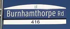
Burnhamthorpe Road
Burnhamthorpe Road is a major arterial road in the cities of Toronto and Mississauga, Ontario; beginning at Dundas Street (from which it initially angles away from before running parallel with), near Islington Avenue, running west and becoming a rural road in the Town of Oakville, where it terminates (after breaking) at Tremaine Road, where it changes name.
  | |||||||
|---|---|---|---|---|---|---|---|
| Halton Regional Road 27 | |||||||
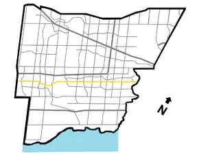 Burnhamthorpe Rd. within Mississauga | |||||||
| Route information | |||||||
| Maintained by City of Toronto City of Mississauga Region of Halton Town of Oakville | |||||||
| Major junctions | |||||||
| West end | |||||||
Ninth Line Winston Churchill Boulevard Mavis Road Hurontario Street Kipling Avenue | |||||||
| East end | Dundas Street | ||||||
| Highway system | |||||||
Roads in Ontario
| |||||||


Unlike most major streets originating in Toronto and continuing into the "905" suburbs, only a short portion is located in Toronto and the street is strongly Mississauga-centric. Also, although Burnhamthorpe is commonly seen as the latter city's main east-west street, the parallel arteries of Dundas Street and Eglinton Avenue are (with the notable exception of the Mississauga City Centre area) busier and have heavier commercial uses along them overall.
The north side of the right-of-way on the street's eastern half through Mississauga is unusually wide as the result of being reserved for a potential light rail transit line that was never built.[1] The reserve was converted into a bicycle trail,[2] with another transit facility (the Mississauga Transitway) being constructed farther north instead.
In Mississauga, the street, unlike most other arterial roads in the regional municipalities surrounding Toronto proper, is not a regional road. However, in Oakville it is signed as Halton Regional Road 27 as far west as Neyagawa Boulevard.
History
Burnhamthorpe Road was originally laid out in 1806 as the first concession road north of Dundas Street in Toronto Township (now Mississauga). It is named after a former hamlet in Mississauga, which in turn was named by settler John Abelson for his hometown of Burnham Thorpe, England.[3] In Toronto, the road was a tolled plank road built in the 1840s running west from the former Village of Islington though Etobicoke Township and was referred to as Mono Sixth Line Road.[4] It was informally also as the Back Line, Adamson Sideroad, and Rogers Road in Toronto Township west of the Credit River, and Back Concession Road in Halton County (present Region) until 1966.[5] The "Back" in these earlier names referred to the practice of backing 200-acre (81 hectare) rectangular farm lots onto the road, while having their access fronting onto the adjacent Dundas Street and what is today Eglinton Avenue.[6]
Until the 1980s, the street was broken by the Credit River, when a high-level bridge was constructed across its deep and wide valley. Further west, to facilitate the crossing of the smaller Mullet Creek ravine by a new alignment, the street deviated southward from its original course, parts of which make up three residential streets; Fifeshire Court, Burbank Road, and Rogers Road (the latter being a historic name) today.[6]
Route description
Burnhamthorpe begins at Dundas Street in the Islington neighborhood in Toronto's west end and heads west, crossing and interchanging with, Highway 427. At Renforth Creek there road was re-routed resulting in a stub to the north that runs as Old Burnhamthrope Road. After crossing the Etobicoke Creek, it enters Mississauga and is designated Burnhamthorpe Road East. At Hurontario Street, it passes by the iconic Absolute World condominium towers, enters Mississauga City Centre, and changes to a West designation. A linear park, lined with residential towers, runs along the south side of the street through here. Landmarks located in the City Centre on or near Burnhamthorpe include Square One Shopping Centre; the Living Arts Centre; and Mississauga Celebration Square; with the Mississauga Civic Centre situated just to the north. Continuing west past the city centre area, it traverses a mixed commercial and residential zone, before crossing over the wide Credit River valley on a high-level bridge, and entering the leafy Erin Mills district. Just west of Winston Churchill Boulevard, it narrows to two lanes, crosses over (but has no interchange with) Highway 403, enters rural northern Oakville, and after approximately another 8 kilometres (5 miles), breaks at Highway 407-ETR and the Sixteen Mile Creek. It resumes briefly west of the creek, and terminates at Tremaine Road. Its course is continued west by the Number 1 Side Road.
Bus routing controversy
Burnhamthorpe Road was a relatively minor artery through Toronto's west end until traffic increased due to the growth of Mississauga. Much of this new traffic consisted of a growing number of MiWay (then known as Mississauga Transit) city buses travelling to and from the Toronto Transit Commission's Islington subway station. By the late 1990s, the number of buses had gotten so high that residents with homes on the street began complaining, and demanded that the MiWay buses use Highway 427 and Dundas St. to access Islington station. They even occasionally blockaded buses in what became known as the Battle of the Buses. The councils of both cities got involved and the TTC eventually banned MiWay buses from using the bus bays at the subway station. But by 2001, the ruckus died down and MiWay's buses began fully using the station again.[7][8]
References
- "The Mississauga Transitway: A History Of The Many Studies". Transit Toronto.
- "Burnhamthorpe Trail".
- http://heritagemississauga.com/page/Burnhamthorpe
- http://365etobicoke.com/history-of-etobicoke/
- http://news.milton.halinet.on.ca/2497237/page/11?n=
- "The history of Mississauga's Fifeshire, Burbank and Rogers Road". Modern Mississauga. January 29, 2020. Retrieved 2020-08-26.
- "A Brief History of Public Transit in Mississauga: Growing Pains". Transit Toronto.
- "Ultimatum issued in Battle of the Buses: Accept compromise or more traffic, McCallion warns (Reposted from the Toronto Star)". Transit Toronto.
Major roads, highways and streets in Toronto | |||||||||
|---|---|---|---|---|---|---|---|---|---|
| North–south |
| ||||||||
| East–west |
| ||||||||
| |||||||||
| |||||||||