California Historical Landmarks in Alameda County
List table of the properties and districts — listed on the California Historical Landmarks — within Alameda County, Northern California.
- Note: Click the "Map of all coordinates" link to the right to view a Google map of all properties and districts with latitude and longitude coordinates in the table below.
Listings
| Image | [1] | Landmark name | Location | City or town | Summary |
|---|---|---|---|---|---|
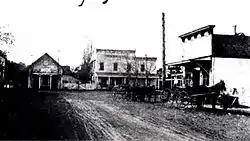
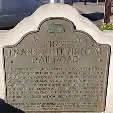 Alameda Terminal - First Transcontinental Railroad |
440 | Alameda Terminal - First Transcontinental Railroad | NW corner of Lincoln Ave and Webster St 37°46′31″N 122°16′37″W |
Alameda | First transcontinental railroad reaching Alameda Terminal on September 6, 1869 |
.JPG.webp) Berkeley City Club |
908 | Berkeley City Club | 2315 Durant Ave 37°52′03″N 122°15′46″W |
Berkeley | Also on the NRHP list as NPS-77000282 |
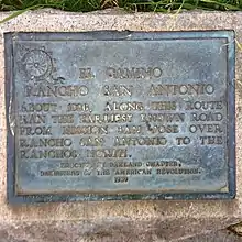 Camino of Rancho San Antonio |
299 | Camino of Rancho San Antonio | SW corner of Oakland and Santa Clara Aves. 37°49′28″N 122°15′32″W |
San Leandro | |
Site of the China Clipper flight departure |
968 | Site of the China Clipper flight departure | Alameda Naval Air Station 37°47′10″N 122°19′07″W |
Alameda | |
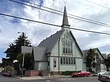 Church of St. James the Apostle |
694 | Church of St. James the Apostle | 1540 12th Ave. 37°47′30″N 122°14′46″W |
Oakland | |
.JPG.webp) Coast Guard Lightship WLV 605 |
1036 | Coast Guard Lightship WLV 605 | Jack London Square 37°47′44″N 122°16′50″W |
Oakland | Also on the NRHP list as NPS-89002462 |
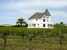 Concannon Vineyard |
641 | Concannon Vineyard | 4590 Tesla Rd. 37°40′00″N 121°44′23″W |
Livermore | |
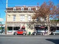 Croll Building |
954 | Croll Building | 1400 Webster St. 37°46′18″N 122°16′36″W |
Alameda | Also on the NRHP list as NPS-82000960 |
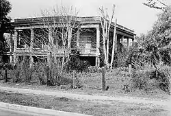 Estudillo Home |
279 | Estudillo Home | 550 W Estudillo Ave. 37°43′24″N 122°09′36″W |
San Leandro | |
 Cresta Blanca Winery |
586 | Cresta Blanca Winery | 5050 Arroyo Rd. 37°37′24″N 121°45′23″W |
Livermore | |
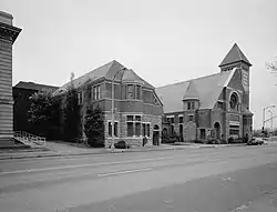 First Unitarian Church of Oakland |
896 | First Unitarian Church of Oakland | 685 14th St. 37°48′23″N 122°16′36″W |
Oakland | Also on the NRHP list as NPS-77000284 |
 Francisco Solano Alviso Adobe |
510 | Francisco Solano Alviso Adobe | 3459 Foothill Rd. 37°39′38″N 121°54′43″W |
Pleasanton | |
.JPG.webp) Joaquin Miller Home |
107 | Joaquin Miller Home | 3300 Joaquin Miller Rd. 37°48′45″N 122°11′08″W |
Oakland | Also on the NRHP list as NPS-66000204 |
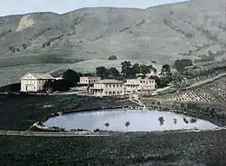 Leland Stanford Winery |
642 | Leland Stanford Winery | 330 Stanford Ave. |
Fremont | |
| 241 | Livermore Memorial Monument | Portola Park 37°41′28″N 121°46′26″W |
Livermore | ||
.JPG.webp) Mills Hall |
849 | Mills Hall | Mills College 37°46′45″N 122°10′57″W |
Oakland | Also on the NRHP list as NPS-71000132 |
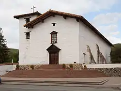 Mission San José |
334 | Mission San José | Mission Blvd at Washington Blvd. 37°32′02″N 121°55′12″W |
Fremont | Also on the NRHP list as NPS-71000131 |
 Paramount Theatre |
884 | Paramount Theatre | 2025 Broadway 37°48′36″N 122°16′04″W |
Oakland | Also on the NRHP list as NPS-73000395 |
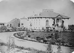
.JPG.webp) Pardee Home |
1027 | Pardee Home | 672 11th St. 37°48′18″N 122°16′35″W |
Oakland | Also on the NRHP list as NPS-76000476 |
| 925 | Peralta Hacienda Site | 2465 34th Ave. 37°47′13″N 122°13′03″W |
Oakland | ||
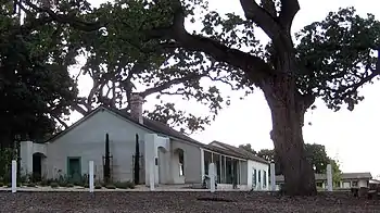
 Peralta Home |
285 | Peralta Home | 561 Lafayette 37°43′51″N 122°09′41″W |
San Leandro | |
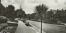 Piedmont Way |
986 | Piedmont Way | Piedmont Ave. between Gayley Rd. and Dwight Way 37°52′04″N 122°15′07″W |
Berkeley | |
| 970 | Rainbow trout species identified | 50 yards past Redwood Gate entrance kiosk, Redwood Regional Park |
Oakland | ||
| 246 | Rancho San Antonio (Peralta Grant) | NW corner of E. 14th and Hays Sts. 37°43′38″N 122°09′29″W |
San Leandro | ||
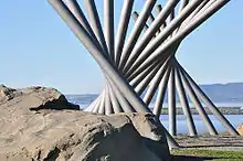 San Leandro Oyster Beds |
824 | San Leandro Oyster Beds | San Leandro Marina 37°41′43″N 122°11′36″W |
San Leandro | |
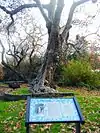
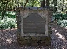 Site of Blossom Rock Navigation Trees |
962 | Site of Blossom Rock Navigation Trees | Redwood Regional Park, Roberts Regional Recreation Area, near the Madrone Picnic Tables 37°48′41″N 122°10′26″W |
Oakland | |
 Site of College of California |
45 | Site of College of California | NE corner of 13th & Franklin Sts. 37°48′12″N 122°16′13″W |
Oakland | |
 Site of the First County Courthouse |
503 | Site of the First County Courthouse | 30977 Union City Blvd. and Smith St. 37°35′48″N 122°04′52″W |
Union City | |
| 776 | Site of the First Public School in Castro Valley | 19200 Redwood Rd. 37°42′24″N 122°04′26″W |
Castro Valley | ||
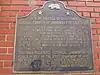
 Site of the nation's first successful sugar beet factory |
768 | Site of the nation's first successful sugar beet factory | 30849 Dyer St. 37°36′02″N 122°04′14″W |
Union City | |
| 676 | Site of Saint Mary's College | 3093 Broadway 37°49′14″N 122°15′41″W |
Oakland | ||
 Site of Shell Mound |
335 | Site of Shell Mound | 4600 block of Shell Mound St. 37°50′02″N 122°17′33″W |
Emeryville | |
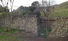
 Ukrania, Site of Agapius Honcharenko Farmstead |
1025 | Ukrania, Site of Agapius Honcharenko Farmstead | Garin Regional Park |
Hayward | |
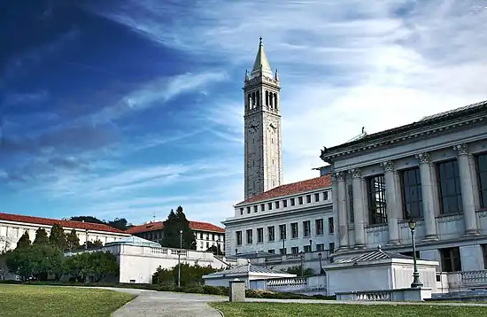 University of California, Berkeley campus |
946 | University of California, Berkeley campus | University of California, Berkeley 37°52′12″N 122°15′32″W |
Berkeley | Also on the NRHP list as NPS-82004638 |
_underway_at_sea_on_9_August_1968_(USN_1116887).jpg.webp) USS Hornet |
1029 | USS Hornet | Pier 3 North, Alameda Point, 707 West Hornet Dr. 37°46′22″N 122°18′10″W |
Alameda | |
 Vallejo Flour Mill |
46 | Vallejo Flour Mill | Mission Blvd, 1/2 west of Vallejo Mill Historical Park 37°34′43″N 121°58′39″W |
Fremont | |
 Wente Bros. Winery |
957 | Wente Bros. Winery | 5565 Tesla Rd. 37°37′26″N 121°45′25″W |
Livermore |
References
- "California Historical Landmarks By County". Ohp.parks.ca.gov. Retrieved 2019-04-03.
See also
| Wikimedia Commons has media related to California Historical Landmarks in Alameda County, California. |
This article is issued from Wikipedia. The text is licensed under Creative Commons - Attribution - Sharealike. Additional terms may apply for the media files.